MyTopo
Homeworth Ohio US Topo Map
Couldn't load pickup availability
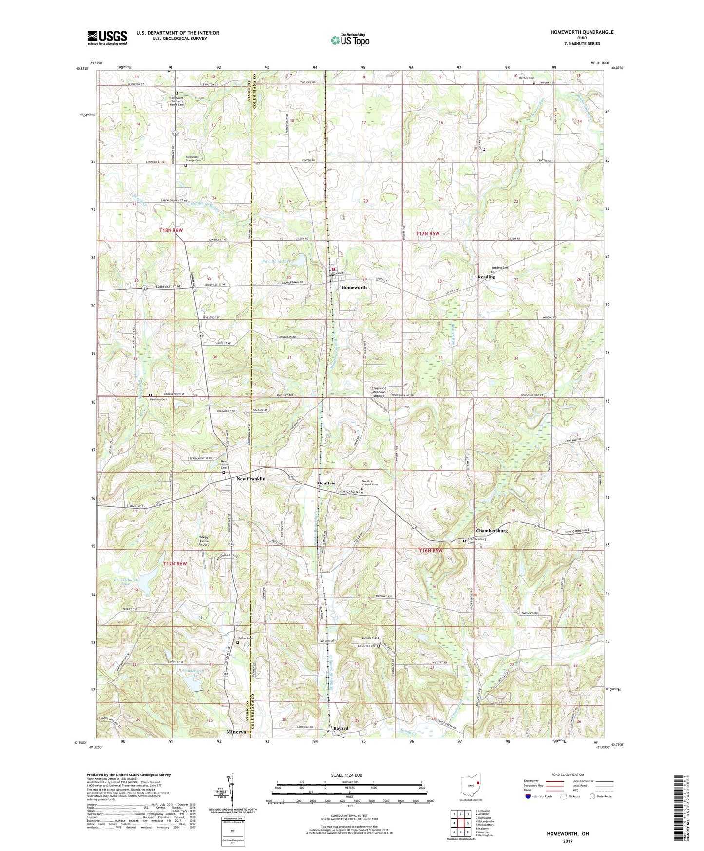
2019 topographic map quadrangle Homeworth in the state of Ohio. Scale: 1:24000. Based on the newly updated USGS 7.5' US Topo map series, this map is in the following counties: Columbiana, Stark. The map contains contour data, water features, and other items you are used to seeing on USGS maps, but also has updated roads and other features. This is the next generation of topographic maps. Printed on high-quality waterproof paper with UV fade-resistant inks.
Quads adjacent to this one:
West: Robertsville
Northwest: Limaville
North: Alliance
Northeast: Damascus
East: Hanoverton
Southeast: Kensington
South: Minerva
Southwest: Malvern
Contains the following named places: Baker School, Bayard, Bayard Post Office, Beaver Lake, Beaver Run, Bethel Cemetery, Bethel Church, Brocklehurst Lake, Brocklehurst Lake Dam, Buckeye Lawn Farm, Bulick Field, Chambersburg, Chambersburg Cemetery, Crosswind Meadows Airport, Edwards Cemetery, Fairmount Childrens Home, Fairmount Children's Home Cemetery, Fairmount Church, Fairmount Grange Cemetery, Hawkins Cemetery, Homeworth, Homeworth Census Designated Place, Homeworth Post Office, Homeworth Volunteer Fire Department, Knox Elementary School, Middle Branch Sandy Creek, Middle Sandy United Presbyterian Church, Moultrie, Moultrie Chapel, Moultrie Chapel Cemetery, Mount Calvary Church, New Franklin, New Franklin Cemetery, New Franklin Methodist Church, New Franklin Post Office, New Franklin School, Pinch School, Prospect Hill School, Reading, Reading Cemetery, Reading Church, Saint Johns Evangelical Lutheran Church, Sleepy Hollow Airport, Township of Knox, Township of West, Vandergrift Lake, Vandergrift Lake Dam, Walker Cemetery, WDJQ-FM (Alliance), Woodland Lake, Woodland Lake Dam, Yeagleys Corners, ZIP Codes: 44625, 44634