MyTopo
Kensington Ohio US Topo Map
Couldn't load pickup availability
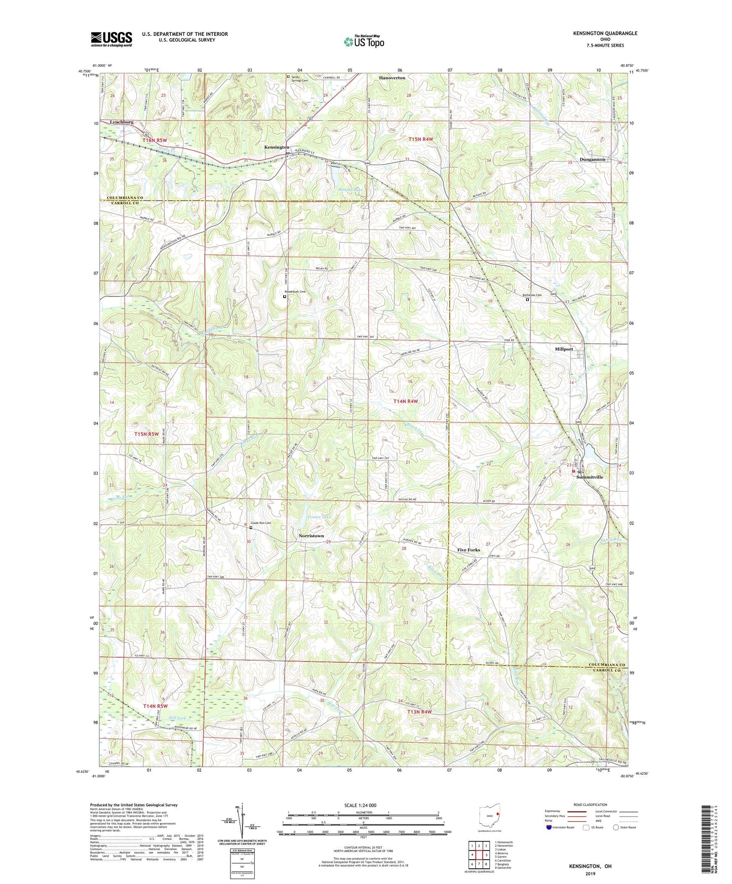
2023 topographic map quadrangle Kensington in the state of Ohio. Scale: 1:24000. Based on the newly updated USGS 7.5' US Topo map series, this map is in the following counties: Carroll, Columbiana. The map contains contour data, water features, and other items you are used to seeing on USGS maps, but also has updated roads and other features. This is the next generation of topographic maps. Printed on high-quality waterproof paper with UV fade-resistant inks.
Quads adjacent to this one:
West: Minerva
Northwest: Homeworth
North: Hanoverton
Northeast: Lisbon
East: Gavers
Southeast: Salineville
South: Bergholz
Southwest: Carrollton
This map covers the same area as the classic USGS quad with code o40080f8.
Contains the following named places: Bethesda Cemetery, Bethesda Church, Buckeye Tree Farm, Dungannon, Dungannon Post Office, Five Forks, France Lake, France Lake Dam, Franklin Elementary School, Franklin Township Volunteer Fire Department, Glade Run Cemetery, Glade Run Church, Kensington, Kensington Post Office, Lynchburg, Manfull Lake, Manfull Lake Dam, Maple Cotton Funeral Home Ambulance Service, Millport, Millport Post Office, Norristown, Norristown Post Office, Roudebush Cemetery, Saint Johns Church, Sandy Beaver Canal, Sandy Springs Cemetery, Summitville, Summitville Clay Products Lake, Summitville Clay Products Lake Dam, Summitville Clay Works Pond Dam, Summitville Post Office, Township of East, Township of Franklin, Village of Summitville, ZIP Codes: 43962, 44423, 44427, 44651