MyTopo
Hanoverton Ohio US Topo Map
Couldn't load pickup availability
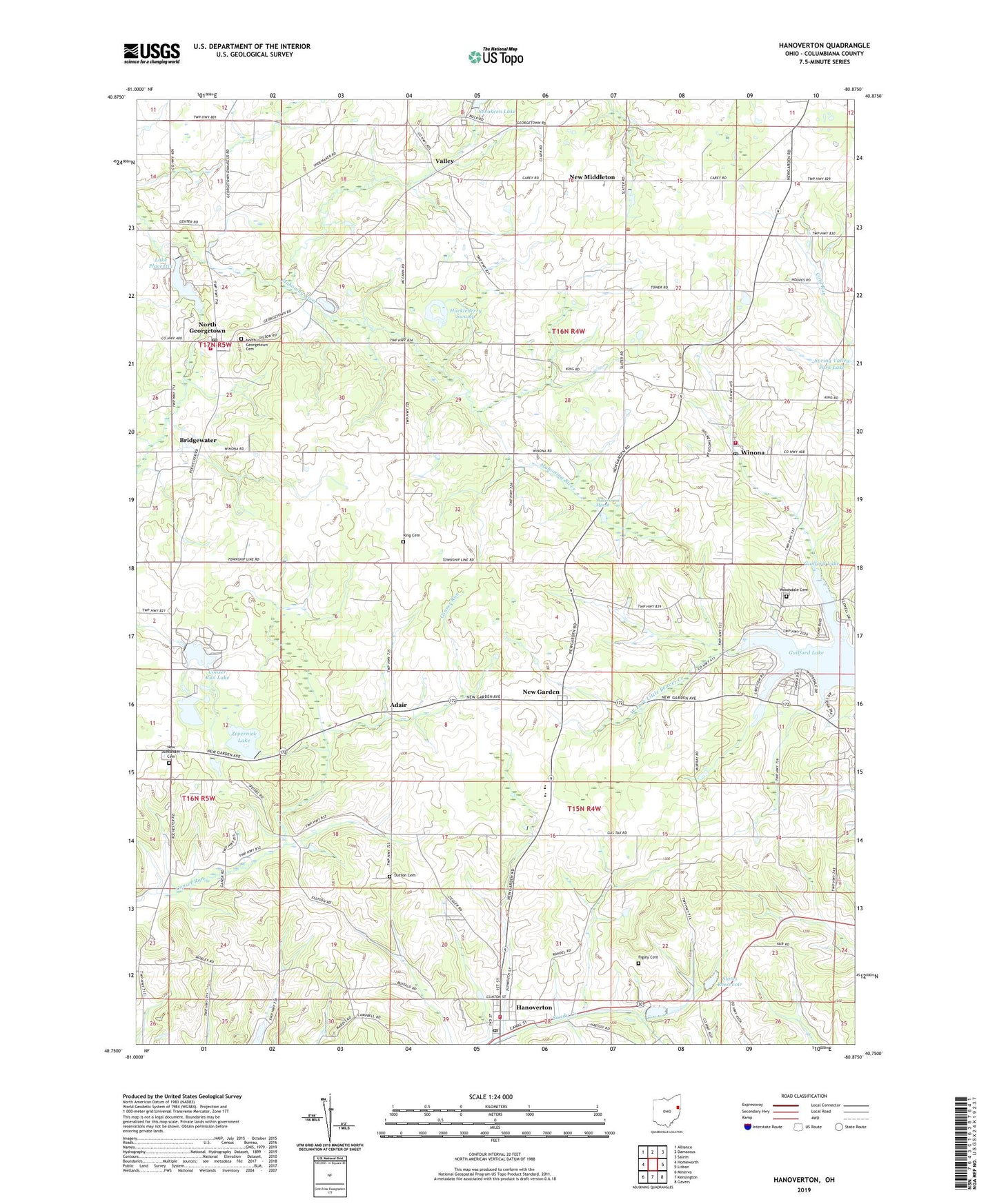
2023 topographic map quadrangle Hanoverton in the state of Ohio. Scale: 1:24000. Based on the newly updated USGS 7.5' US Topo map series, this map is in the following counties: Columbiana. The map contains contour data, water features, and other items you are used to seeing on USGS maps, but also has updated roads and other features. This is the next generation of topographic maps. Printed on high-quality waterproof paper with UV fade-resistant inks.
Quads adjacent to this one:
West: Homeworth
Northwest: Alliance
North: Damascus
Northeast: Salem
East: Lisbon
Southeast: Gavers
South: Kensington
Southwest: Minerva
This map covers the same area as the classic USGS quad with code o40080g8.
Contains the following named places: Adair, Adair Post Office, Aegerter Farms, Bridgewater, Burch Dairy Farm, Conser Run Lake, Crist Dairy Farm, Dutton Cemetery, Figley Cemetery, Guilford Lake, Guilford Lake Census Designated Place, Guilford Lake State Park, Hanover Township Volunteer Fire Department, Hanoverton, Hanoverton Canal Town Historic District, Hanoverton Post Office, Huckleberry Swamp, King Cemetery, Lake Placentia, Lake Placentia Dam, Lake P'na, Lake P'na Dam, New Alexander, New Alexander Cemetery, New Garden, New Middleton, Newgarden Post Office, North Georgetown, North Georgetown Cemetery, North Georgetown Post Office, North Georgetown Volunteer Fire Department, Paradise Lake Dam, Sevakeen Lake, Slates Dam, Slates Reservoir, Township of Butler, Township of Hanover, United Elementary School, United High School, United Schools, Valley, Valley Post Office, Village of Hanoverton, Vincents Orchards, Watercress Marsh, Winona, Winona Butler Fire Department, Winona Evangelical Friends Church, Winona Post Office, Woodsdale Cemetery, WSOM-AM (Salem), Zepernick Lake, Zepernick Lake Dam, Zepernick Lake Wildlife Area, ZIP Code: 44493