MyTopo
Damascus Ohio US Topo Map
Couldn't load pickup availability
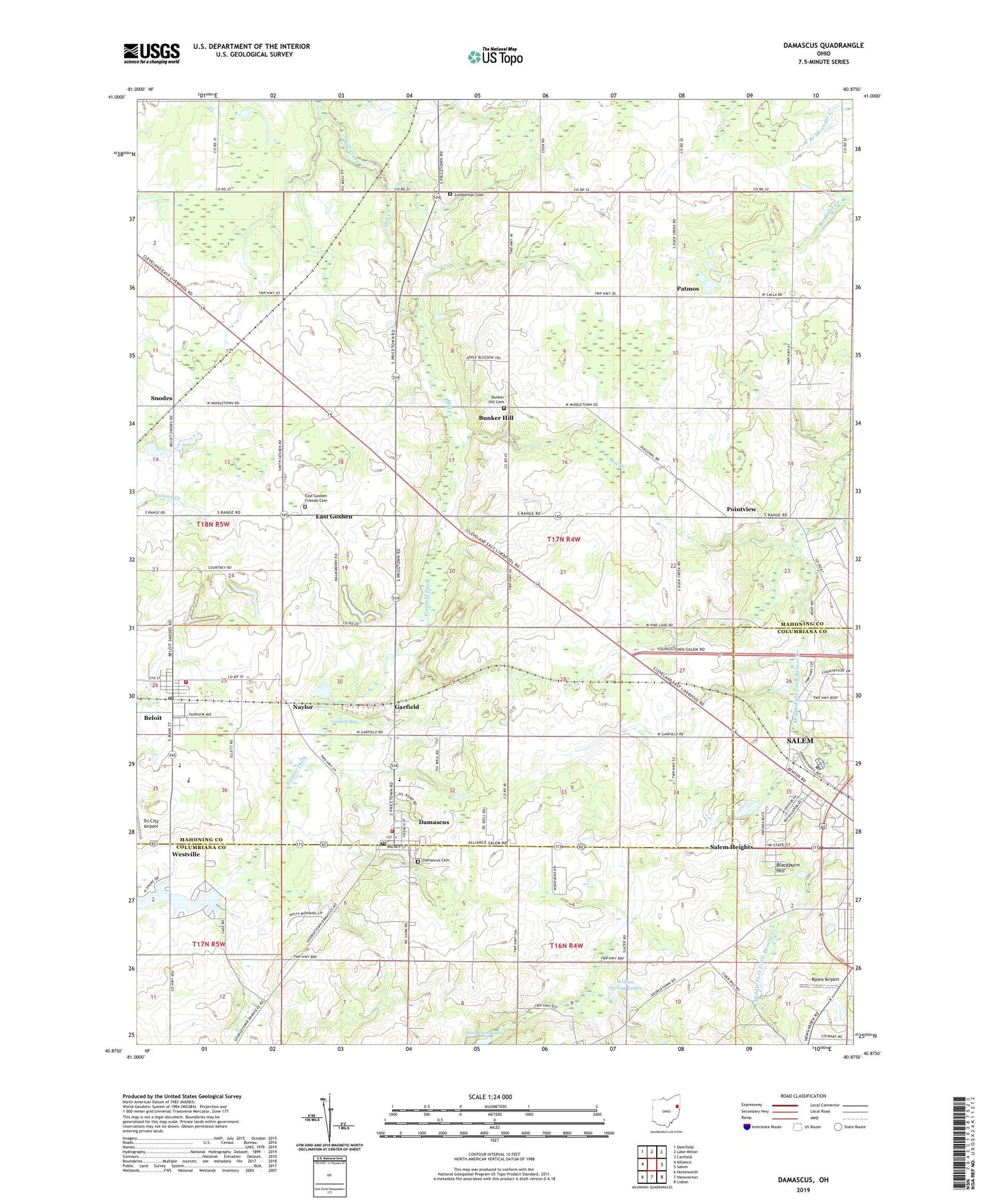
2023 topographic map quadrangle Damascus in the state of Ohio. Scale: 1:24000. Based on the newly updated USGS 7.5' US Topo map series, this map is in the following counties: Mahoning, Columbiana, Portage. The map contains contour data, water features, and other items you are used to seeing on USGS maps, but also has updated roads and other features. This is the next generation of topographic maps. Printed on high-quality waterproof paper with UV fade-resistant inks.
Quads adjacent to this one:
West: Alliance
Northwest: Deerfield
North: Lake Milton
Northeast: Canfield
East: Salem
Southeast: Lisbon
South: Hanoverton
Southwest: Homeworth
This map covers the same area as the classic USGS quad with code o40080h8.
Contains the following named places: Beech Ridge Church, Beloit, Beloit Elementary School, Beloit Fire Department Station 1, Beloit Post Office, Blackburn Hill, Boswell, Boswell Post Office, Boyds Corners, Bunker Hill, Bunker Hill Cemetery, Bunker Hill United Methodist Church, Butler Mobile City, Camp Merrydale, Christytown, Damascus, Damascus Cemetery, Damascus Census Designated Place, Damascus Post Office, Damascus Volunteer Fire Department, Damascus Wastewater Treatment Plant, East Goshen, East Goshen Friends Cemetery, Garfield, Garfield Bog, Garfield Ditch, Garfield Post Office, Goshen Center, Goshen Center Elementary School, Koons Airport, Lumberton Cemetery, Naylor, Naylor Ditch, New Buffalo Post Office, O K Dies Airport, Patmos, Patmos Post Office, Peru School, Pointview, Ponderosa Heliport, Salem Country Club, Salem Heights, Salem Heights Census Designated Place, Smith Hog Farms, Snodes, Snodes Post Office, Township of Goshen, Tri-City Airport, Village of Beloit, West Branch High School, West Branch Junior High School, Westville, Westville Lake Golf Course, Wilbur Church, Willow Grove, Willow Spring Lakes, WNEO-TV (Alliance), Yankee Crossing, ZIP Code: 44609