MyTopo
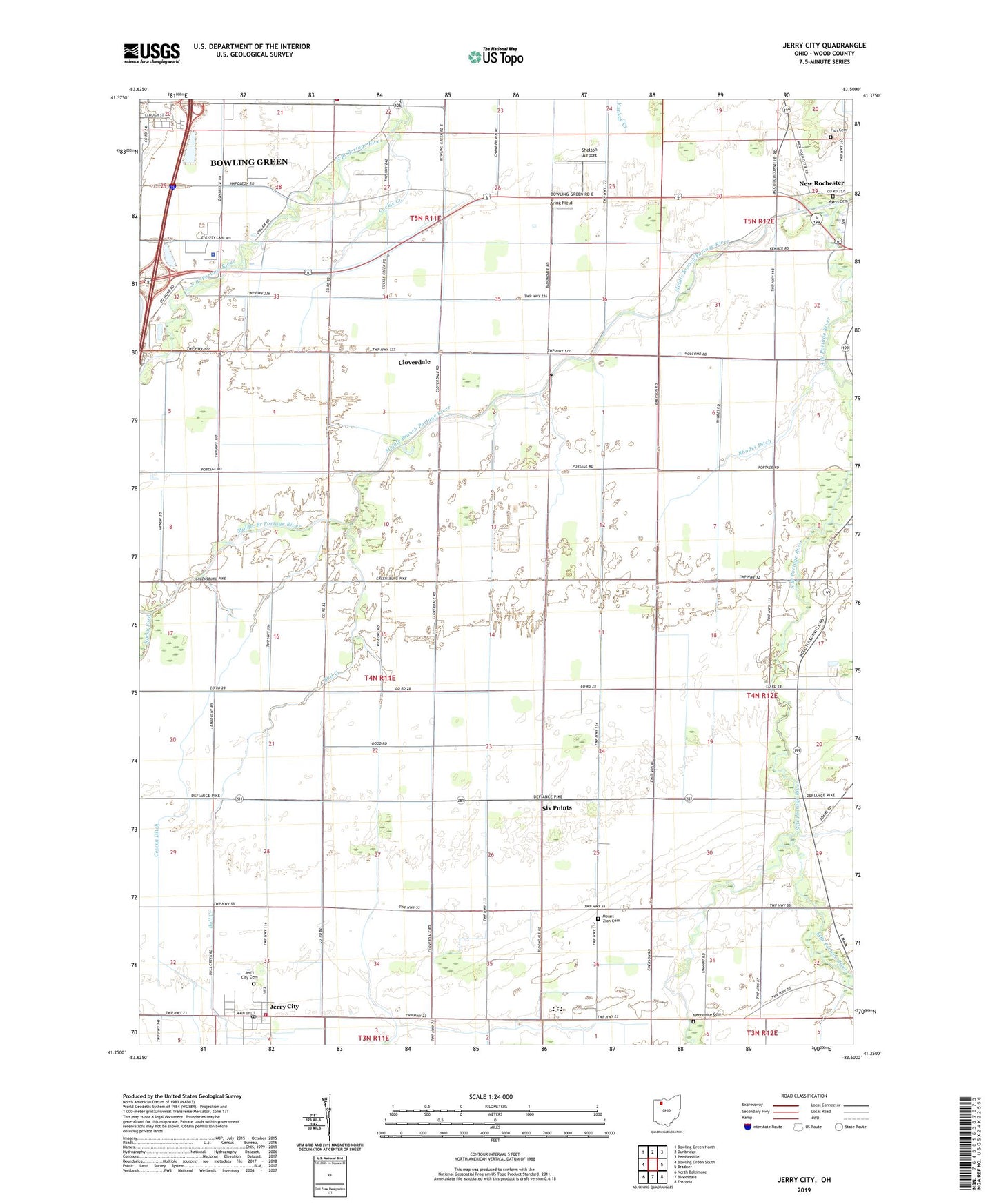
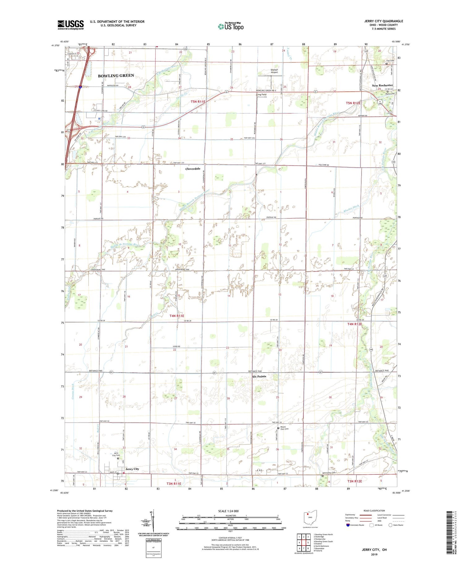
Jerry City Ohio US Topo Map
Couldn't load pickup availability
2019 topographic map quadrangle Jerry City in the state of Ohio. Scale: 1:24000. Based on the newly updated USGS 7.5' US Topo map series, this map is in the following counties: Wood. The map contains contour data, water features, and other items you are used to seeing on USGS maps, but also has updated roads and other features. This is the next generation of topographic maps. Printed on high-quality waterproof paper with UV fade-resistant inks.
Quads adjacent to this one:
West: Bowling Green South
Northwest: Bowling Green North
North: Dunbridge
Northeast: Pemberville
East: Bradner
Southeast: Fostoria
South: Bloomdale
Southwest: North Baltimore
Contains the following named places: Aring Field, Bull Creek, Carter Park, Cessna Ditch, Cloverdale, Cloverdale United Methodist Church, Cuckle Creek, East Branch Portage River, East Branch South Branch Portage River, Eckert Ditch, Elmwood Elementary School, Elmwood High School, Elmwood Middle School, Fish Cemetery, Hope Church, Jerry City, Jerry City Cemetery, Jerry City Fire Department, Jerry City Post Office, Mennonite Cemetery, Meyer Farms, Mid - County Ambulance 120, Middle Branch Portage River, Mount Zion Cemetery, Mount Zion Church, Myers Cemetery, New Rochester, Portage School, Rhodes Ditch, Saint Pauls Church, Shelton Airport, Six Points, South Branch Portage River, Township of Portage, Village of Jerry City, Wood County, Wood County Historical Center, Wood County Home, Wood County Sheriff's Office, ZIP Codes: 43437, 43451, 43466