MyTopo
Bradner Ohio US Topo Map
Couldn't load pickup availability
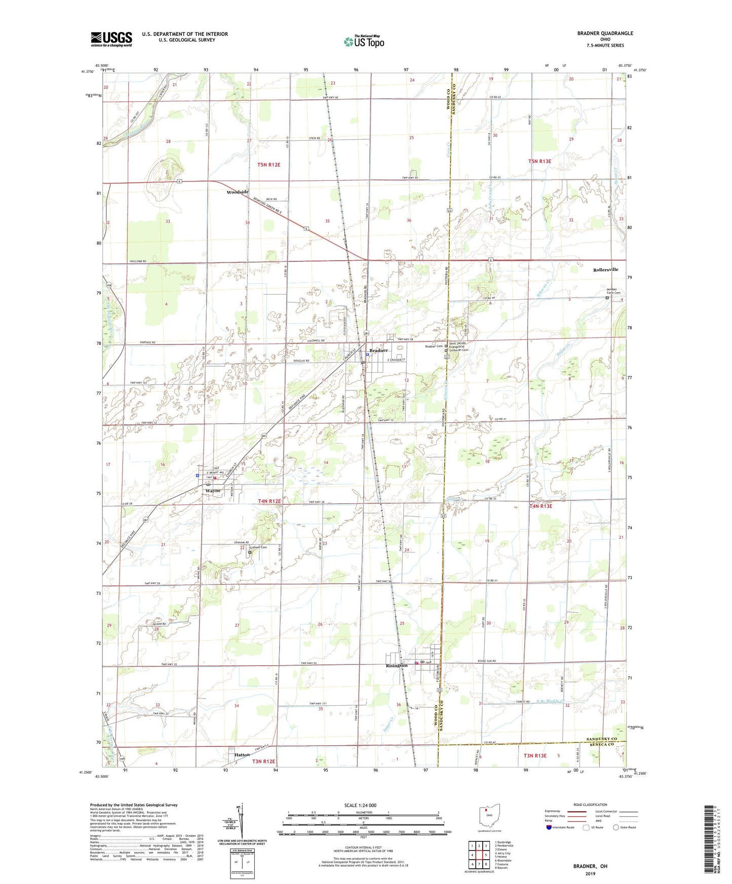
2023 topographic map quadrangle Bradner in the state of Ohio. Scale: 1:24000. Based on the newly updated USGS 7.5' US Topo map series, this map is in the following counties: Wood, Sandusky, Seneca. The map contains contour data, water features, and other items you are used to seeing on USGS maps, but also has updated roads and other features. This is the next generation of topographic maps. Printed on high-quality waterproof paper with UV fade-resistant inks.
Quads adjacent to this one:
West: Jerry City
Northwest: Dunbridge
North: Pemberville
Northeast: Elmore
East: Helena
Southeast: Bascom
South: Fostoria
Southwest: Bloomdale
This map covers the same area as the classic USGS quad with code o41083c4.
Contains the following named places: Bradner, Bradner Branch Wood County District Public Library, Bradner Cemetery, Bradner Fire Department, Bradner Police Department, Bradner Post Office, Bradner Preserve, Bradner Sewage Treatment Plant, Bradner Village Park, Bruningsville Station, Church Camp, City of Risingsun, Deininger Farms, Graham Cemetery, Haslinger Orchards, Hatton, Lakota Central Elementary School, Lakota West Elementary School, Magrum Farms, Montgomery Township House, Pember Farm Cemetery, Risingsun, Risingsun Community Park, Risingsun Police Department, Risingsun Post Office, Risingsun Volunteer Fire Department, Rollersville, Rollersville Post Office, Rupke Farms, Saint Jacobs Evangelical Lutheran Cemetery, Saint James Church, Saint Pauls United Methodist Church, Township of Montgomery, Twin Maples Trailer Court, Village of Bradner, Village of Risingsun, Village of Wayne, Wayne, Wayne Elementary School, Wayne Police Department, Wayne Post Office, Wayne Public Library, Wayne Volunteer Fire Department, Woodside, ZIP Codes: 43406, 43457