MyTopo
Bloomdale Ohio US Topo Map
Couldn't load pickup availability
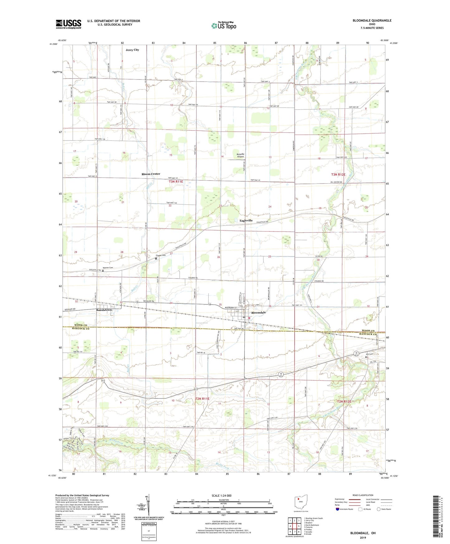
2023 topographic map quadrangle Bloomdale in the state of Ohio. Scale: 1:24000. Based on the newly updated USGS 7.5' US Topo map series, this map is in the following counties: Wood, Hancock. The map contains contour data, water features, and other items you are used to seeing on USGS maps, but also has updated roads and other features. This is the next generation of topographic maps. Printed on high-quality waterproof paper with UV fade-resistant inks.
Quads adjacent to this one:
West: North Baltimore
Northwest: Bowling Green South
North: Jerry City
Northeast: Bradner
East: Fostoria
Southeast: Alvada
South: Arcadia
Southwest: Findlay
This map covers the same area as the classic USGS quad with code o41083b5.
Contains the following named places: Ark Cemetery, Bairdstown, Bloom Center, Bloom Township House, Bloomdale, Bloomdale Branch Wayne Public Library, Bloomdale Elementary School, Bloomdale Fire and Rescue, Bloomdale Post Office, Chapel Cemetery, Eagleville, McArdle Airport, Township of Bloom, Village of Bairdstown, Village of Bloomdale, Weaver Cemetery, ZIP Code: 44817