MyTopo
Jewett Ohio US Topo Map
Couldn't load pickup availability
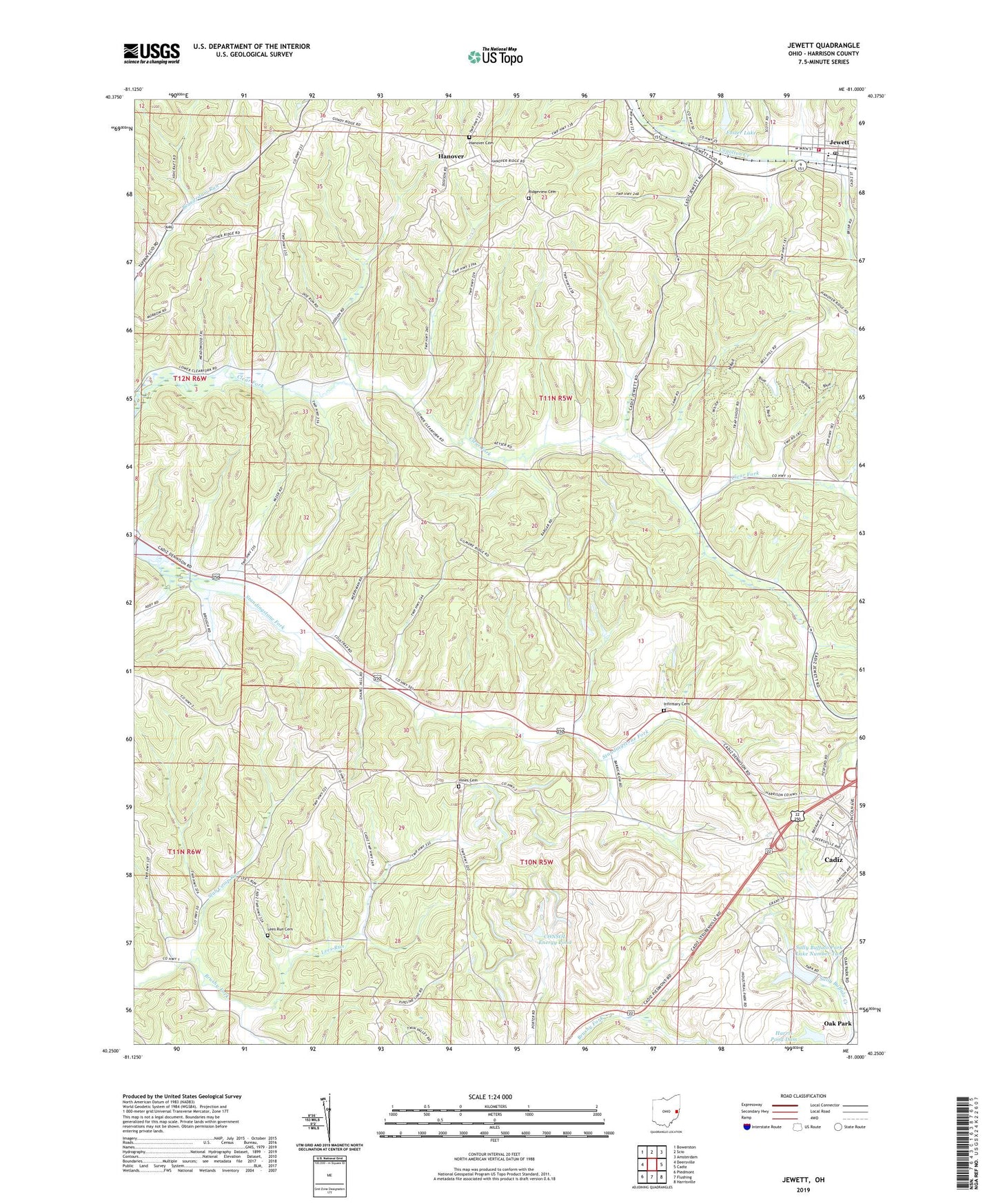
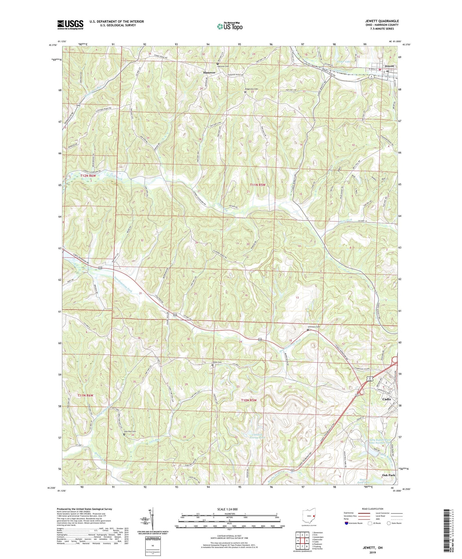
2019 topographic map quadrangle Jewett in the state of Ohio. Scale: 1:24000. Based on the newly updated USGS 7.5' US Topo map series, this map is in the following counties: Harrison. The map contains contour data, water features, and other items you are used to seeing on USGS maps, but also has updated roads and other features. This is the next generation of topographic maps. Printed on high-quality waterproof paper with UV fade-resistant inks.
Quads adjacent to this one:
West: Deersville
Northwest: Bowerston
North: Scio
Northeast: Amsterdam
East: Cadiz
Southeast: Harrisville
South: Flushing
Southwest: Piedmont
Contains the following named places: Anderson Mine, Asbury Chapel, B and B Mine, Baltzell Trailer Court, Cadiz Westgate Elementary School, Church of God, CONSOL Energy Pond, Consolidation Coal Pond 0210-010 Dam, Cope Mine, Domestic Mine, Enfield, Enfield Post Office, Foster Lake, Foster Lake Dam, Hanover, Hanover Cemetery, Harris Pond Dam, Harrison County, Harrison County Home, Hines Cemetery, Infirmary Cemetery, Jewett, Jewett Post Office, Jewett Volunteer Fire Department, Jewett-Scio Elementary School, Kerr Mine, Lees Run, Lees Run Cemetery, Moraville, Moraville Post Office, Muskingum Watershed Conservancy District, Pickering Mine, Ridge Church, Ridgeview Cemetery, Sally Buffalo Park Dam, Sally Buffalo Park Dam Number Two, Sally Buffalo Park Lake Number Two, Sally Buffalo Park Reservoir, Slab Camp Run, Stacy, Stacy Post Office, Standingstone Fork, Tappan Airpark, Township of Archer, Township of Cadiz, Village of Jewett