MyTopo
Scio Ohio US Topo Map
Couldn't load pickup availability
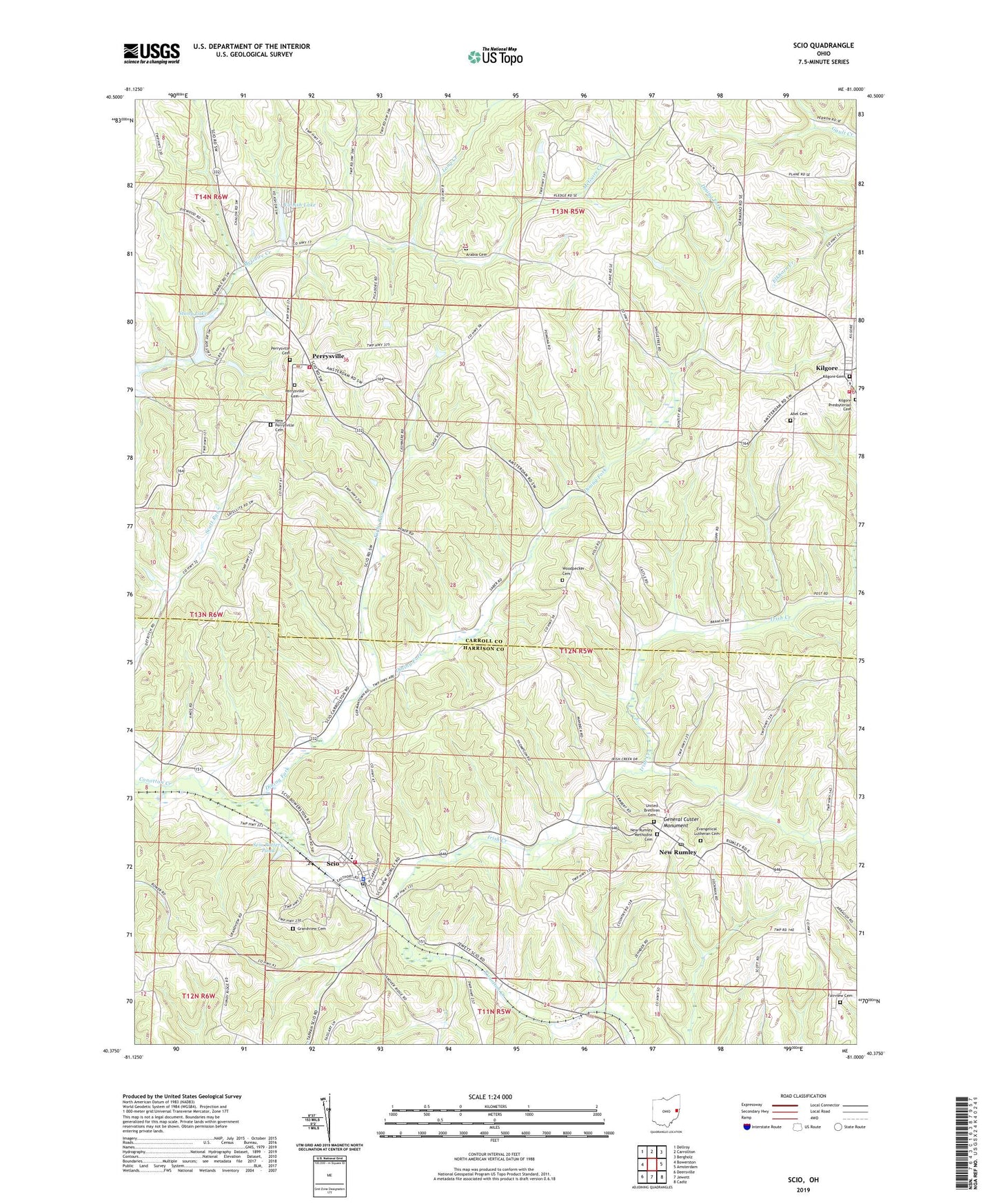
2023 topographic map quadrangle Scio in the state of Ohio. Scale: 1:24000. Based on the newly updated USGS 7.5' US Topo map series, this map is in the following counties: Carroll, Harrison. The map contains contour data, water features, and other items you are used to seeing on USGS maps, but also has updated roads and other features. This is the next generation of topographic maps. Printed on high-quality waterproof paper with UV fade-resistant inks.
Quads adjacent to this one:
West: Bowerston
Northwest: Dellroy
North: Carrollton
Northeast: Bergholz
East: Amsterdam
Southeast: Cadiz
South: Jewett
Southwest: Deersville
This map covers the same area as the classic USGS quad with code o40081d1.
Contains the following named places: Abel Cemetery, Arabia Cemetery, Camp Ecco, Dining Fork, Evangelical Lutheran Cemetery, Fairview Cemetery, General Custer Monument, Grandview Cemetery, Irish Creek, Jewett-Scio High School, Kilgore, Kilgore Cemetery, Kilgore Elementary School, Kilgore Post Office, Kilgore Presbyterian Cemetery, Kilgore Squad Ambulance Service, Kirby Run, Lick Fork, Long Creek, Loudon Township Volunteer Fire Department, New Perrysville Cemetery, New Rumley, New Rumley Methodist Cemetery, New Rumley Methodist Church, New Rumley Post Office, Perry Township Fire Department, Perry Township Squad, Perrysville, Perrysville Cemetery, Perrysville United Brethren Church, Perrysville United Methodist Church, Scio, Scio Police Department, Scio Post Office, Scio Pottery Pond, Scio Pottery Pond Dam, Scio Volunteer Fire Department, Stony Lake, Stony Lake Dam, Township of North, Township of Perry, Township of Rumley, United Brethren Cemetery, Village of Scio, Vo-Ash Lake, Vo-Ash Lake Dam, Woodpecker Cemetery, ZIP Code: 43988