MyTopo
Amsterdam Ohio US Topo Map
Couldn't load pickup availability
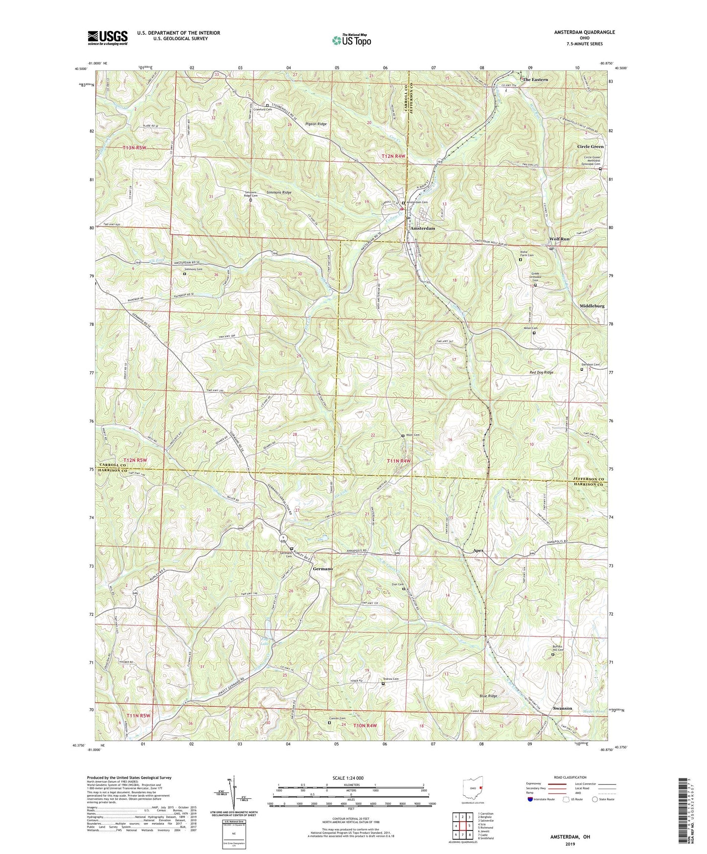
2023 topographic map quadrangle Amsterdam in the state of Ohio. Scale: 1:24000. Based on the newly updated USGS 7.5' US Topo map series, this map is in the following counties: Harrison, Carroll, Jefferson. The map contains contour data, water features, and other items you are used to seeing on USGS maps, but also has updated roads and other features. This is the next generation of topographic maps. Printed on high-quality waterproof paper with UV fade-resistant inks.
Quads adjacent to this one:
West: Scio
Northwest: Carrollton
North: Bergholz
Northeast: Salineville
East: Richmond
Southeast: Smithfield
South: Cadiz
Southwest: Jewett
This map covers the same area as the classic USGS quad with code o40080d8.
Contains the following named places: Amsterdam, Amsterdam Cemetery, Amsterdam Post Office, Amsterdam Volunteer Fire Company, Apex, Apex Energy Landfill, Apex Sanitary Landfill, Arba Vue Farms, Blue Ridge, Buffalo Hill Cemetery, Cannan Cemetery, Circle Green, Circle Green Methodist Episcopal Cemetery, Circle Green Post Office, Cox Creek, Crawford Cemetery, Davidson Cemetery, Elk Fork, Elk Lick, Fay Dam, Fay Lake, Gault Creek, Germano, Germano Cemetery, Germano Post Office, Goose Creek, Greek Orthodox Cemetery, Indian Lake, Kisha Farm Cemetery, Middleburg, Miller Cemetery, Mizer Cemetery, Order of the Sacred & Immaculate Hearts of Jesus, Pigeon Ridge, Red Dog Ridge, Saint Josephs School, Simmons Cemetery, Simmons Ridge, Simmons Ridge Cemetery, Swanson, Tedrow Cemetery, The Eastern, Township of German, Township of Loudon, Township of Springfield, Village of Amsterdam, Wolf Run, Wolf Run Post Office, Zion Cemetery, ZIP Codes: 43903, 43970, 43986