MyTopo
Kalida Ohio US Topo Map
Couldn't load pickup availability
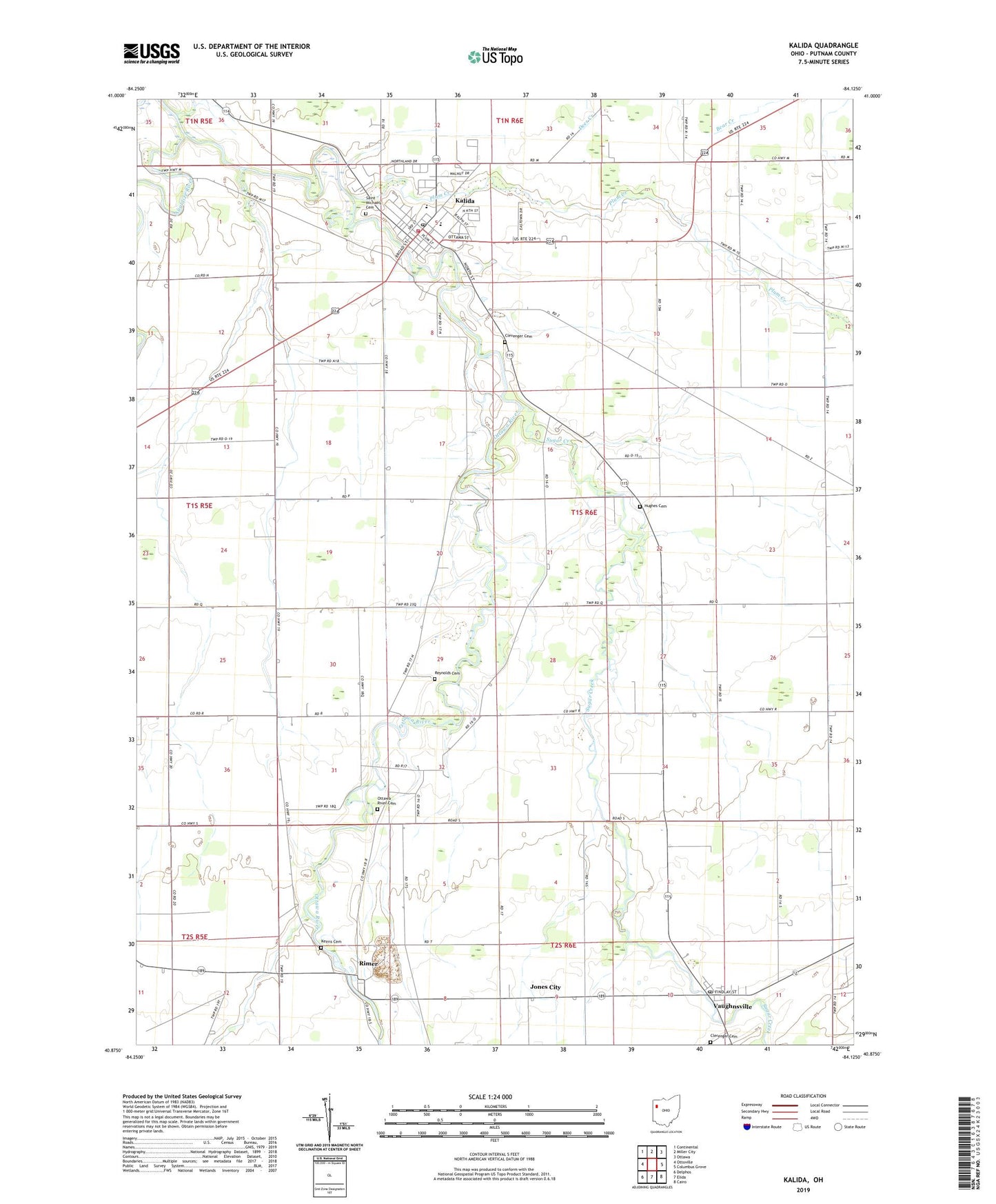
2023 topographic map quadrangle Kalida in the state of Ohio. Scale: 1:24000. Based on the newly updated USGS 7.5' US Topo map series, this map is in the following counties: Putnam. The map contains contour data, water features, and other items you are used to seeing on USGS maps, but also has updated roads and other features. This is the next generation of topographic maps. Printed on high-quality waterproof paper with UV fade-resistant inks.
Quads adjacent to this one:
West: Ottoville
Northwest: Continental
North: Miller City
Northeast: Ottawa
East: Columbus Grove
Southeast: Cairo
South: Elida
Southwest: Delphos
This map covers the same area as the classic USGS quad with code o40084h2.
Contains the following named places: Arrowhead Trailer Park Number 1, Clerenger Cemetery, Clevenger Cemetery, Clevengers, Hughes Cemetery, Jones City, Kalida, Kalida Elementary School, Kalida High School, Kalida Post Office, Kalida Volunteer Fire Department, Keirns Cemetery, Ottawa River, Ottawa River Cemetery, Ottawa River Church, Plum Creek, Remlinger Fish Farm, Reynolds Cemetery, Rimer, Rimer Post Office, Saint Michaels Catholic Church, Saint Michaels Cemetery, Seitz, Sugar Creek, Thompson Church, Township of Sugar Creek, Township of Union, Vaughnsville, Vaughnsville Census Designated Place, Vaughnsville Post Office, Village of Kalida, ZIP Code: 45853