MyTopo
Ottoville Ohio US Topo Map
Couldn't load pickup availability
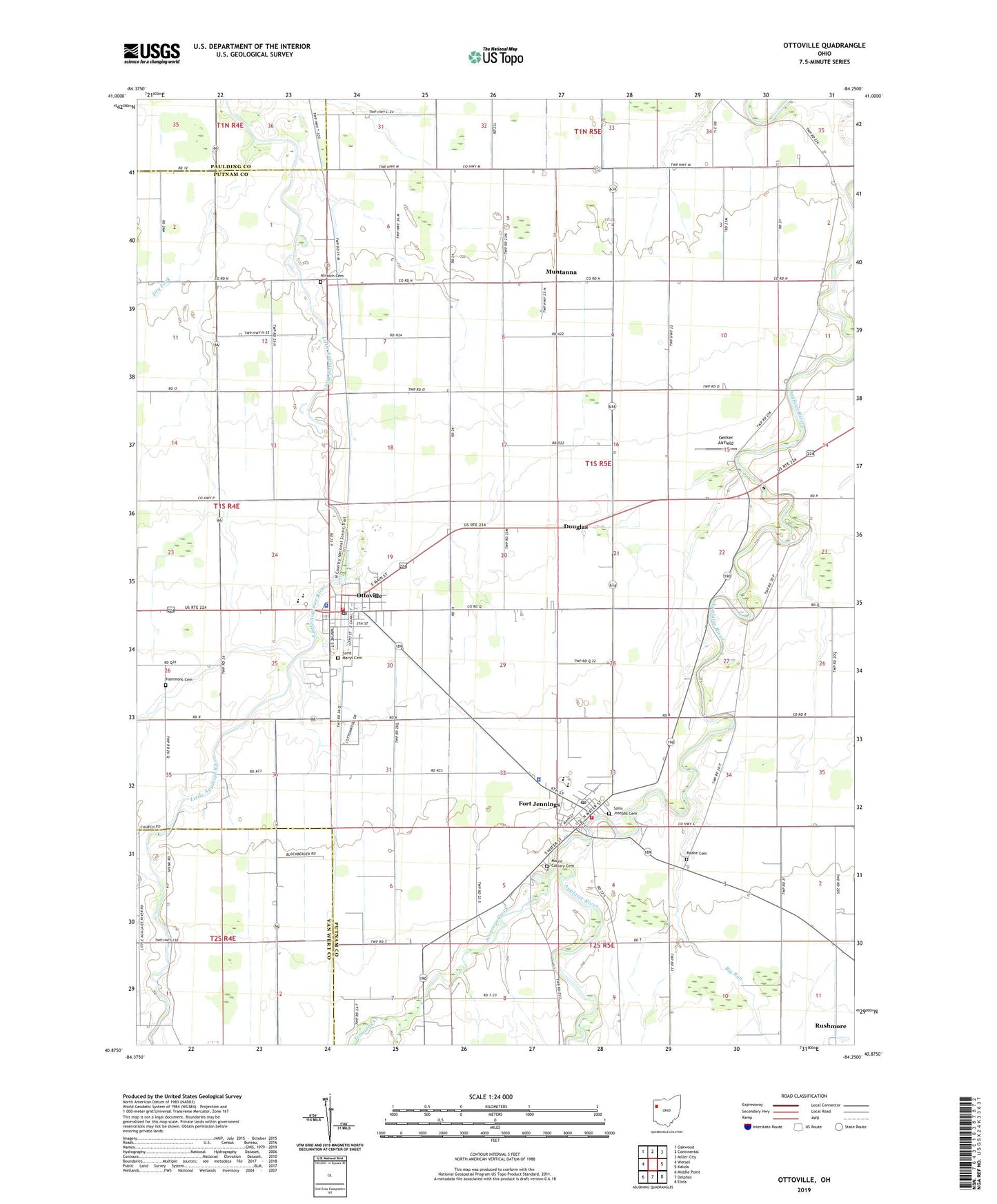
2023 topographic map quadrangle Ottoville in the state of Ohio. Scale: 1:24000. Based on the newly updated USGS 7.5' US Topo map series, this map is in the following counties: Putnam, Van Wert, Paulding. The map contains contour data, water features, and other items you are used to seeing on USGS maps, but also has updated roads and other features. This is the next generation of topographic maps. Printed on high-quality waterproof paper with UV fade-resistant inks.
Quads adjacent to this one:
West: Wetsel
Northwest: Oakwood
North: Continental
Northeast: Miller City
East: Kalida
Southeast: Elida
South: Delphos
Southwest: Middle Point
This map covers the same area as the classic USGS quad with code o40084h3.
Contains the following named places: Antioch Cemetery, Antioch Church, Big Run, Brandehoff Ditch, Country Manor Estates, Delphos Country Club, Douglas, Douglas Post Office, Dry Fork, Flat Fork, Fort Jennings, Fort Jennings Elementary School, Fort Jennings High School, Fort Jennings Police Department, Fort Jennings Post Office, Fort Jennings Volunteer Fire Department, Gerker Airfield, Gerker School, Hammons Cemetery, Immaculate Conception Catholic Church, Jennings Creek, Montana, Mount Calvary Cemetery, Muntanna, Muntanna Post Office, Ostendorf School, Ottoville, Ottoville High School, Ottoville Police Department, Ottoville Post Office, Ottoville Volunteer Fire Department, Peters School, Raabe Cemetery, Saint Johns Evangelical Lutheran Church, Saint Josephs Catholic Church, Saint Josephs Cemetery, Saint Marys Cemetery, Township of Jackson, Township of Jennings, Township of Monterey, Village of Fort Jennings, Village of Ottoville, Vogt School, ZIP Codes: 45827, 45844, 45876