MyTopo
La Rue Ohio US Topo Map
Couldn't load pickup availability
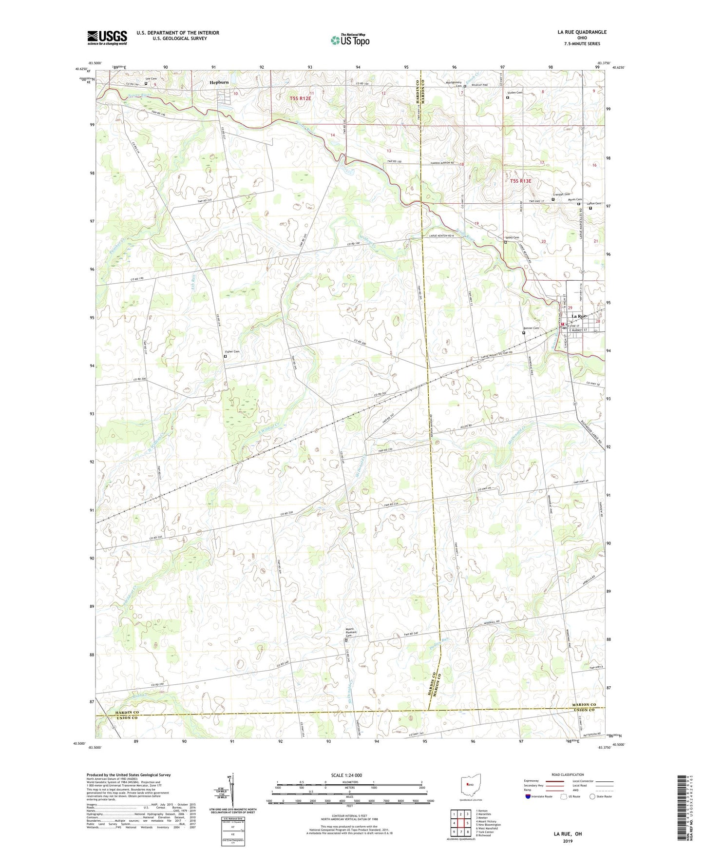
2019 topographic map quadrangle La Rue in the state of Ohio. Scale: 1:24000. Based on the newly updated USGS 7.5' US Topo map series, this map is in the following counties: Hardin, Marion, Union. The map contains contour data, water features, and other items you are used to seeing on USGS maps, but also has updated roads and other features. This is the next generation of topographic maps. Printed on high-quality waterproof paper with UV fade-resistant inks.
Quads adjacent to this one:
West: Mount Victory
Northwest: Kenton
North: Marseilles
Northeast: Meeker
East: New Bloomington
Southeast: Richwood
South: York Center
Southwest: West Mansfield
Contains the following named places: Allen School, Ash Run, Bonner Cemetery, Crandall Cemetery, Elgin West Elementary School, Fairview School, Fisher Cemetery, Hampton School, Hepburn, Hepburn Post Office, La Rue, La Rue Post Office, La Rue United Methodist Church, LaRue Cemetery, Lee Cemetery, Lenox School, Linwood School, Marshs, McDonald School, Montgomery Cemetery, Montgomery Methodist Episcopal Church, Mount Pleasant Cemetery, Mount Pleasant Church of God, Myres Cemetery, North Wildcat Creek, Panther Creek, Pfeiffer, Pfeiffer Post Office, Pleasant Grove School, Pleasant Hill School, Rush Creek School, Saint Joseph Catholic Church, Schertzger School, Scioto Valley Fire Department, South Wildcat Creek, Stahl School, Stofcheck Ambulance Service, Township of Dudley, Vesey Cemetery, Village of La Rue, Virden Cemetery, Wildcat Creek, Windfall School, Winnemac, ZIP Code: 43340