MyTopo
York Center Ohio US Topo Map
Couldn't load pickup availability
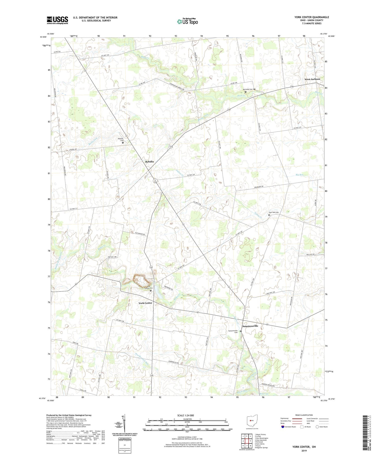
2023 topographic map quadrangle York Center in the state of Ohio. Scale: 1:24000. Based on the newly updated USGS 7.5' US Topo map series, this map is in the following counties: Union. The map contains contour data, water features, and other items you are used to seeing on USGS maps, but also has updated roads and other features. This is the next generation of topographic maps. Printed on high-quality waterproof paper with UV fade-resistant inks.
Quads adjacent to this one:
West: West Mansfield
Northwest: Mount Victory
North: La Rue
Northeast: New Bloomington
East: Richwood
Southeast: Magnetic Springs
South: Peoria
Southwest: East Liberty
This map covers the same area as the classic USGS quad with code o40083d4.
Contains the following named places: Arbela, Arbela Post Office, Beechdale School, Bolenbaugh School, Brush Run, Burnside Cemetery, Byhalia, Byhalia Cemetery, Byhalia Post Office, Cahill School, Camp Union, Day Lay Egg Farm, East York Cemetery, Fountain Grove School, Fouts School, Grace Chapel, Grace Temple School, Haynesville, Howard School, Mad River Egg Farm, Merit School, Middle Branch Bokes Creek, Middleton School, Miller School, Pleasant Valley School, Powder Lick Run, Rocky Fork, Sherwood School, Sommersville Cemetery, Summersville, Township of Washington, Township of York, Union Baptist Church, Washington Township Hall, West Jackson, Wilderness School, York Center, York Center Cemetery