MyTopo
New Bloomington Ohio US Topo Map
Couldn't load pickup availability
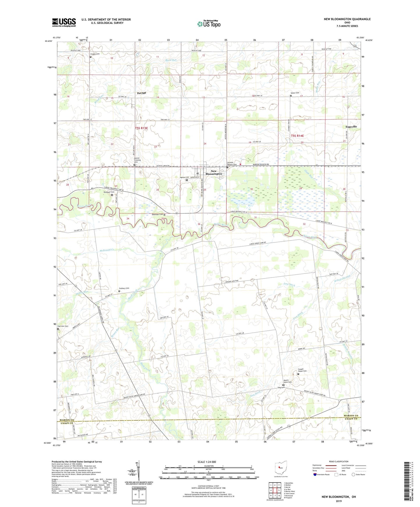
2023 topographic map quadrangle New Bloomington in the state of Ohio. Scale: 1:24000. Based on the newly updated USGS 7.5' US Topo map series, this map is in the following counties: Marion, Union. The map contains contour data, water features, and other items you are used to seeing on USGS maps, but also has updated roads and other features. This is the next generation of topographic maps. Printed on high-quality waterproof paper with UV fade-resistant inks.
Quads adjacent to this one:
West: La Rue
Northwest: Marseilles
North: Meeker
Northeast: Morral
East: Marion West
Southeast: Prospect
South: Richwood
Southwest: York Center
This map covers the same area as the classic USGS quad with code o40083e3.
Contains the following named places: Agosta Cemetery, Beckley School, Bell Corners, Big Island School, Big Island Wildlife Area, Big Island Wildlife Area Dam, Big Island Wildlife Area Reservoir, Brown Run, Chapel Cemetery, Cleveland School, Cooper Vestal Cemetery, DeCliff, Devries Dairy, Dickason Cemetery, Dudley Run, Ebenezer Cemetery, Espyville, Espyville Post Office, Fairhaven School, Fairview Cemetery, German Reform Cemetery, Glade Run, Glenview School, Gurley, Gurley Post Office, Guthery Cemetery, Harrisburg School, Holmesville, Hoover Crossing Cemetery, Irey Ditch, Jones School, McDonald Creek, Metz School, Moran School, Morans Switch, Mount Olive Cemetery, Mount Olive Church, New Bloomington, New Bloomington Post Office, New Vision Fire and Rescue, Rush Creek, Salem Cemetery, Salem Church of God, Scioto School, Township of Bowling Green, Township of Montgomery, Village of New Bloomington, Wildcat School, Zieg Cemetery, Zieg Ditch, ZIP Codes: 43332, 43341