MyTopo
Magnetic Springs Ohio US Topo Map
Couldn't load pickup availability
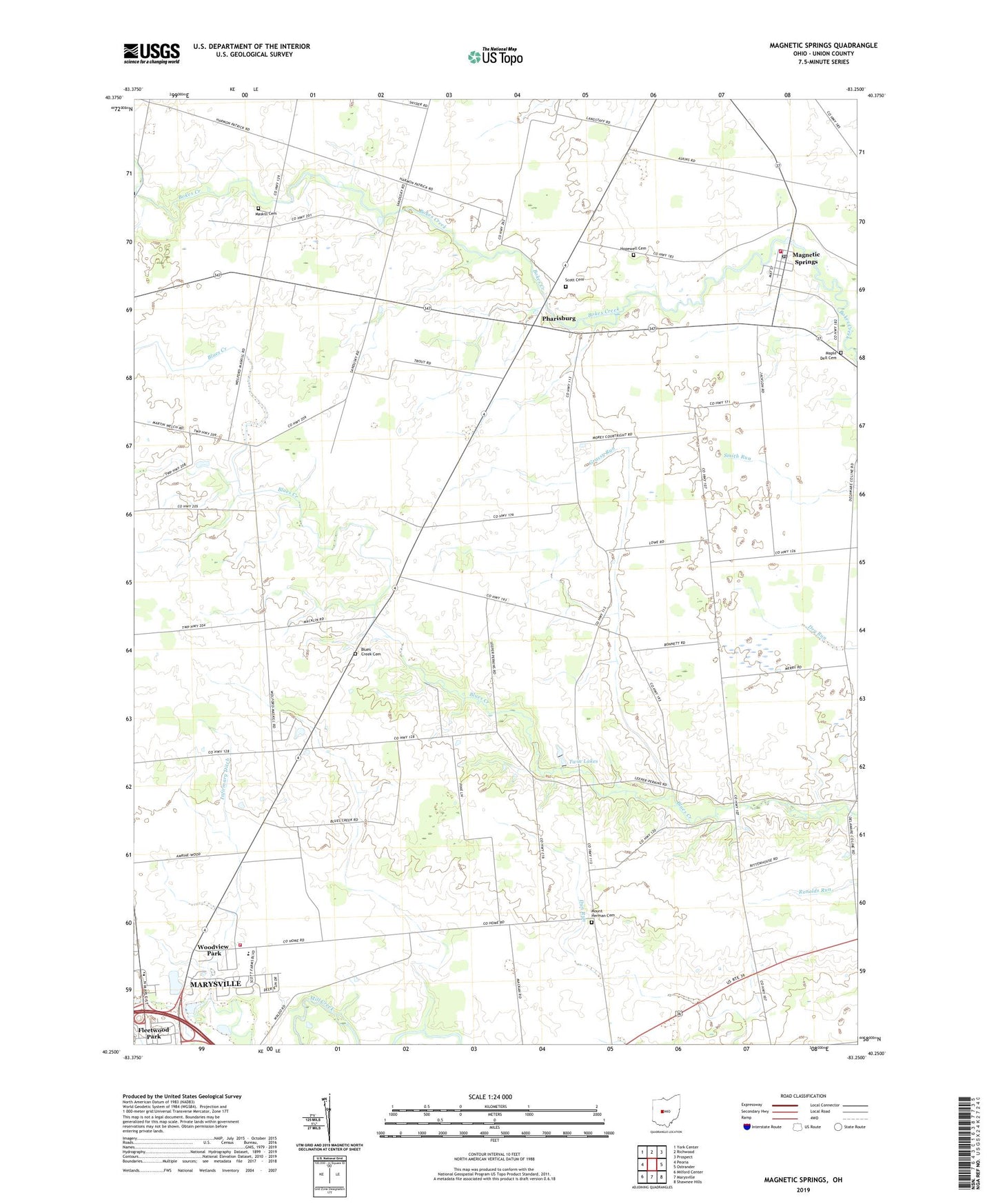
2019 topographic map quadrangle Magnetic Springs in the state of Ohio. Scale: 1:24000. Based on the newly updated USGS 7.5' US Topo map series, this map is in the following counties: Union. The map contains contour data, water features, and other items you are used to seeing on USGS maps, but also has updated roads and other features. This is the next generation of topographic maps. Printed on high-quality waterproof paper with UV fade-resistant inks.
Quads adjacent to this one:
West: Peoria
Northwest: York Center
North: Richwood
Northeast: Prospect
East: Ostrander
Southeast: Shawnee Hills
South: Marysville
Southwest: Milford Center
Contains the following named places: Ashton Meadows, Bayes Airport, Blackhawk School, Blues Creek Cemetery, Blues Creek Golf Course, Blues Creek School, Bonnette School, Cotton Slash, Elliot School, Fleetwood Park, Grassy Run, Hildreth School, Hopewell Cemetery, Hull School, Infirmary Ditch, Lee School, Leesburg Township Fire and Emergency Medical Services, Leesburg Township Hall, Leesburg-Magnetic Elementary School, Magnetic Springs, Magnetic Springs Post Office, Magnetic Springs United Methodist Church, Magnetic Springs Village Hall, Maple Dell Cemetery, Maskill Cemetery, McFadden School, Miller School, Mount Herman Cemetery, Mount Hermon School, Parrott Village, Perkins School, Pharisburg, Pharisburg Post Office, Phelps Run, Phelps School, Scott Cemetery, Springdale Church, Springdale School, Tanner Crossing School, Thompson School, Township of Dover, Township of Leesburg, Twin Lakes, Union County, Union County Home, Union County Sports Complex, Village of Magnetic Springs, West Blues Creek School, WNRJ-FM (Marysville), Woodview Park, ZIP Codes: 43036, 43040