MyTopo
Marysville Ohio US Topo Map
Couldn't load pickup availability
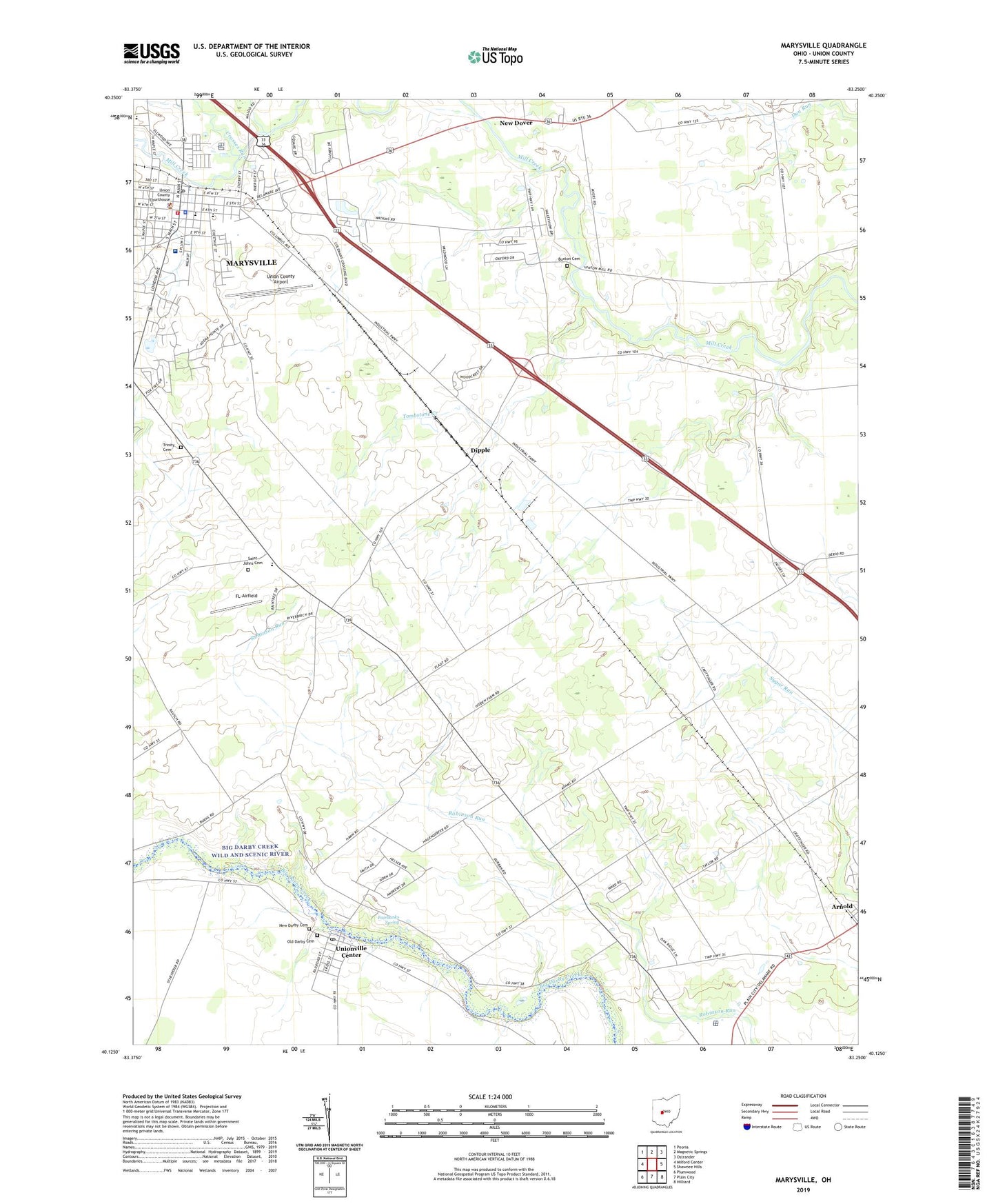
2023 topographic map quadrangle Marysville in the state of Ohio. Scale: 1:24000. Based on the newly updated USGS 7.5' US Topo map series, this map is in the following counties: Union. The map contains contour data, water features, and other items you are used to seeing on USGS maps, but also has updated roads and other features. This is the next generation of topographic maps. Printed on high-quality waterproof paper with UV fade-resistant inks.
Quads adjacent to this one:
West: Milford Center
Northwest: Peoria
North: Magnetic Springs
Northeast: Ostrander
East: Shawnee Hills
Southeast: Hilliard
South: Plain City
Southwest: Plumwood
This map covers the same area as the classic USGS quad with code o40083b3.
Contains the following named places: Adena Pointe, Airport Park, Allen Chapel African Methodist Episcopal Church, Arnold, Arnold Post Office, Buxton Cemetery, Buxton Meadows, Cardinal Market Park, Carriage Acres, City of Marysville, Countryside Mobile Home Park, Crosses Run, Darby Meadows, Darby Township Hall, Dipple, Dover School, Dover Township Hall, Eljer Park, Evangelical Friends Church, Fairbanks Spring, First Congregational Church, First English Evangelical Lutheran Church, First Presbyterian Church, First United Methodist Church, Five Points Shopping Center, FL-Airfield, Glad Tidings Assembly of God Church, Greenwood Colony, Gruenbaum Dairy Farm, Hillcrest Mobile Home Park, J-Em Farm Airport, Kare Medical Transport Service, Marysville, Marysville City Hall, Marysville Estates, Marysville Fire Division Station 272, Marysville High School, Marysville Historic District, Marysville Middle School, Marysville Post Office, Marysville Public Library, Marysville Sewage Treatment Plant, Marysville Square Industrial/Commercial Park, McCarthy Park, Memorial Hospital of Union County, Mid Ohio Industrial Park, Mill Creek Estates, Millcreek Meadows, New Darby Cemetery, New Dover, Old Darby Cemetery, Our Lady of Lourdes Roman Catholic Church, Paris Township Hall, Pleasant Ridge, Rolling Meadows Golf Course, Saint Johns Cemetery, Saint Johns Church, Saint Johns School, Schwartzkopf Park, Stocksdale Shopping Center, Stofcheck Ambulance Service, Tombstone Creek, Township of Darby, Township of Paris, Trinity Cemetery, Trinity Lutheran Church, Trinity Lutheran School, Union County Airport, Union County Childrens Home, Union County Courthouse, Union County Fairgrounds, Union County Sheriff's Office, Unionville Center, Unionville Center Post Office, Unionville Center Village Hall, Village of Unionville Center, WUCO-AM (Marysville), ZIP Code: 43077