MyTopo
Ostrander Ohio US Topo Map
Couldn't load pickup availability
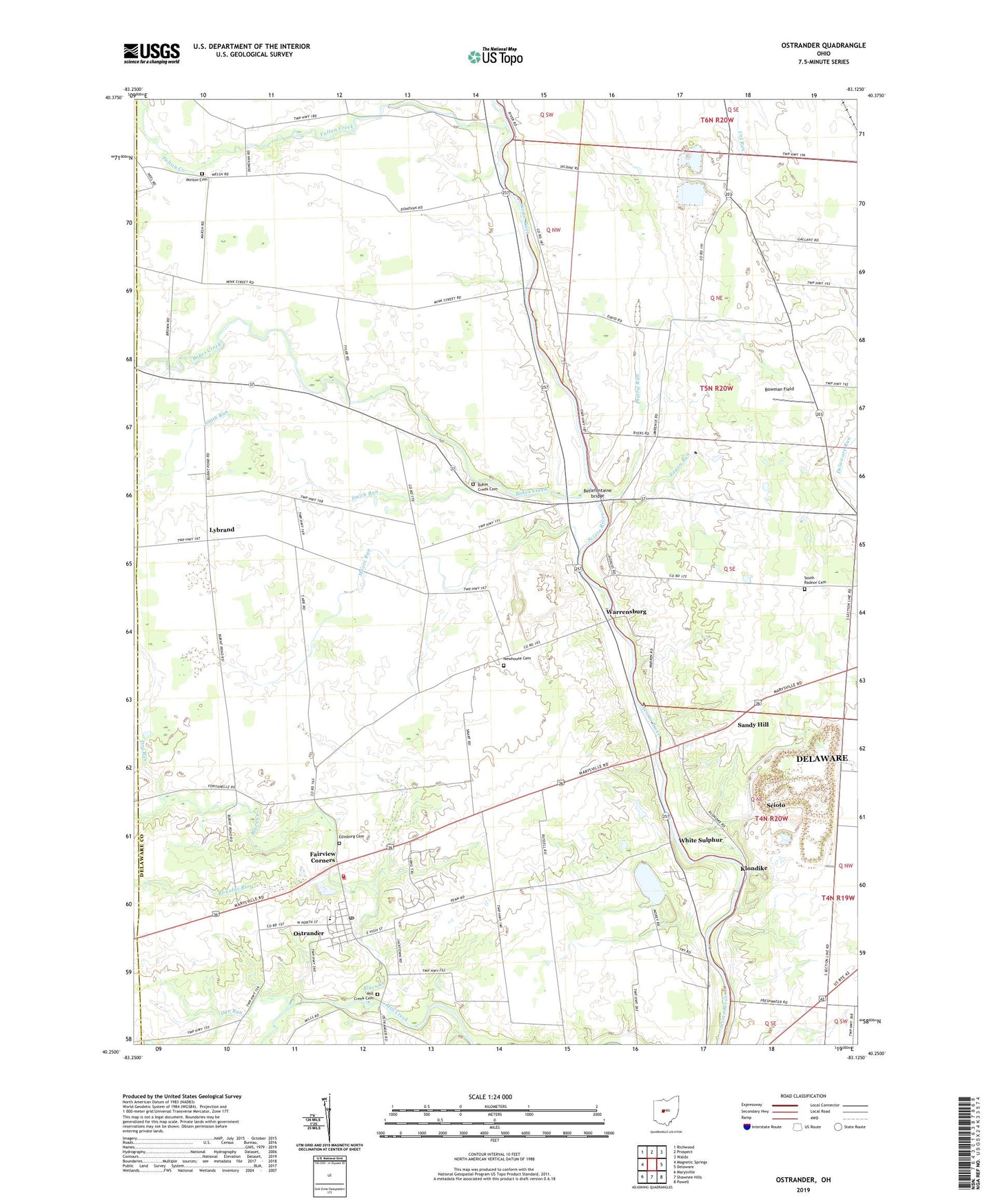
2023 topographic map quadrangle Ostrander in the state of Ohio. Scale: 1:24000. Based on the newly updated USGS 7.5' US Topo map series, this map is in the following counties: Delaware, Union. The map contains contour data, water features, and other items you are used to seeing on USGS maps, but also has updated roads and other features. This is the next generation of topographic maps. Printed on high-quality waterproof paper with UV fade-resistant inks.
Quads adjacent to this one:
West: Magnetic Springs
Northwest: Richwood
North: Prospect
Northeast: Waldo
East: Delaware
Southeast: Powell
South: Shawnee Hills
Southwest: Marysville
This map covers the same area as the classic USGS quad with code o40083c2.
Contains the following named places: Bellefontaine bridge, Blues Creek, Bokes Creek, Bokes Creek Cemetery, Bowman Field, Brindle Corner, Buckeye Valley West Elementary School, Dry Run, Dun Run, Eagon Run, Edinburg Cemetery, Fairview Corners, Fulton Creek, Gabriel Corners, Klondike, Larkspur Farm, Lybrand, Lybrand Post Office, Mill Creek Airport, Mill Creek Cemetery, Millcreek Golf Course, Minton Cemetery, Moors Run, Newhouse Cemetery, Old Stone Church, Ostrander, Ostrander Post Office, Prairie Run, Ronolds Run, Sandy Hill, Scioto, Scioto Township Fire Department Station 370, Smith Run, South Radnor Cemetery, Township of Scioto, Village of Ostrander, Warrensburg, Warrensburg Post Office, White Sulphur, White Sulphur Post Office, ZIP Code: 43061