
MyTopo
Mendon Ohio US Topo Map
Couldn't load pickup availability
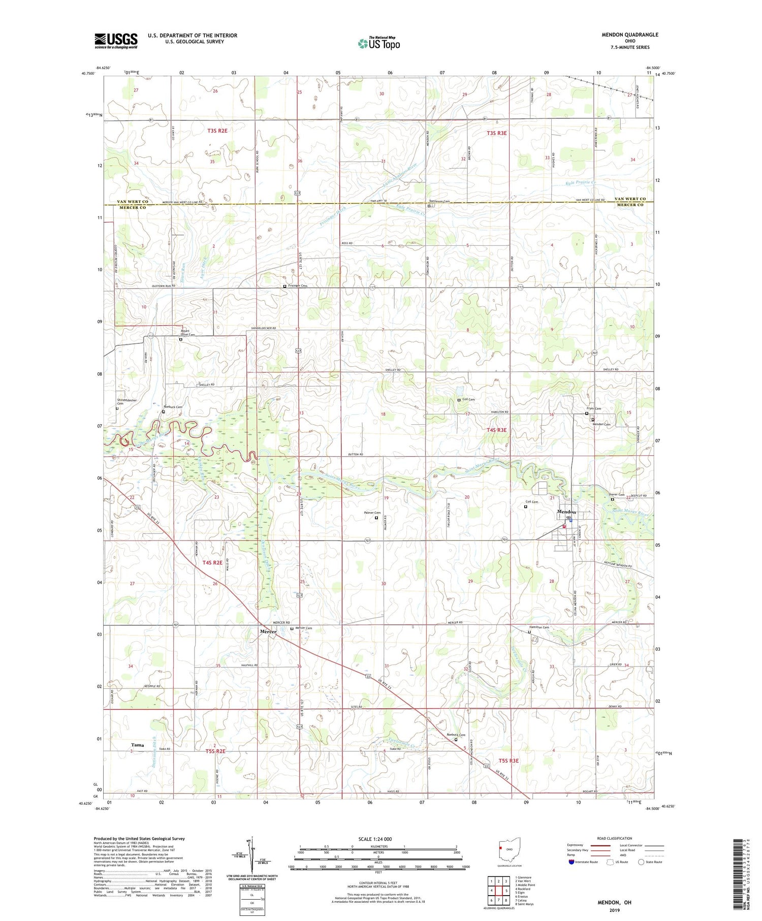
2019 topographic map quadrangle Mendon in the state of Ohio. Scale: 1:24000. Based on the newly updated USGS 7.5' US Topo map series, this map is in the following counties: Mercer, Van Wert. The map contains contour data, water features, and other items you are used to seeing on USGS maps, but also has updated roads and other features. This is the next generation of topographic maps. Printed on high-quality waterproof paper with UV fade-resistant inks.
Quads adjacent to this one:
West: Rockford
Northwest: Glenmore
North: Van Wert
Northeast: Middle Point
East: Elgin
Southeast: Saint Marys
South: Celina
Southwest: Erastus
Contains the following named places: A and A Greenhouse, Ayre Ditch, Bethel Church, Bevington School, Blue Corner School, Boltzell School, Coil Cemetery, Copp School, Dennison Ditch, Frisinger Cemetery, Frisinger Ditch, Frisinger School, Fryer Cemetery, Fryer School, Gross School, Hamilton Cemetery, Kyle Prairie Creek, Liberty Egg Farm, Mendon, Mendon - Union Fire Department, Mendon Cemetery, Mendon First Church of God, Mendon Police Department, Mendon Post Office, Mendon United Methodist Church, Mendon-Union Elementary School, Mendon-Union High School, Mercer, Mercer Cemetery, Mercer Post Office, Mount Hope School, Mount Olive Cemetery, Mount Tabor Church, Palmer Cemetery, Prairie School, Profit Farm, Protzman School, Red School, Roebuck Cemetery, Roebuck School, School Number 1, School Number 2, Sherer Cemetery, Shindeldecker Cemetery, Tama, Tamah Post Office, Tomlinson Cemetery, Town Run, Township of Union, Twelvemile Creek, Victor School, Village of Mendon, Wesley Chapel, Yankee Run, ZIP Code: 45862


