MyTopo
Elgin Ohio US Topo Map
Couldn't load pickup availability
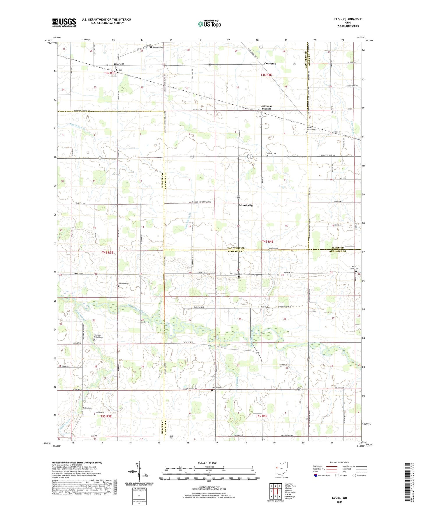
2023 topographic map quadrangle Elgin in the state of Ohio. Scale: 1:24000. Based on the newly updated USGS 7.5' US Topo map series, this map is in the following counties: Mercer, Auglaize, Van Wert, Allen. The map contains contour data, water features, and other items you are used to seeing on USGS maps, but also has updated roads and other features. This is the next generation of topographic maps. Printed on high-quality waterproof paper with UV fade-resistant inks.
Quads adjacent to this one:
West: Mendon
Northwest: Van Wert
North: Middle Point
Northeast: Delphos
East: Spencerville
Southeast: Moulton
South: Saint Marys
Southwest: Celina
This map covers the same area as the classic USGS quad with code o40084f4.
Contains the following named places: Barber School, Bethel Church, Book School, Calvary Cemetery, Calvary Evangelical Methodist Church, Charity Church, Converse, Converse Post Office, Converse Station, Eightmile Creek, Elgin, Elgin Post Office, Elm Grove School, Fairview Church, Fissel Lauth Cemetery, Gallman Farms, Goodwin Cemetery, Hamilton Bethel Cemetery, Hance Cemetery, Hankin Cemetery, Hussey Cemetery, Hussey Creek, Jennings Prairie Ditch, Jennings School, Jennings-Spencerville Elementary School, Longs School, Monticello, Monticellow Post Office, Mount Union Cemetery, Mount Union Church, New Salem Cemetery, New Salem Church, North Union School, Pleasant Grove Baptist Church, Robbins Cemetery, Roller School, Ross Church, School Number 4, School Number 6, School Number 8, Seibert Farm, Shere School, Smith School, South Union School, Swamp School, Thomas Ditch, Townsend School, Township of Salem, Village of Elgin, Wilson School, ZIP Code: 45838