MyTopo
Middle Point Ohio US Topo Map
Couldn't load pickup availability
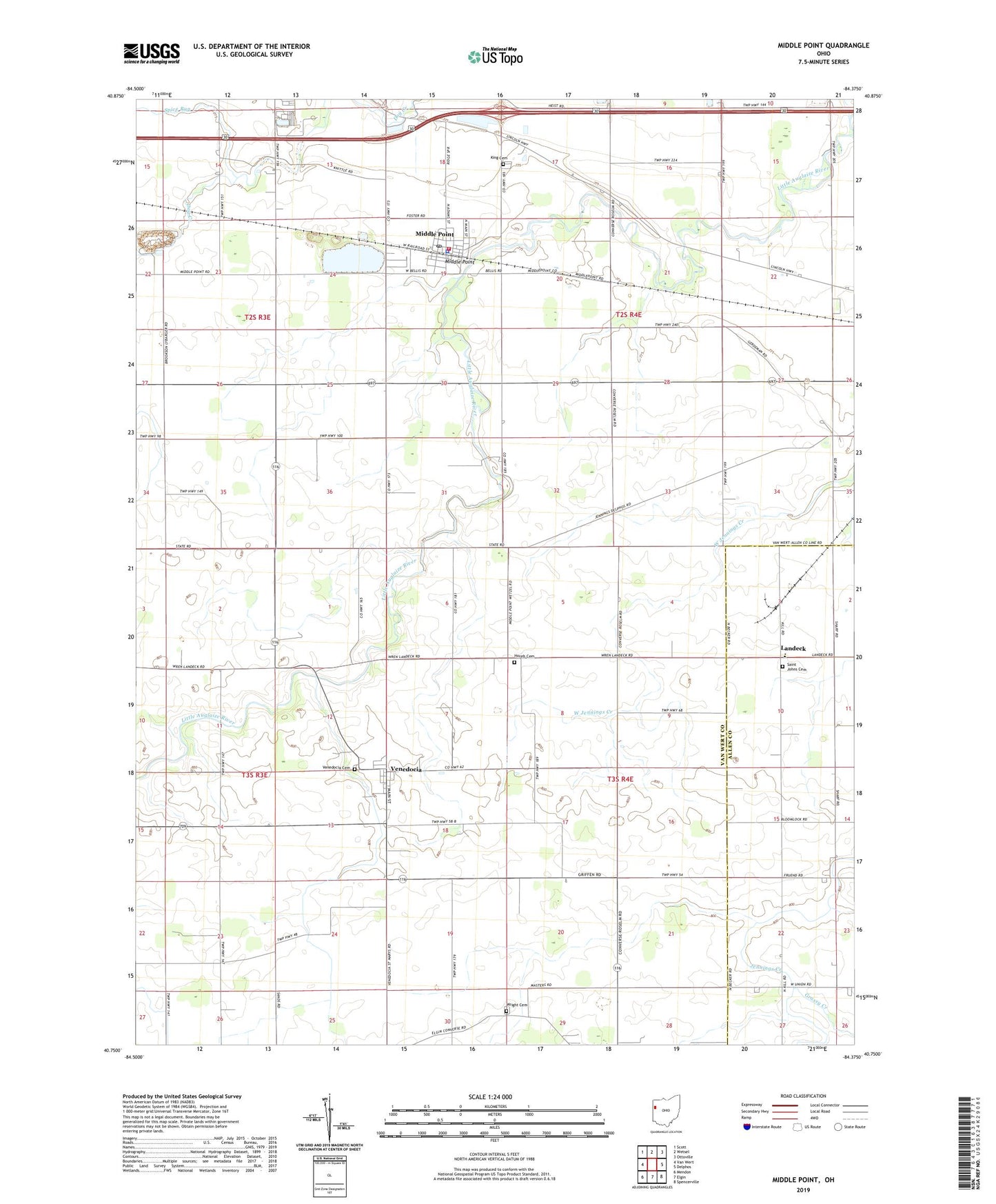
2023 topographic map quadrangle Middle Point in the state of Ohio. Scale: 1:24000. Based on the newly updated USGS 7.5' US Topo map series, this map is in the following counties: Van Wert, Allen. The map contains contour data, water features, and other items you are used to seeing on USGS maps, but also has updated roads and other features. This is the next generation of topographic maps. Printed on high-quality waterproof paper with UV fade-resistant inks.
Quads adjacent to this one:
West: Van Wert
Northwest: Scott
North: Wetsel
Northeast: Ottoville
East: Delphos
Southeast: Spencerville
South: Elgin
Southwest: Mendon
This map covers the same area as the classic USGS quad with code o40084g4.
Contains the following named places: Auglaize School, Baer Farms, Brumback Library Middle Point Branch, Buckeye School, Dover School, Evans Ditch, Grassy Creek, Grove Church, Hempfling Dairy Farms, Horeb Cemetery, Horeb Church, Kimmet Ditch, King Cemetery, King School, Landeck, Landeck Elementary School, Landneck Post Office, Lincolnview East Elementary School, Lindeman School, Middle Point, Middle Point Fire Department / Middle Point Emergency Medical Services, Middle Point Police Department, Middle Point Post Office, Morris Ditch, Prairie School, Pugh School, Ridge Township Stone Quarry, Ringwald Egg Ranch, Saint John the Baptist Catholic Church, Saint Johns Cemetery, Saint Johns School, Salem United Presbyterian Church, Spice Run, Summerset School, Township of Jennings, Township of Washington, Van-Del Drive-In, Venedocia, Venedocia Cemetery, Venedocia Post Office, Village of Middle Point, Village of Venedocia, Whites Ditch, Wolf Ditch, Wright Cemetery, ZIP Code: 45894