MyTopo
Monnett Ohio US Topo Map
Couldn't load pickup availability
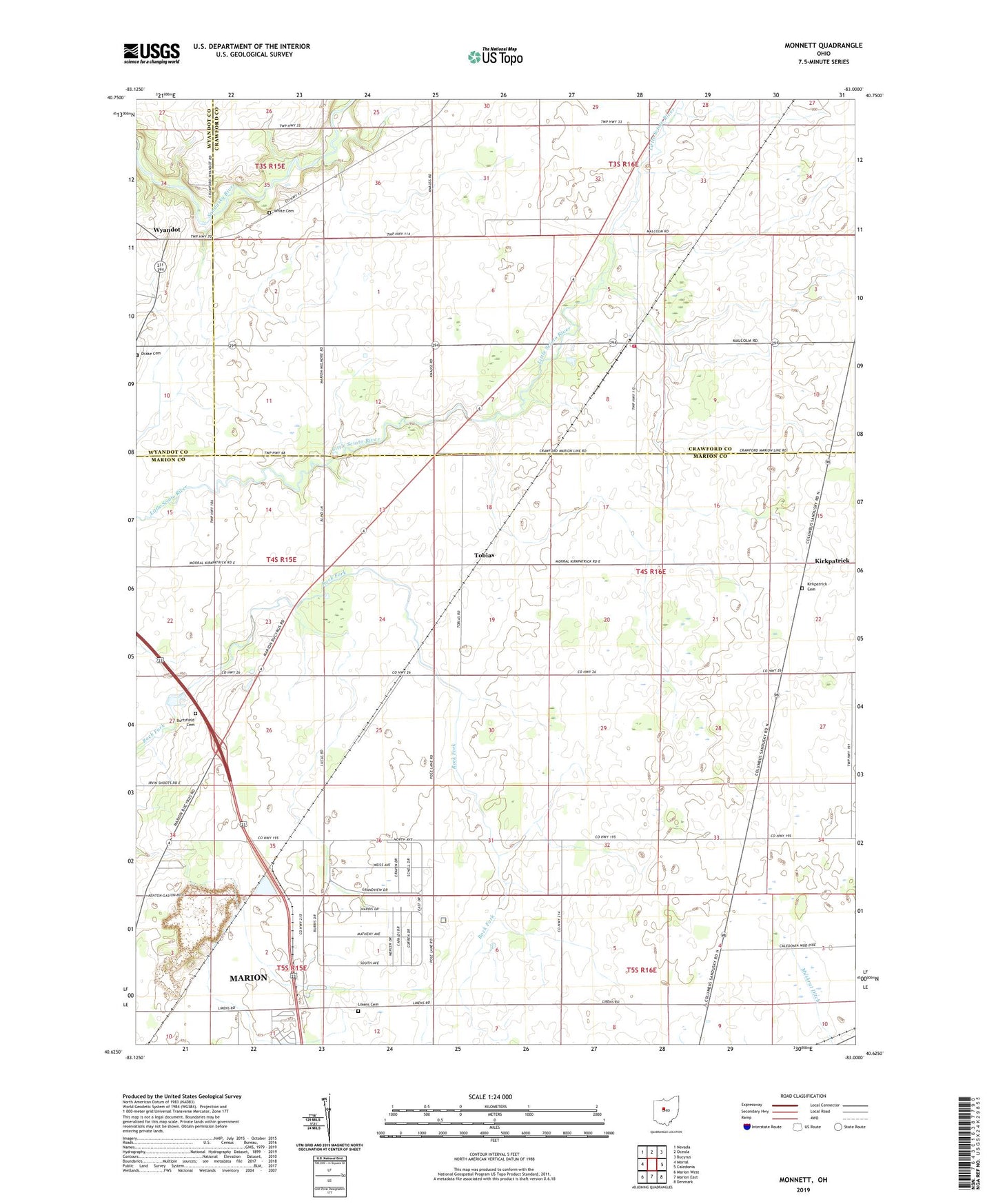
2019 topographic map quadrangle Monnett in the state of Ohio. Scale: 1:24000. Based on the newly updated USGS 7.5' US Topo map series, this map is in the following counties: Marion, Crawford, Wyandot. The map contains contour data, water features, and other items you are used to seeing on USGS maps, but also has updated roads and other features. This is the next generation of topographic maps. Printed on high-quality waterproof paper with UV fade-resistant inks.
Quads adjacent to this one:
West: Morral
Northwest: Nevada
North: Oceola
Northeast: Bucyrus
East: Caledonia
Southeast: Denmark
South: Marion East
Southwest: Marion West
Contains the following named places: Burtsfield Cemetery, Dallas Township Fire Department, Grandview Estates, Kirkpatrick, Kirkpatrick Cemetery, Kirkpatrick Post Office, Likens Cemetery, Likens Church, Monnett, Monnett Post Office, River Valley Estates, Tobias, Tobias Post Office, Township of Dallas, Township of Scott, White Cemetery, Wyandot