MyTopo
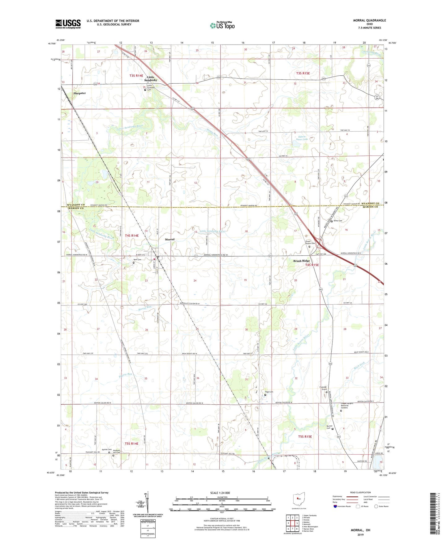
Morral Ohio US Topo Map
Couldn't load pickup availability
2023 topographic map quadrangle Morral in the state of Ohio. Scale: 1:24000. Based on the newly updated USGS 7.5' US Topo map series, this map is in the following counties: Marion, Wyandot. The map contains contour data, water features, and other items you are used to seeing on USGS maps, but also has updated roads and other features. This is the next generation of topographic maps. Printed on high-quality waterproof paper with UV fade-resistant inks.
Quads adjacent to this one:
West: Meeker
Northwest: Upper Sandusky
North: Nevada
Northeast: Oceola
East: Monnett
Southeast: Marion East
South: Marion West
Southwest: New Bloomington
This map covers the same area as the classic USGS quad with code o40083f2.
Contains the following named places: Ackley Farms, Bretz Cemetery, Brewer Cemetery, Brush Ridge, Carpenters Corners, Chapel Heights Memorial Gardens, Drake Cemetery, Edwin Naus Lake, Edwin Naus Lake Dam, Fetter and Son Farms, Fitzhugh Grave, Grand Prairie Cemetery, Grand Prairie Elementary School, Hickory Grove Golf Course, Honey Run, Kannel Cemetery, Little Sandusky, Little Sandusky Cemetery, Loudenslager Acres, Morral, Morral - Salt Rock Township Fire Department, Morral Elementary School, Morral Post Office, Morral Run, Neff Cemetery, Ohio State Highway Patrol - Marion Patrol Post, Page Cemetery, Pleasant Hill Cemetery, Pleasant Hill Union Church, Richmond Farms, Ridgedale High School, Ridgedale Middle School, Rock Fork, Township of Grand Prairie, Township of Pitt, Township of Salt Rock, Village of Morral, ZIP Code: 43323