MyTopo
Five Points Ohio US Topo Map
Couldn't load pickup availability
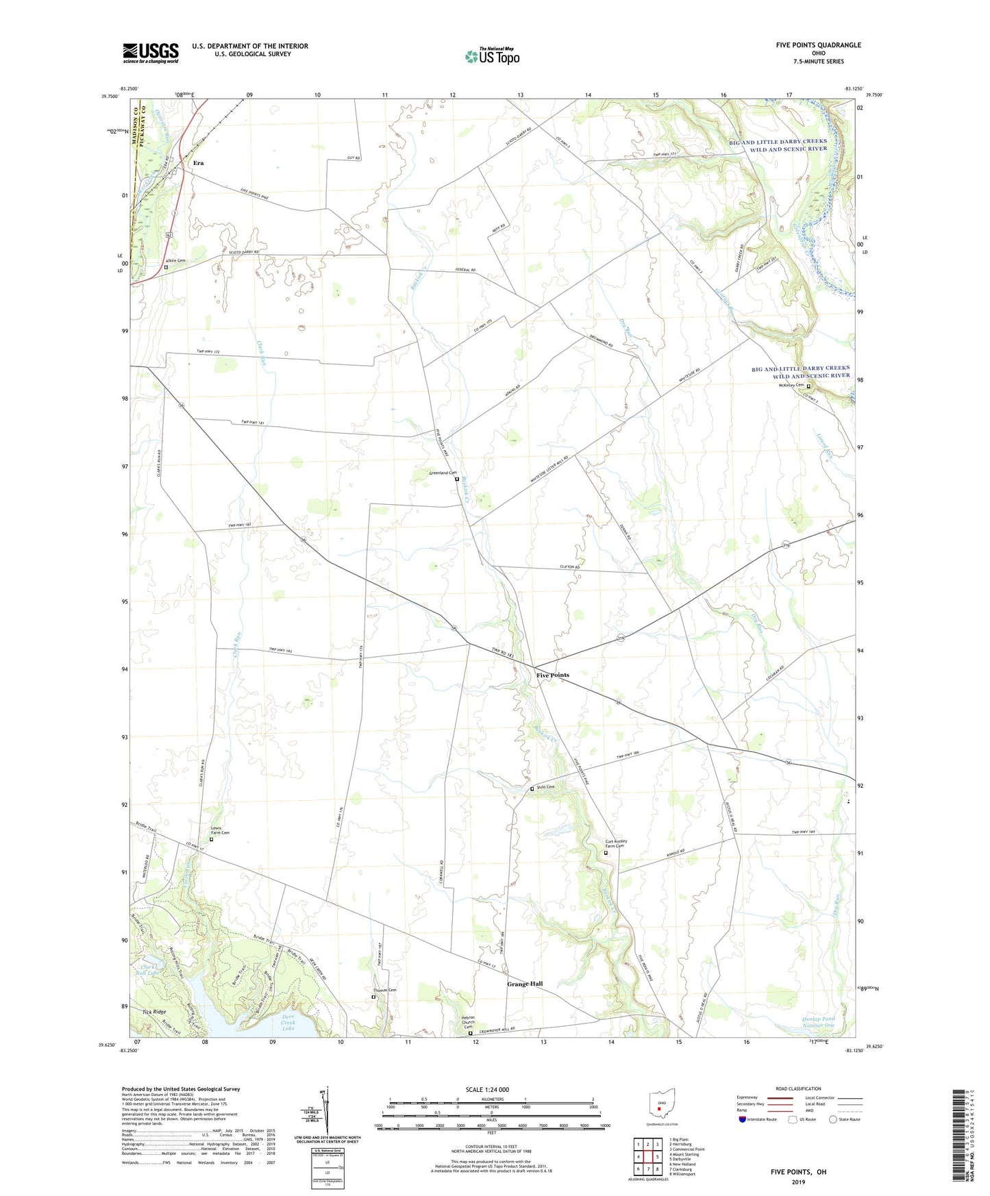
2023 topographic map quadrangle Five Points in the state of Ohio. Scale: 1:24000. Based on the newly updated USGS 7.5' US Topo map series, this map is in the following counties: Pickaway, Madison. The map contains contour data, water features, and other items you are used to seeing on USGS maps, but also has updated roads and other features. This is the next generation of topographic maps. Printed on high-quality waterproof paper with UV fade-resistant inks.
Quads adjacent to this one:
West: Mount Sterling
Northwest: Big Plain
North: Harrisburg
Northeast: Commercial Point
East: Darbyville
Southeast: Williamsport
South: Clarksburg
Southwest: New Holland
This map covers the same area as the classic USGS quad with code o39083f2.
Contains the following named places: Alkire Cemetery, Allen School, Anderson Farms, Barnes Family Farms, Clark Run, Clark Run Dam, Clark Run Lake, Curt Knisley Farm Cemetery, Dick School, Dunlap Pond Dam Number One, Dunlap Pond Number One, Era, Era Post Office, Five Points, Fivepoints Post Office, Grange Hall, Greenbrier Creek, Greenland Cemetery, Greenland Church, Greenland School, Gulicks Ford, Hebron Church, Hebron Church Cemetery, Hill School, Hobuck School, Ingman School, Keppler Ford, Larey School, Lewis Farm Cemetery, Limbs and Leaves Tree Farm, McKinley Cemetery, McKinley School, Monroe Elementary School, Opossum Run, Pickens Tree Farm, Pleasant Grove School, Rebellion School, Robison School, Rowlen School, Shilo Cemetery, Spring Valley Farm, Sun Set Mobile Home Park, Thomas Cemetery, Thomas School, Tick Ridge, Tick Ridge School, Township of Monroe, West Union Shool, White School