MyTopo
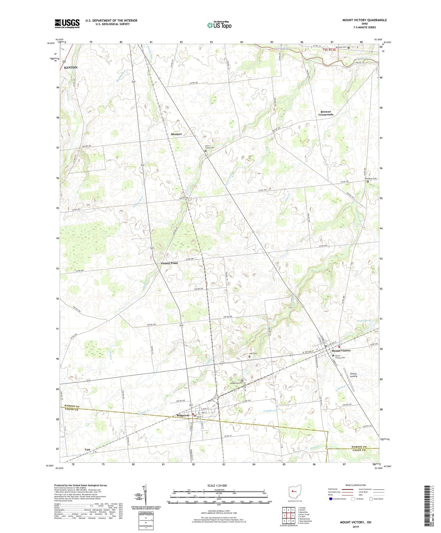
Mount Victory Ohio US Topo Map
Couldn't load pickup availability
2019 topographic map quadrangle Mount Victory in the state of Ohio. Scale: 1:24000. Based on the newly updated USGS 7.5' US Topo map series, this map is in the following counties: Hardin, Logan, Union. The map contains contour data, water features, and other items you are used to seeing on USGS maps, but also has updated roads and other features. This is the next generation of topographic maps. Printed on high-quality waterproof paper with UV fade-resistant inks.
Quads adjacent to this one:
West: Silver Creek
Northwest: Foraker
North: Kenton
Northeast: Marseilles
East: La Rue
Southeast: York Center
South: West Mansfield
Southwest: Rushsylvania
Contains the following named places: Allinger School, Amish School, Beech Grove School, Beechdale School, Black and White School, Browns Crossroads, Champion School, Compromise School, Elliotts Landing, Elsasser Farm, Garwood Run, Grassy Point, Grassy Point Post Office, Hale Cemetery, Jims Creek, Kerns School, Lynn Grove Cemetery, Maple Grove School, McKinley Farms, Mentzer, Morrison Cemetery, Mount Victory, Mount Victory Cemetery, Mount Victory Post Office, Otterbein, Otterbein Cemetery, Otterbein Church, Ridgemont Elementary School, Ridgemont High School, Ridgeway, Ridgeway Cemetery, Ridgeway Post Office, Ridgeway Volunteer Fire Department, Rosewood Rescue Squad, Shiloh School, Southeast Hardin - Northwest Union Joint Fire District, Southeastern Hardin Ambulance District, Spring Grove School, Township of Buck, Township of Hale, Van, Village of Mount Victory, Village of Ridgeway, West Creek Church, Wolf Creek, Wolf Creek Church, Wolf Creek School, Ziegler Pond, Ziegler Pond Dam, ZIP Code: 43345