MyTopo
New Holland Ohio US Topo Map
Couldn't load pickup availability
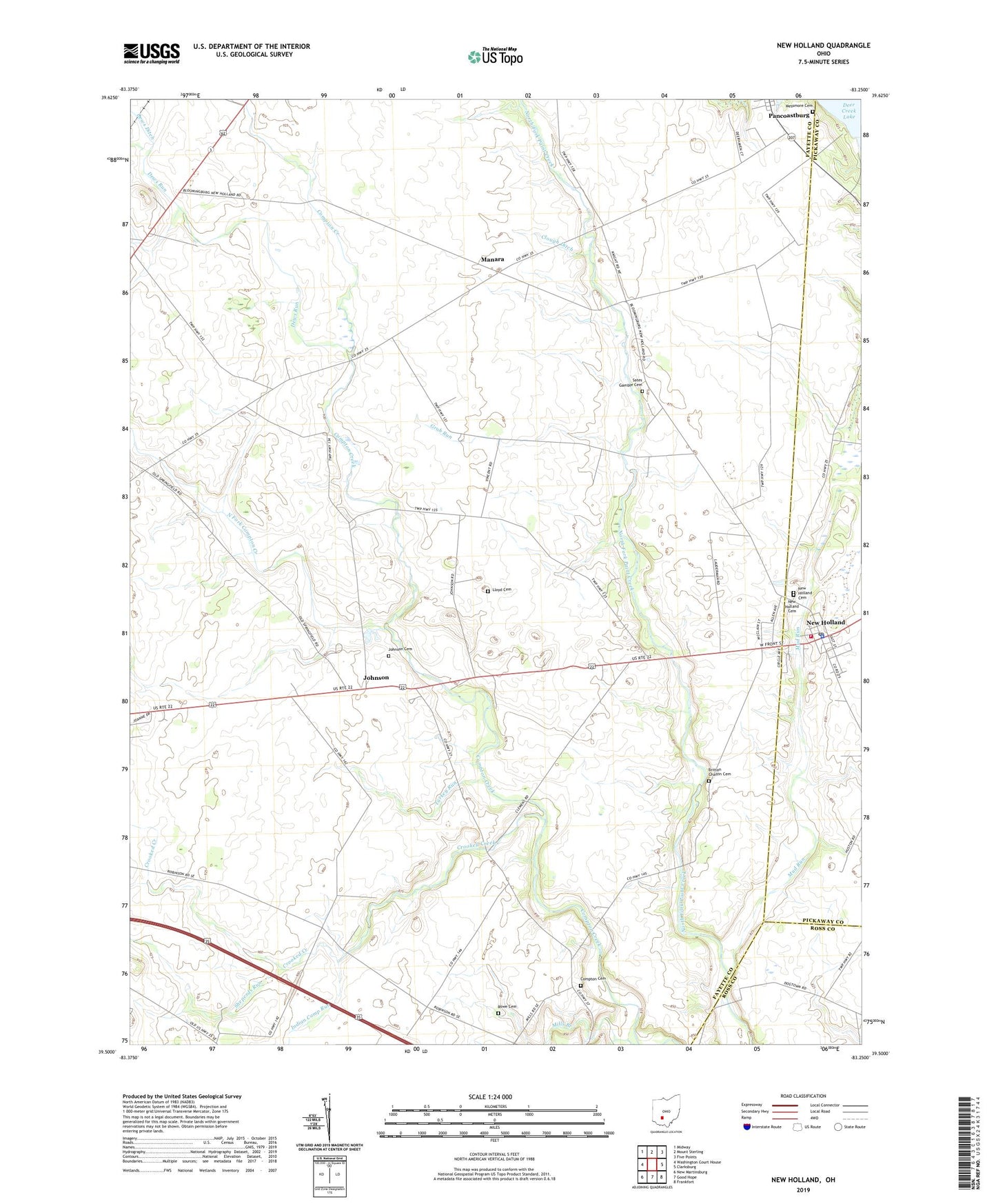
2019 topographic map quadrangle New Holland in the state of Ohio. Scale: 1:24000. Based on the newly updated USGS 7.5' US Topo map series, this map is in the following counties: Fayette, Pickaway, Ross. The map contains contour data, water features, and other items you are used to seeing on USGS maps, but also has updated roads and other features. This is the next generation of topographic maps. Printed on high-quality waterproof paper with UV fade-resistant inks.
Quads adjacent to this one:
West: Washington Court House
Northwest: Midway
North: Mount Sterling
Northeast: Five Points
East: Clarksburg
Southeast: Frankfort
South: Good Hope
Southwest: New Martinsburg
Contains the following named places: Britton Chaffin Cemetery, Clough Ditch, Compton Cemetery, Crooked Creek, Daniels Family Farm, Dews Run, Eggleton Farms, Grub Run, Indian Camp Run, Johnson, Johnson Cemetery, Kingfred, Lloyd Cemetery, Manara, Manara School, Manera Post Office, Marion Township Centralized School, Messmore Cemetery, Mud Run, New Holland, New Holland Cemetery, New Holland Church of Christ, New Holland Elementary School, New Holland Fire Department, New Holland High School, New Holland Police Department, New Holland Post Office, New Holland United Methodist Church, North Fork Compton Creek, Pancoastburg, Pancoastburg Census Designated Place, Pancoastburg Post Office, Rowe Cemetery, Sates Gamble Cemetery, Sheperds Run, Stinson Farms, Township of Marion, Turkey Run, Village of New Holland, West Holland, ZIP Code: 43145