MyTopo
New Martinsburg Ohio US Topo Map
Couldn't load pickup availability
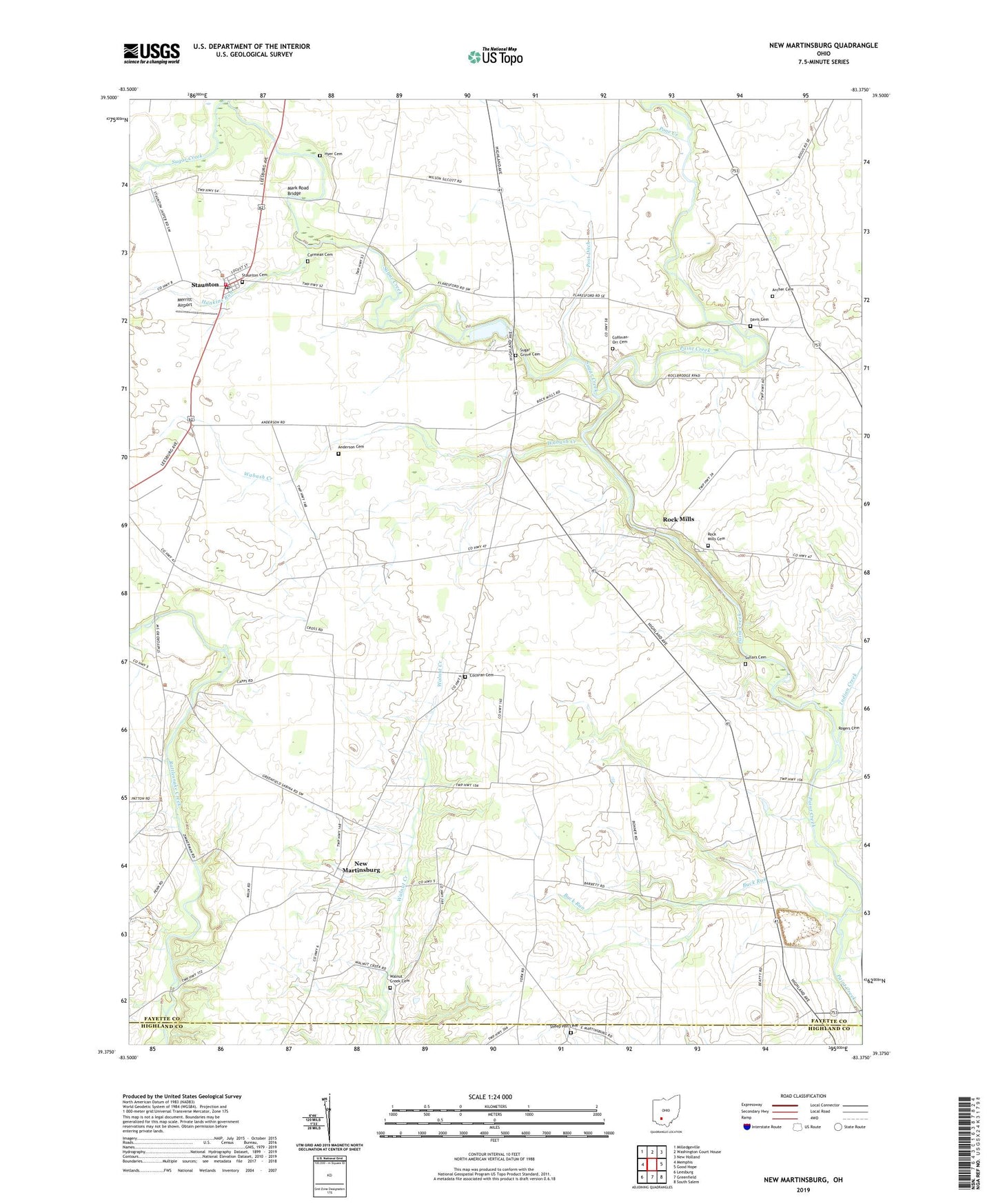
2023 topographic map quadrangle New Martinsburg in the state of Ohio. Scale: 1:24000. Based on the newly updated USGS 7.5' US Topo map series, this map is in the following counties: Fayette, Highland. The map contains contour data, water features, and other items you are used to seeing on USGS maps, but also has updated roads and other features. This is the next generation of topographic maps. Printed on high-quality waterproof paper with UV fade-resistant inks.
Quads adjacent to this one:
West: Memphis
Northwest: Milledgeville
North: Washington Court House
Northeast: New Holland
East: Good Hope
Southeast: South Salem
South: Greenfield
Southwest: Leesburg
This map covers the same area as the classic USGS quad with code o39083d4.
Contains the following named places: Anderson Cemetery, Aquilla School, Archer Cemetery, Black Farms, Blue Rock Quarry, Boyds, Buck Run, Buck Run School, Buckeye Hills Golf Course, Buena Vista, Buena Vista School, Carmean Cemetery, Cochran Cemetery, Coffman-Orr Cemetery, Concord - Green Township Volunteer Fire Department, Davis Cemetery, Ghormley, Hankins Run, Hyer Cemetery, Indian Creek, Locust Grove School, Mark Road Bridge, Merritt Airport, Methodist Episcopal Church, New Martinsburg, New Martinsburg Post Office, Pikes Peak School, Plainview School, Pone Creek, Post Ditch, Rock Mills, Rock Mills Cemetery, Rock Mills School, Shady Grove School, Sheep Pen Cemetery, Smithville School, Sollars Cemetery, Staunton, Staunton Cemetery, Staunton Elementary School, Staunton Post Office, Staunton United Methodist Church, Sugar Creek, Sugar Grove Cemetery, Sugar Grove School, Sugar Grove United Methodist Church, Sunshine School, Township of Perry, Township of Union, Wabash Creek, Walnut Creek Cemetery