MyTopo
North Kingsville Ohio US Topo Map
Couldn't load pickup availability
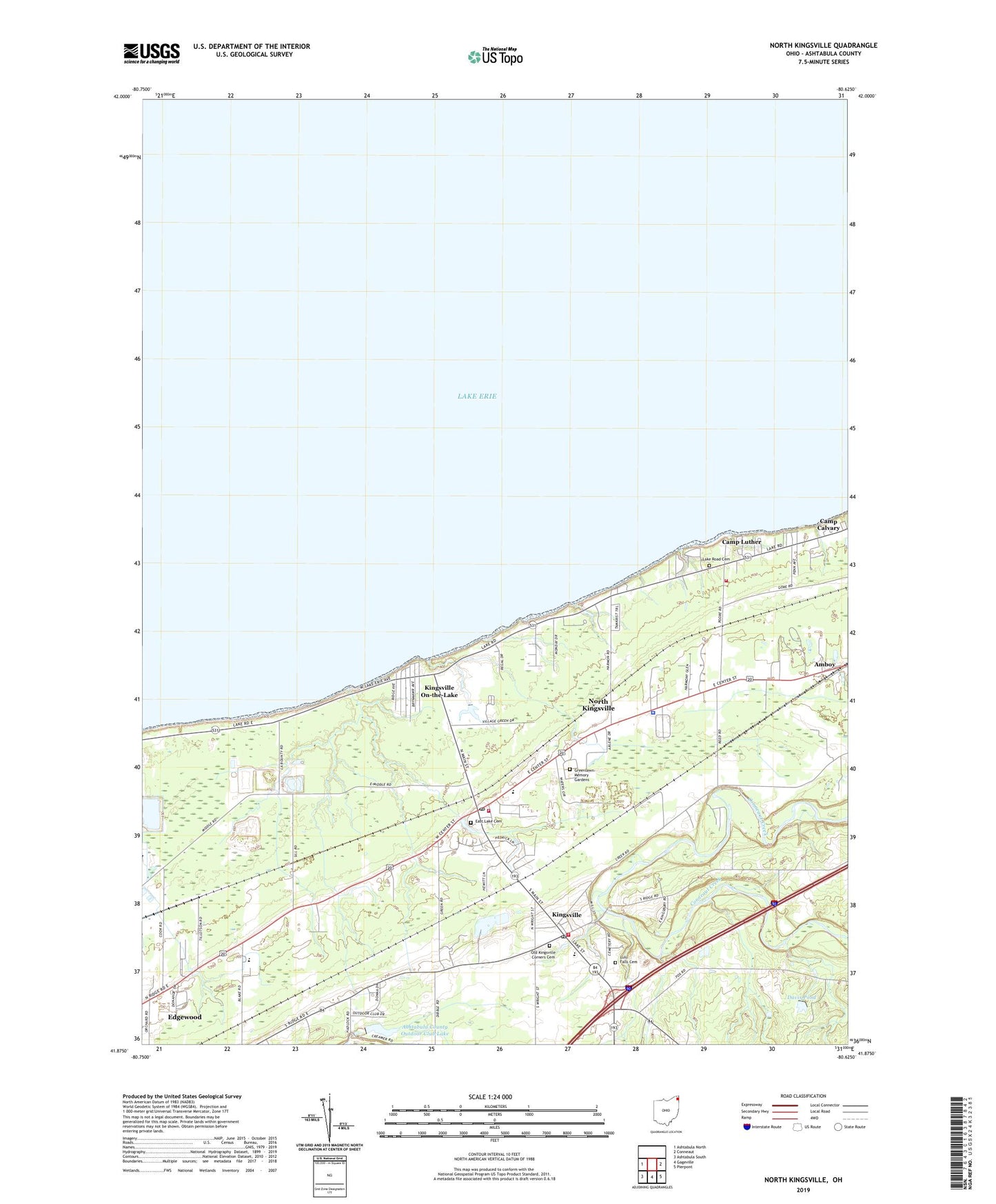
2023 topographic map quadrangle North Kingsville in the state of Ohio. Scale: 1:24000. Based on the newly updated USGS 7.5' US Topo map series, this map is in the following counties: Ashtabula. The map contains contour data, water features, and other items you are used to seeing on USGS maps, but also has updated roads and other features. This is the next generation of topographic maps. Printed on high-quality waterproof paper with UV fade-resistant inks.
Quads adjacent to this one:
West: Ashtabula North
East: Conneaut
Southeast: Pierpont
South: Gageville
Southwest: Ashtabula South
This map covers the same area as the classic USGS quad with code o41080h6.
Contains the following named places: Ashtabula County Home, Ashtabula County Outdoor Club Lake, Ashtabula County Outdoor Club Lake Dam, Ashtabula-Conneaut Airport, Belding Pit, Camp Calvary, Camp Luther, Davis Pond, Davis Pond Dam, East Lake Cemetery, Edgewood Census Designated Place, Edgewood High School, Effluent Treatment Pond Number Four, Effluent Treatment Pond Number Four Dam, First Baptist Church, Green Acres, Greenlawn Memory Gardens, Kingsville, Kingsville Census Designated Place, Kingsville Elementary School, Kingsville On-the-Lake, Kingsville Post Office, Kingsville Presbyterian Church, Kingsville Township Fire Department, Lake Road Cemetery, Lulu Falls Cemetery, Meadowlake Farm, Mobile Acres, North Kingsville, North Kingsville Elementary School, North Kingsville Police Department, North Kingsville Post Office, North Kingsville Presbyterian Church, North Kingsville Volunteer Fire Department Station 1 Headquarters, North Kingsville Volunteer Fire Department Station 2, Old Kingsville Corners Cemetery, Southwood Colony, Sunset Park, Taylor Mobile Home Park, Township of Kingsville, Village Green Park, Village of North Kingsville