MyTopo
Old Washington Ohio US Topo Map
Couldn't load pickup availability
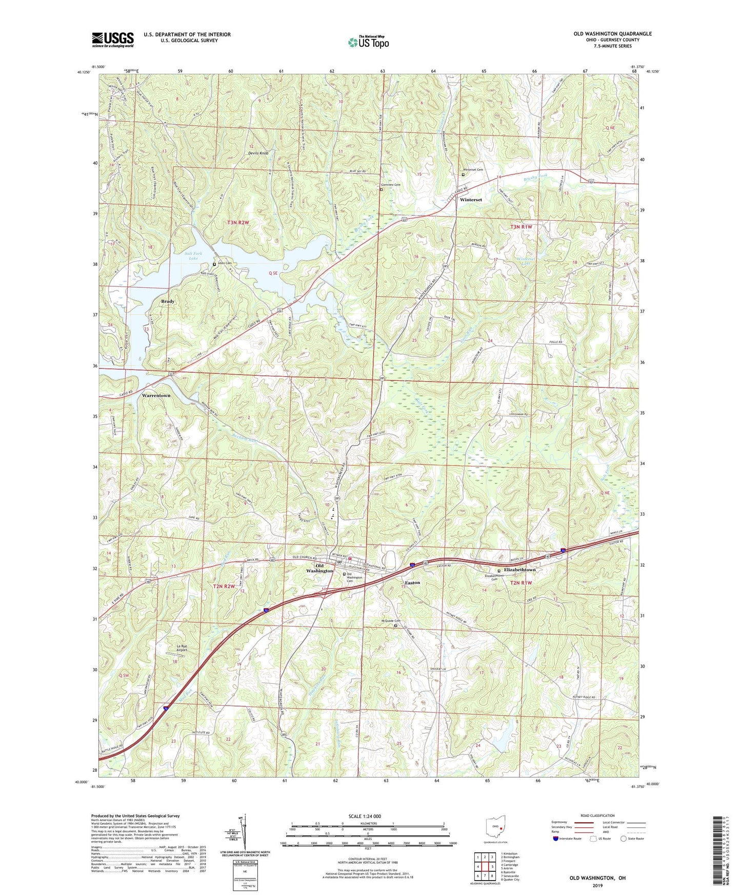
2023 topographic map quadrangle Old Washington in the state of Ohio. Scale: 1:24000. Based on the newly updated USGS 7.5' US Topo map series, this map is in the following counties: Guernsey. The map contains contour data, water features, and other items you are used to seeing on USGS maps, but also has updated roads and other features. This is the next generation of topographic maps. Printed on high-quality waterproof paper with UV fade-resistant inks.
Quads adjacent to this one:
West: Cambridge
Northwest: Kimbolton
North: Birmingham
Northeast: Freeport
East: Antrim
Southeast: Quaker City
South: Senecaville
Southwest: Byesville
This map covers the same area as the classic USGS quad with code o40081a4.
Contains the following named places: Allen Cemetery, Allen Chapel, Beeham Run, Brady, Brady Post Office, Brothers Aviation, Brushy Fork, Brushy Fork Church, Buckeye Trail High School, Butternut Dairy, Christian Creek, Coon Run, Crossroads School, Deep Cut School, Devils Knob, Easton, Elizabethtown, Elizabethtown Cemetery, Fourmile School, Glenview Cemetery, Grand Ridge School, Guernsey County, Hendershot Farm, Institute School, La Rue Airport, Madison Elementary School, Madison High School, McQuade Cemetery, Oak Hill Mobile Home Village, Old Washington, Old Washington Cemetery, Old Washington Elementary School, Old Washington Historic District, Old Washington Post Office, Old Washington Volunteer Fire Department, Salt Fork Reservoir, Salt Fork Wildlife Area, Shipley School, Township of Center, Township of Jefferson, Township of Madison, Township of Wills, Village of Old Washington, Warrentown, Winterset, Winterset Cemetery, Winterset Lake, Winterset Lake Dam, Winterset Post Office, ZIP Codes: 43755, 43768