MyTopo
Quaker City Ohio US Topo Map
Couldn't load pickup availability
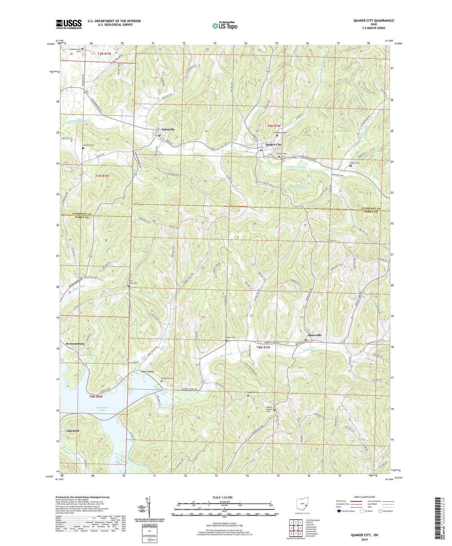
2023 topographic map quadrangle Quaker City in the state of Ohio. Scale: 1:24000. Based on the newly updated USGS 7.5' US Topo map series, this map is in the following counties: Noble, Guernsey. The map contains contour data, water features, and other items you are used to seeing on USGS maps, but also has updated roads and other features. This is the next generation of topographic maps. Printed on high-quality waterproof paper with UV fade-resistant inks.
Quads adjacent to this one:
West: Senecaville
Northwest: Old Washington
North: Antrim
Northeast: Fairview
East: Barnesville
Southeast: Lewisville
South: Summerfield
Southwest: Sarahsville
This map covers the same area as the classic USGS quad with code o39081h3.
Contains the following named places: B & O Railroad Pond, B & O Railroad Pond Dam, Batesville, Batesville Post Office, Beaver Baptist Cemetery, Beaver Baptist Church, Beaver Creek, Beaver School, Deal School, Eldon Cemetery, Friends Cemetery, Glady Run, Greenlawn Cemetery, Griggs School, Hague School, Hall School, House Cemetery, Jones School, Lakeland, Leatherwood Cemetery, Leatherwood Valley Farms, Longs School, Mount Zion Church, Mud Run, Mud Run School, Palestine Cemetery, Palestine Church of Christ, Quaker City, Quaker City Elementary School, Quaker City Fire Department, Quaker City Post Office, Renner School, Richland Meetinghouse, Saint Johns Cemetery, Saint Johns Church, Salesville, Salesville Census Designated Place, Salesville Post Office, Sandhill Cemetery, Science Hill School, Shannon Run, Spencer Station, Spencer's Station Post Office, Sue-Lin Acres, Township of Beaver, Township of Millwood, Tuckyno School, Village of Batesville, Village of Quaker City, Village of Salesville, Wesley Chapel, Wyscarver Cemetery, Wyscarver School, Yoker Creek, Yoker Valley, ZIP Code: 43773