
MyTopo
Orwell Ohio US Topo Map
Couldn't load pickup availability
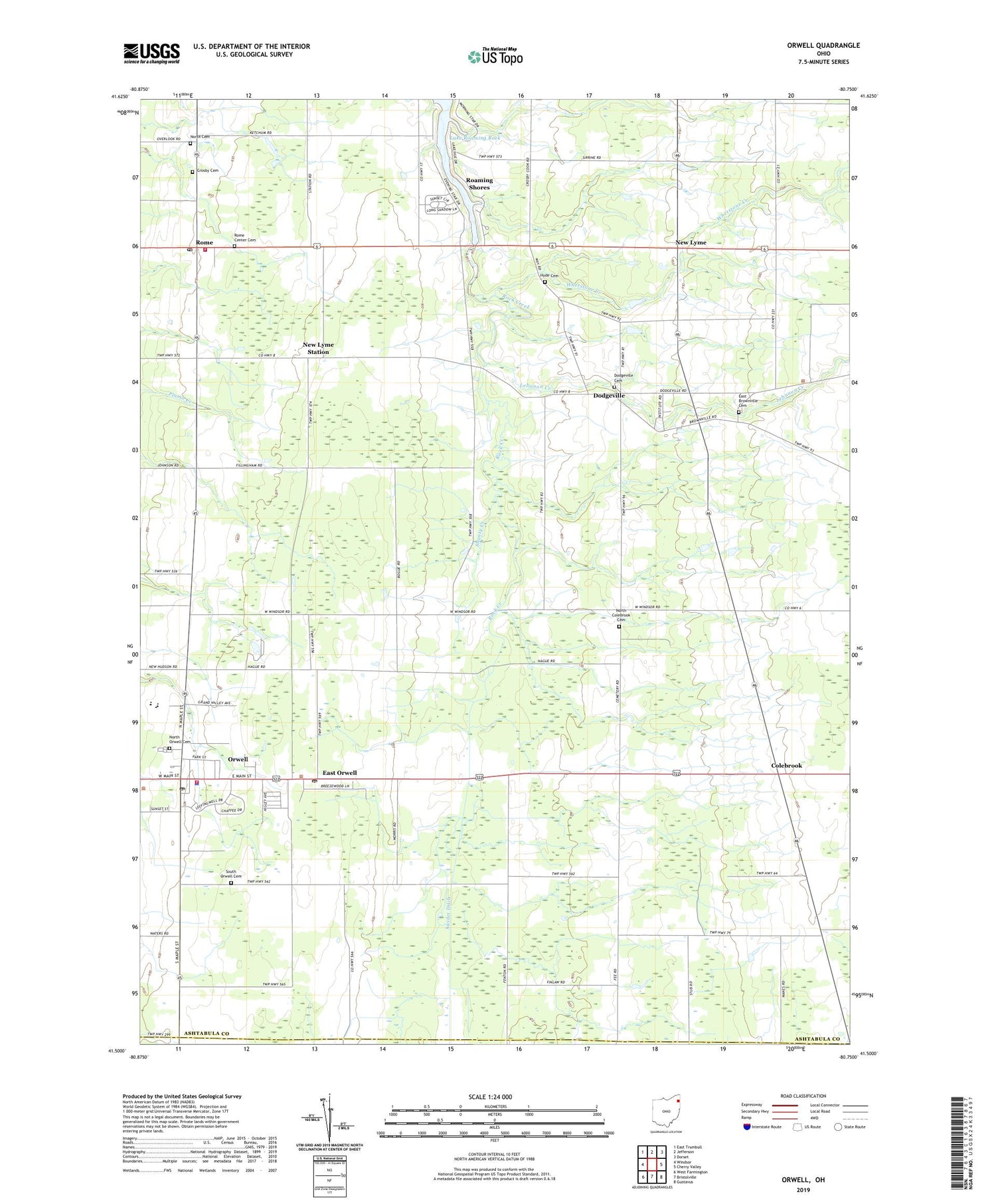
2019 topographic map quadrangle Orwell in the state of Ohio. Scale: 1:24000. Based on the newly updated USGS 7.5' US Topo map series, this map is in the following counties: Ashtabula, Trumbull. The map contains contour data, water features, and other items you are used to seeing on USGS maps, but also has updated roads and other features. This is the next generation of topographic maps. Printed on high-quality waterproof paper with UV fade-resistant inks.
Quads adjacent to this one:
West: Windsor
Northwest: East Trumbull
North: Jefferson
Northeast: Dorset
East: Cherry Valley
Southeast: Gustavus
South: Bristolville
Southwest: West Farmington
Contains the following named places: Asbury Park, Ashtabula County South Central Ambulance District, Benton Farms, Briarwood Farm, Champion Executive Airport, Colebrook, Colebrook Elementary School, Crosby Cemetery, Deeming School, Dodgeville, Dodgeville Cemetery, East Brownville Cemetery, East Orwell, East Orwell Post Office, Grand Valley Elementary School, Grand Valley High School, Humphries Farm, Hyde Cemetery, Kalas Farms, Lebanon Creek, Maple Lane Farm, Mate's Farms, New England Schoolhouse, New Lyme, New Lyme Station, New Lyme Station Post Office, North Cemetery, North Colebrook Cemetery, North Orwell Cemetery, Northside Farms, Orwell, Orwell Post Office, Orwell State Wildlife Area, Orwell Station, Orwell Village Police Department, Orwell Volunteer Fire Department, Rome, Rome Center Cemetery, Rome Post Office, Rome Station, Rome Volunteer Fire Department, Rome-Hartsgrove Elementary School, Shanty Creek, South New Lyme, South Orwell Cemetery, Stackhouse Farm, Teegarden Farm, Township of Colebrook, Township of New Lyme, Township of Orwell, Township of Rome, Village of Orwell, Whetstone Creek, ZIP Codes: 44076, 44085


