MyTopo
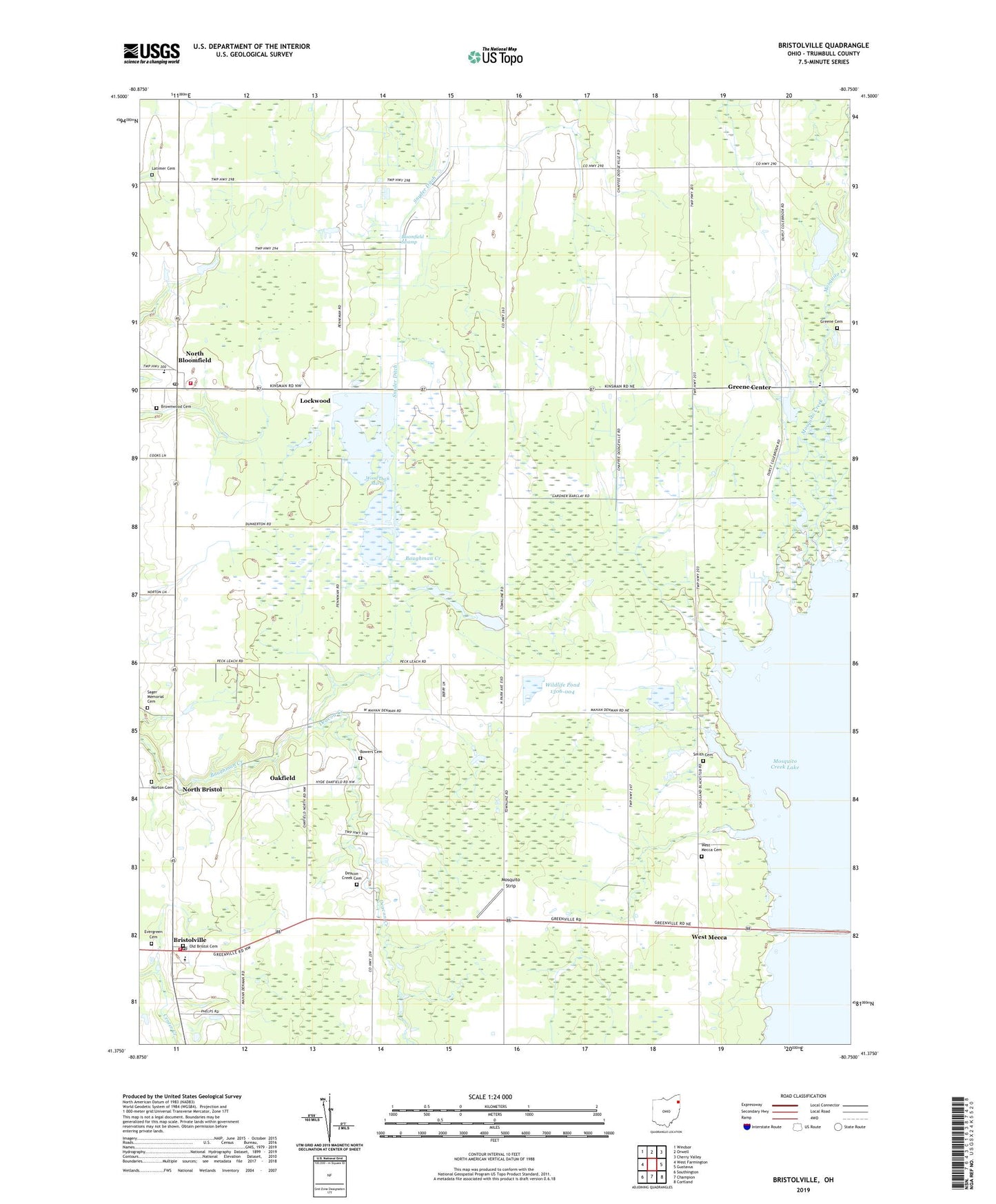
Bristolville Ohio US Topo Map
Couldn't load pickup availability
2023 topographic map quadrangle Bristolville in the state of Ohio. Scale: 1:24000. Based on the newly updated USGS 7.5' US Topo map series, this map is in the following counties: Trumbull. The map contains contour data, water features, and other items you are used to seeing on USGS maps, but also has updated roads and other features. This is the next generation of topographic maps. Printed on high-quality waterproof paper with UV fade-resistant inks.
Quads adjacent to this one:
West: West Farmington
Northwest: Windsor
North: Orwell
Northeast: Cherry Valley
East: Gustavus
Southeast: Cortland
South: Champion
Southwest: Southington
This map covers the same area as the classic USGS quad with code o41080d7.
Contains the following named places: Agler Farm, B M Farm, Bloomfield High School, Bloomfield Swamp, Bloomfield Township Volunteer Fire Department Station 15, Bowers Cemetery, Bristol Fire Department, Bristol High School, Bristolville, Bristolville Church of the Brethren, Bristolville Post Office, Bristolville Station, Bristolville United Methodist Church, Bristolwood Golf Course, Brownwood Cemetery, Deacon Creek, Deacon Creek Cemetery, Deacon Creek Corner, Dulka Farm, Evergreen Cemetery, Greene Cemetery, Greene Center, Greene Community Foursquare Church, Latimer Cemetery, Lockwood, Lockwood Post Office, Malone Farms, Maple Lawn Farm, Meacham Corners, Mosquito Creek State Wildlife Area, Mosquito Strip, North Bloomfield, North Bloomfield Post Office, North Bristol, North Bristol Christian Church, North Bristol Post Office, Norton Cemetery, Oakfield, Oakfield Post Office, Old Bristol Pioneer Cemetery, Parke Farms, Sager Memorial Cemetery, Salash Farm, Smith Cemetery, Snyder Ditch, Spokane, Spokane Post Office, Sugar Island, Township of Bloomfield, Township of Bristol, Township of Greene, Township of Mecca, West Mecca, West Mecca Cemetery, West Mecca Post Office, West Mecca United Methodist Church, Wildlife Pond 1306-004, Wildlife Pond 1306-004 Dam, Wood Duck Marsh, ZIP Codes: 44402, 44450


