MyTopo
Windsor Ohio US Topo Map
Couldn't load pickup availability
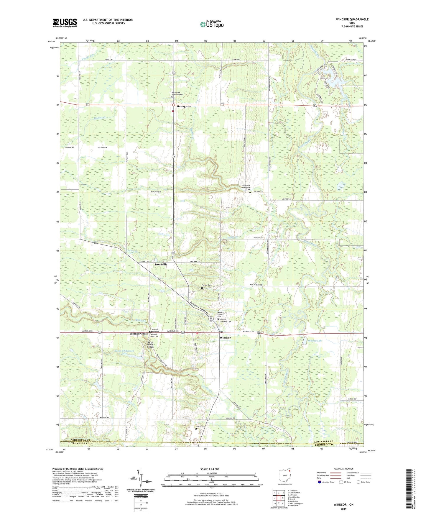
2023 topographic map quadrangle Windsor in the state of Ohio. Scale: 1:24000. Based on the newly updated USGS 7.5' US Topo map series, this map is in the following counties: Ashtabula, Trumbull. The map contains contour data, water features, and other items you are used to seeing on USGS maps, but also has updated roads and other features. This is the next generation of topographic maps. Printed on high-quality waterproof paper with UV fade-resistant inks.
Quads adjacent to this one:
West: East Claridon
Northwest: Thompson
North: East Trumbull
Northeast: Jefferson
East: Orwell
Southeast: Bristolville
South: West Farmington
Southwest: Middlefield
This map covers the same area as the classic USGS quad with code o41080e8.
Contains the following named places: Amish Church, Buckeye Farms, Camp Whitewood, Camp Whitewood Lake, Camp Whitewood Lake Dam, Christ Church Episcopal, Crooked Creek, Crooked Creek Farm, Doubletake Farm, Grand Valley Church, Hartsgrove, Hartsgrove Post Office, Hartsgrove Township Cemetery, Hartsgrove United Church of Christ, Hartsgrove Volunteer Fire Department, Hornung Hops Farms, Hoskins Creek, Indian Creek, Lake Cardinal, Lake Cardinal Dam, Lake Lobo Farm, Loomis Cemetery, Marshy Meadows Farm, Midway Lake, Phelps Creek, Pioneer Cemetery, Plumb Creek, Southeast Hartsgrove Cemetery, Stoneville, Stoneville Post Office, Township of Hartsgrove, Township of Windsor, Warner Hollow Bridge, Windsor, Windsor Corners Cemetery, Windsor Corners Historic District, Windsor Elementary School, Windsor Fire and Rescue, Windsor Greenhouse, Windsor Mill Cemetery, Windsor Mills, Windsor Mills Cemetery, Windsor Mills Post Office, Windsor Post Office, Windsor Township Cemetery, Windsor United Methodist Church, ZIP Code: 44099