MyTopo
West Farmington Ohio US Topo Map
Couldn't load pickup availability
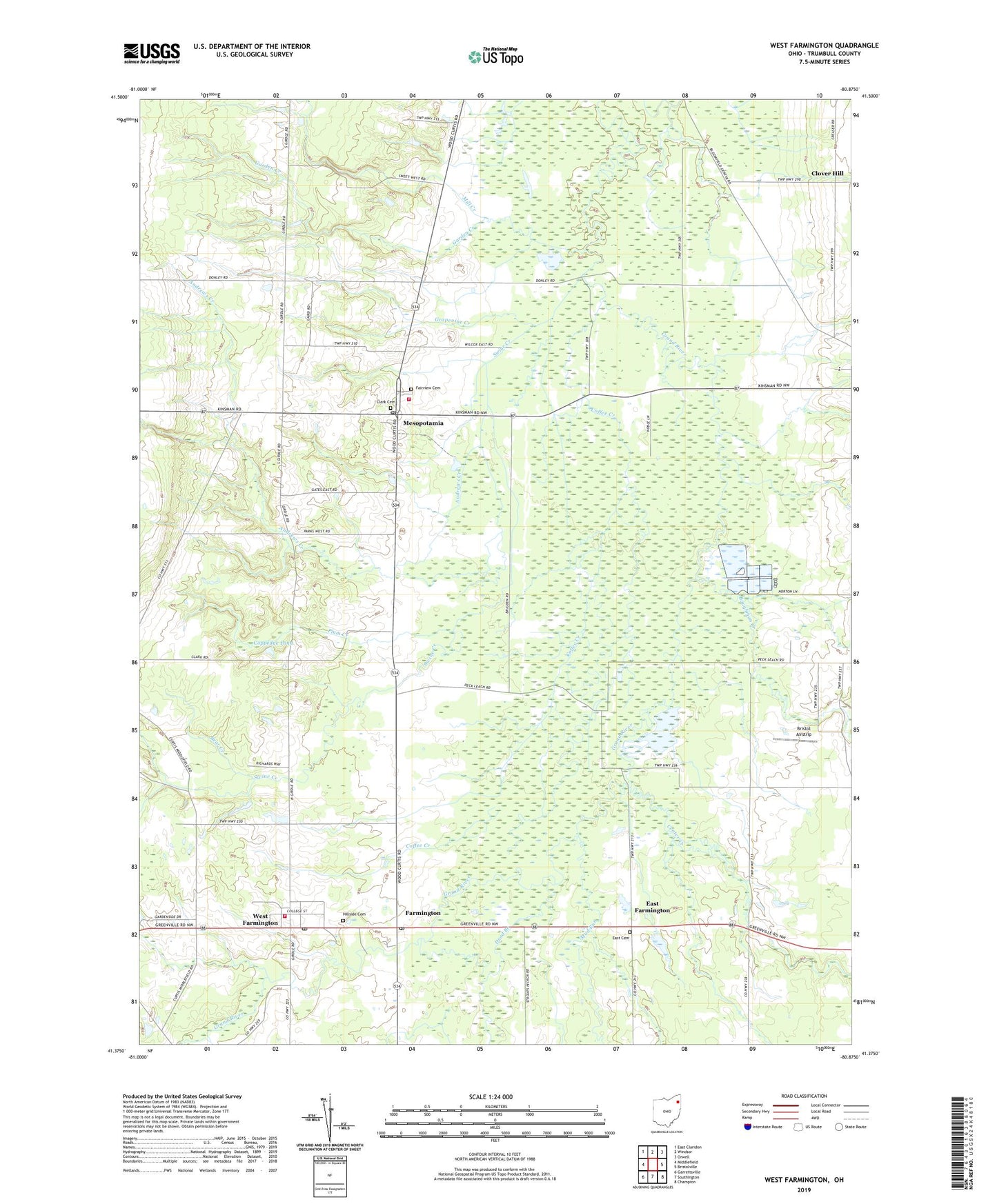
2023 topographic map quadrangle West Farmington in the state of Ohio. Scale: 1:24000. Based on the newly updated USGS 7.5' US Topo map series, this map is in the following counties: Trumbull. The map contains contour data, water features, and other items you are used to seeing on USGS maps, but also has updated roads and other features. This is the next generation of topographic maps. Printed on high-quality waterproof paper with UV fade-resistant inks.
Quads adjacent to this one:
West: Middlefield
Northwest: East Claridon
North: Windsor
Northeast: Orwell
East: Bristolville
Southeast: Champion
South: Southington
Southwest: Garrettsville
This map covers the same area as the classic USGS quad with code o41080d8.
Contains the following named places: Andrews Creek, Baughman Creek, Bear Creek, Bristol Airstrip, Bristol-Farmington Elementary School, Center Creek, Center Creek Corners, Center Creek Farms, Clark Cemetery, Clover Hill, Coffee Corners, Coffee Creek, Coppedge Pond, Coppedge Pond Dam, Dead Branch, Double K Farms, East Cemetery, East Farmington, Fairview Cemetery, Farmdale Post Office, Farmington, Farmington Post Office, Farmington Township Volunteer Fire Department Station 22, Garden Creek, Grand River State Wildlife Area, Grapevine Creek, Hillside Cemetery, Mesopotamia, Mesopotamia Elementary School, Mesopotamia Post Office, Mesopotamia United Methodist Church, Mesopotamia Village Historic District, Mesopotamia Volunteer Fire Department, Mill Creek, Morrison Field Airport, Mud Run, Parker Farms, Plum Creek, Shady Maple Farm, Swine Creek, Tounshendeaux Airport, Township of Farmington, Township of Mesopotamia, Village of West Farmington, Viney Hill Farms, West Farmington, West Farmington Post Office, West Farmington United Methodist Church, ZIP Code: 44439