MyTopo
East Claridon Ohio US Topo Map
Couldn't load pickup availability
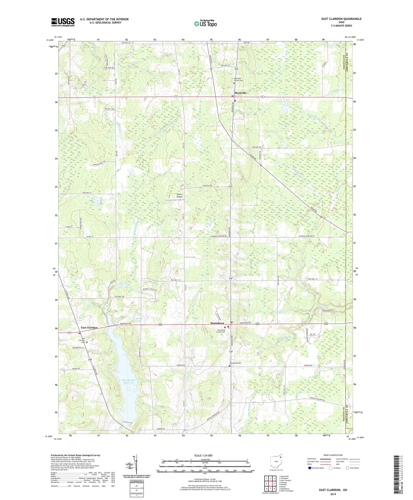
2023 topographic map quadrangle East Claridon in the state of Ohio. Scale: 1:24000. Based on the newly updated USGS 7.5' US Topo map series, this map is in the following counties: Geauga, Ashtabula, Trumbull. The map contains contour data, water features, and other items you are used to seeing on USGS maps, but also has updated roads and other features. This is the next generation of topographic maps. Printed on high-quality waterproof paper with UV fade-resistant inks.
Quads adjacent to this one:
West: Chardon
Northwest: Painesville
North: Thompson
Northeast: East Trumbull
East: Windsor
Southeast: West Farmington
South: Middlefield
Southwest: Burton
This map covers the same area as the classic USGS quad with code o41081e1.
Contains the following named places: Barnes Corners, Beardsley, Bod Airfield, Claridon Elementary School, Culbertsons Corners School, East Branch Reservoir, East Branch Reservoir Dam, East Claridon, East Claridon Cemetery, East Claridon Post Office, Grandview Country Club, Hambden Orchard Wildlife Area, Huntsburg, Huntsburg Cemetery, Huntsburg Center Cemetery, Huntsburg Elementary School, Huntsburg Post Office, Huntsburg School, Middlefield Fire Department Station 2, Montville, Montville Center Cemetery, Montville Ditch, Montville Fire and Rescue, Montville Post Office, Nassau Astronomical Station, North Branch Phelps Creek, Rick's Airport, South Branch Phelps Creek, Spring Lake, Township of Huntsburg, Township of Montville, ZIP Codes: 44046, 44064