MyTopo
Pemberville Ohio US Topo Map
Couldn't load pickup availability
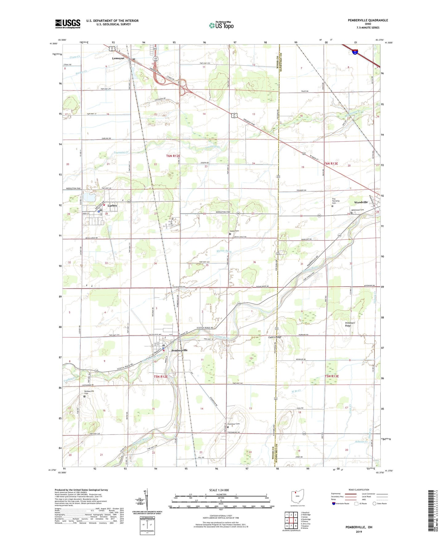
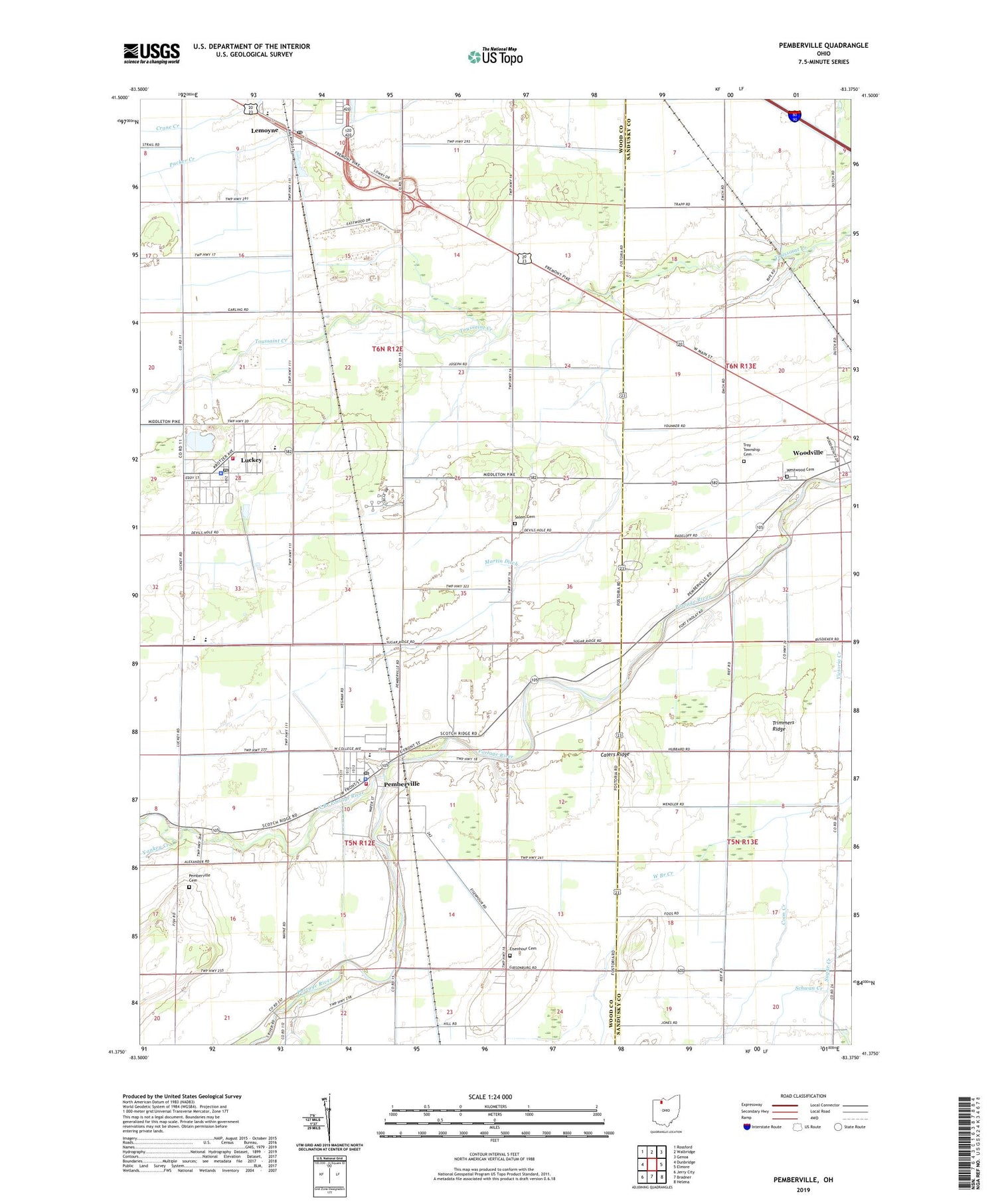
2019 topographic map quadrangle Pemberville in the state of Ohio. Scale: 1:24000. Based on the newly updated USGS 7.5' US Topo map series, this map is in the following counties: Wood, Sandusky. The map contains contour data, water features, and other items you are used to seeing on USGS maps, but also has updated roads and other features. This is the next generation of topographic maps. Printed on high-quality waterproof paper with UV fade-resistant inks.
Quads adjacent to this one:
West: Dunbridge
Northwest: Rossford
North: Walbridge
Northeast: Genoa
East: Elmore
Southeast: Helena
South: Bradner
Southwest: Jerry City
Contains the following named places: Calers Ridge, Eastwood High School, Eastwood Middle School, Eisenhour Cemetery, Foos Ditch, Freedom Township Hall, Hiview Airport, Laffertys Trailer Court, Lemoyne, Lemoyne Elementary School, Lemoyne Post Office, Luckey, Luckey Elementary School, Luckey Police Department, Luckey Post Office, Luckey Quarry, Martin Ditch, North Branch Portage River, Pemberville, Pemberville - Freedom Fire Department, Pemberville Cemetery, Pemberville Elementary School, Pemberville Police Department, Pemberville Post Office, Salem Cemetery, Salem Lutheran Church, Schwan Creek, South Branch Coon Creek, Tousaint, Township of Freedom, Township of Troy, Trimmers Ridge, Troy Township Cemetery, Troy Township Volunteer Fire Department and Emergency Medical Services, Village of Luckey, Village of Pemberville, Westwood Cemetery, William Henry Harrison Park, WRED-FM (Gibsonburg), Yankey Creek, Zion Church, ZIP Codes: 43443, 43450