MyTopo
Helena Ohio US Topo Map
Couldn't load pickup availability
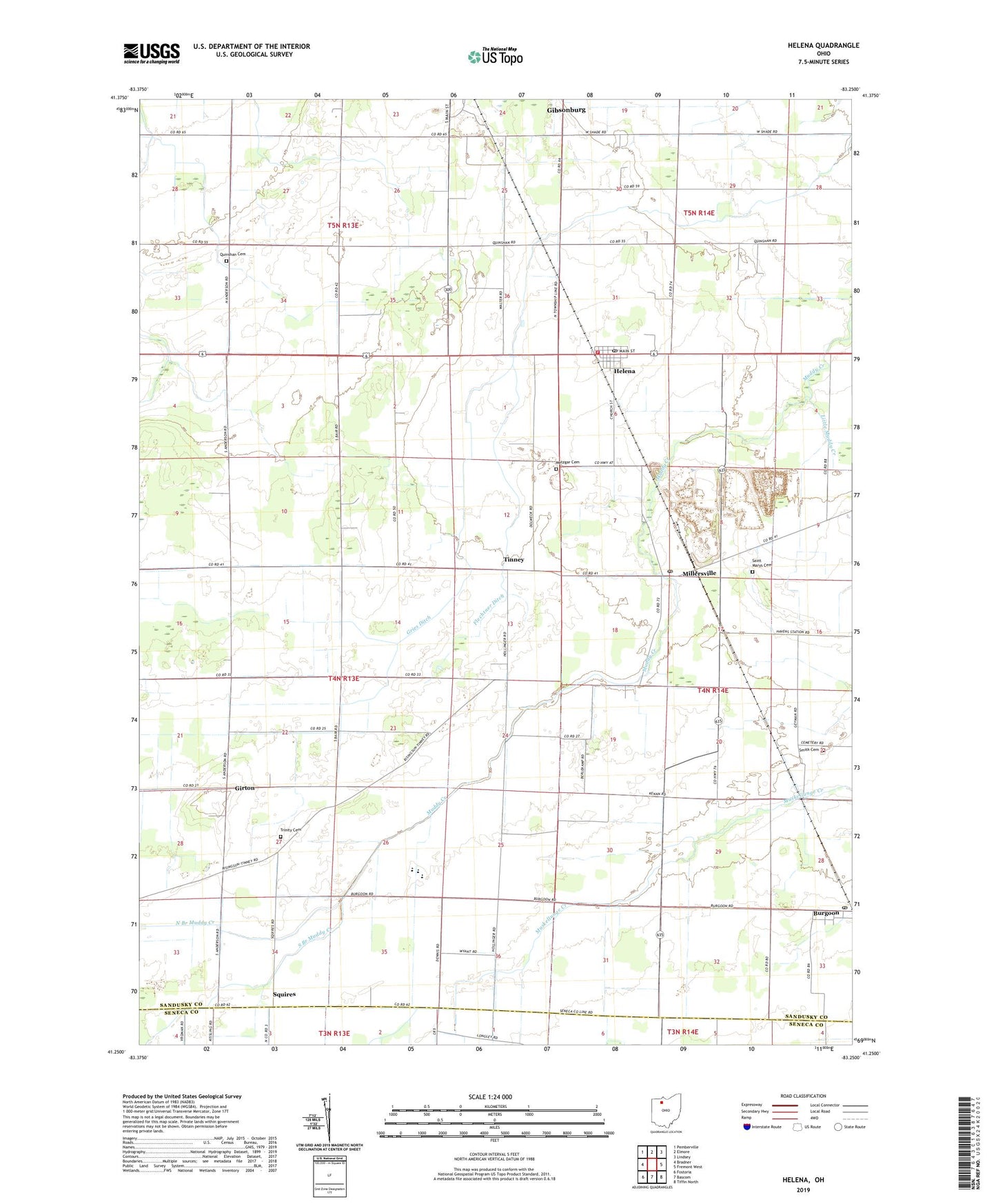
2023 topographic map quadrangle Helena in the state of Ohio. Scale: 1:24000. Based on the newly updated USGS 7.5' US Topo map series, this map is in the following counties: Sandusky, Seneca. The map contains contour data, water features, and other items you are used to seeing on USGS maps, but also has updated roads and other features. This is the next generation of topographic maps. Printed on high-quality waterproof paper with UV fade-resistant inks.
Quads adjacent to this one:
West: Bradner
Northwest: Pemberville
North: Elmore
Northeast: Lindsey
East: Fremont West
Southeast: Tiffin North
South: Bascom
Southwest: Fostoria
This map covers the same area as the classic USGS quad with code o41083c3.
Contains the following named places: Burgoon, Burgoon United Methodist Church, Canaan Church, Flechtner Ditch, Girton, Girton Church of God, Girton Post Office, Gries Ditch, Helena, Helena Community Volunteer Fire Department, Helena Post Office, Lakota High School, Metzgar Cemetery, Millersville, Millersville Post Office, Mud Creek Prairie, North Branch Muddy Creek, Ottawa Prairie, Pfizer State Park, Quinshan Cemetery, Ritter Wildlife Area, Saint Marys Catholic Church, Saint Marys Cemetery, Saint Marys School, Scott Township Hall, Shiloh United Methodist Church, Smith Cemetery, South Branch Muddy Creek, Squires, Squires Post Office, Tinney, Tinney Post Office, Township of Madison, Township of Scott, Trinity Cemetery, Trinity Church, Village of Burgoon, Village of Helena, White Star Quarry, ZIP Codes: 43435, 44841