MyTopo
Leipsic Ohio US Topo Map
Couldn't load pickup availability
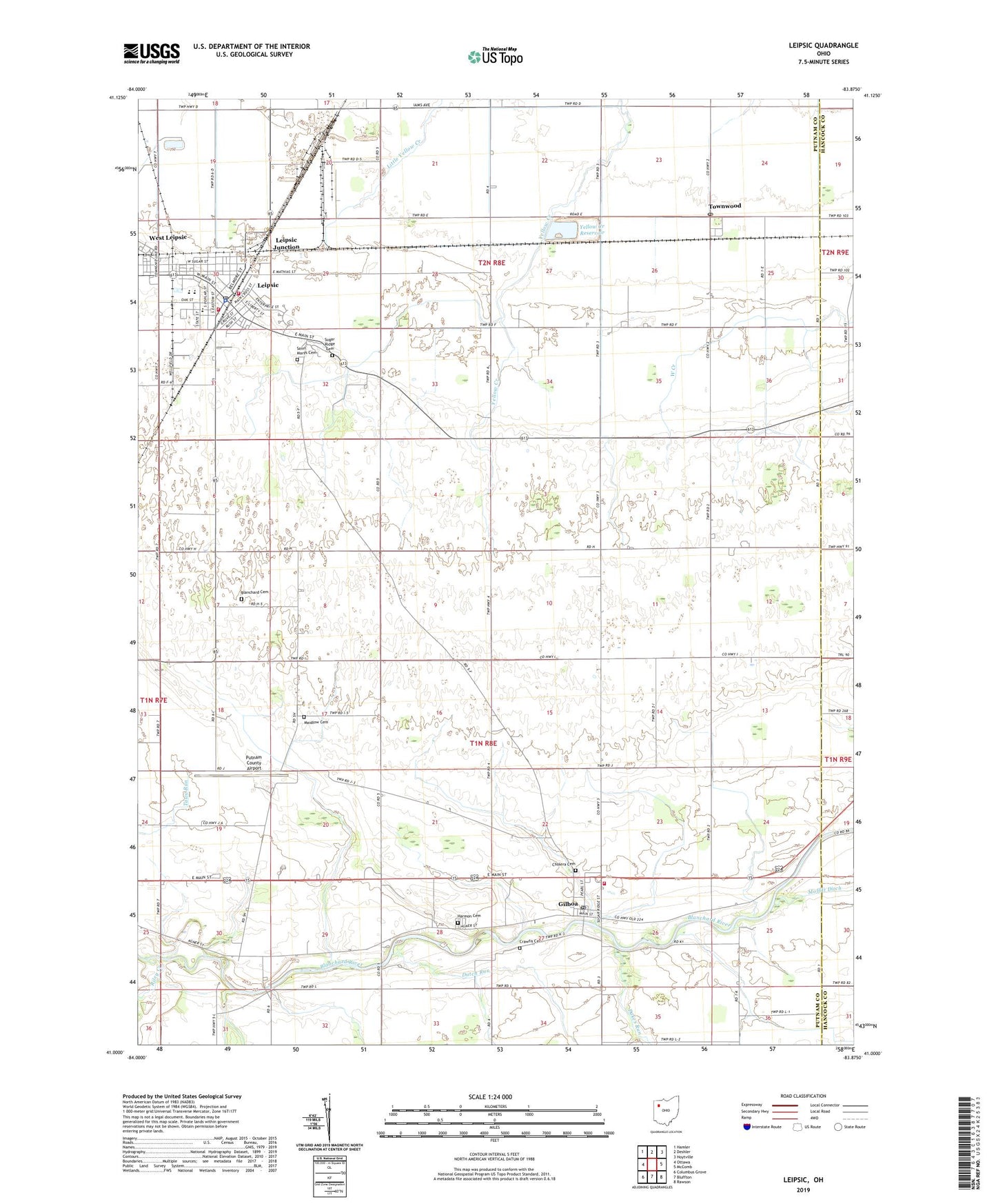
2023 topographic map quadrangle Leipsic in the state of Ohio. Scale: 1:24000. Based on the newly updated USGS 7.5' US Topo map series, this map is in the following counties: Putnam, Hancock. The map contains contour data, water features, and other items you are used to seeing on USGS maps, but also has updated roads and other features. This is the next generation of topographic maps. Printed on high-quality waterproof paper with UV fade-resistant inks.
Quads adjacent to this one:
West: Ottawa
Northwest: Hamler
North: Deshler
Northeast: Hoytville
East: McComb
Southeast: Rawson
South: Bluffton
Southwest: Columbus Grove
This map covers the same area as the classic USGS quad with code o41083a8.
Contains the following named places: Blanchard Cemetery, Blanchard Township Gilboa Fire Department, Cholera Cemetery, Crawfis Cemetery, Crawfish College, Dukes Run, Dutch Run, First Christian Church, First Lutheran Church, Gilboa, Gilboa Elementary School, Gilboa Main Street Historic District, Gilboa Post Office, Gilboa Quarry, Gilboa United Methodist Church, Harmon Cemetery, Hovest Farms, Leipsic, Leipsic Elementary School, Leipsic Emergency Medical Services, Leipsic High School, Leipsic Junction, Leipsic Police Department, Leipsic Post Office, Leipsic Upground Reservoir Dam, Leipsic Volunteer Fire Department Station 1, Leipsic Volunteer Fire Department Station 2, Maidlow Cemetery, Melody Acres Trailer Park, Orchard Lane Trailer Court, Pleasant Grove Church, Putnam County Airport, Putnam County Home, Riley Creek, Saint Marys Catholic Church, Saint Marys Cemetery, Saint Marys School, Sugar Ridge Cemetery, Township of Blanchard, Township of Van Buren, Townwood, Townwood Post Office, Village of Gilboa, Village of Leipsic, Yellow Creek Reservoir, ZIP Code: 45856