MyTopo
Reno Beach Ohio US Topo Map
Couldn't load pickup availability
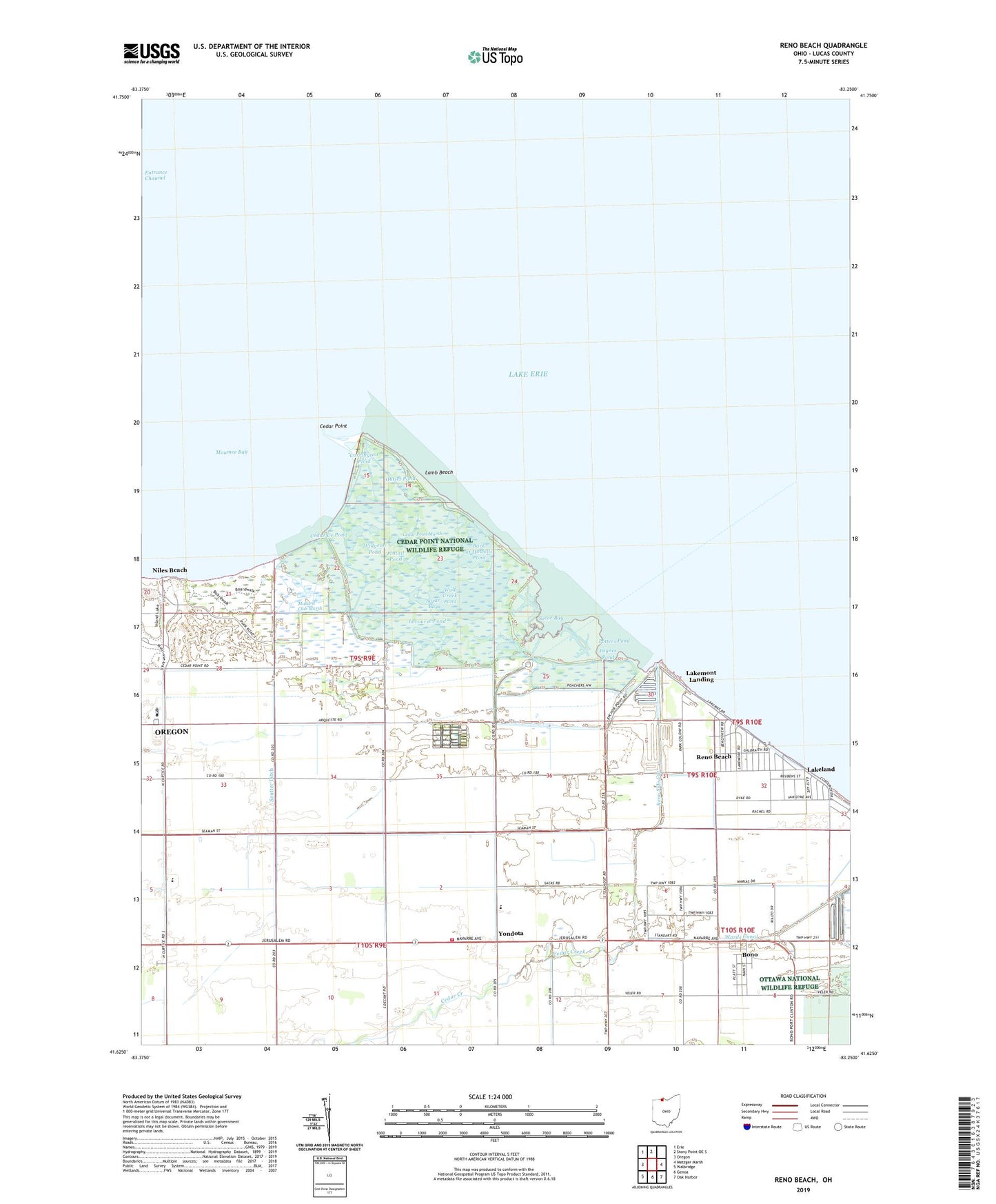
2023 topographic map quadrangle Reno Beach in the state of Ohio. Scale: 1:24000. Based on the newly updated USGS 7.5' US Topo map series, this map is in the following counties: Lucas. The map contains contour data, water features, and other items you are used to seeing on USGS maps, but also has updated roads and other features. This is the next generation of topographic maps. Printed on high-quality waterproof paper with UV fade-resistant inks.
Quads adjacent to this one:
West: Oregon
Northwest: Erie
North: Stony Point OE S
East: Metzger Marsh
Southeast: Oak Harbor
South: Genoa
Southwest: Walbridge
This map covers the same area as the classic USGS quad with code o41083f3.
Contains the following named places: Anchor Point Marina, Back of Howells Pond, Berger Road Ditch, Bono, Bono Post Office, Carrington Pond, Cedar Creek, Cedar Creek Pond, Cedar Point, Cedar Point Clubhouse, Cedar Point Marsh, Cedar Point National Wildlife Refuge, Eisenhower Intermediate School, Goose Pond, Hannah Pond, Haskell Pond, Jerusalem Township Fire Department, Lacourse Pond, Lakeland, Lakemont Landing, Lamb Beach, Long Pond, Mallard Club Marsh, Mallard Club Marsh State Wildlife Area, New Jerusalem, Niles Beach, Niles Pond, Oregon City Filtration Plant, Our Lady of Mount Carmel Church, Outlet Pond, Paynes Pond, Pintail Pond, Potters Pond, Reno Beach, Reno Beach Census Designated Place, Reno Side Cut, Saint Lukes Church, Sautter Ditch, Scottish Links Golf Course, Secor Bay, Suzar Bay, Wards Canal, WDHO Radio Tower, Widgeon Pond, Williams Ditch, WNWO-TV (Toledo), Wolf Creek, Wolf Creek Pond, Yondota, Yondota Post Office, ZIP Code: 43412