MyTopo
Richwood Ohio US Topo Map
Couldn't load pickup availability
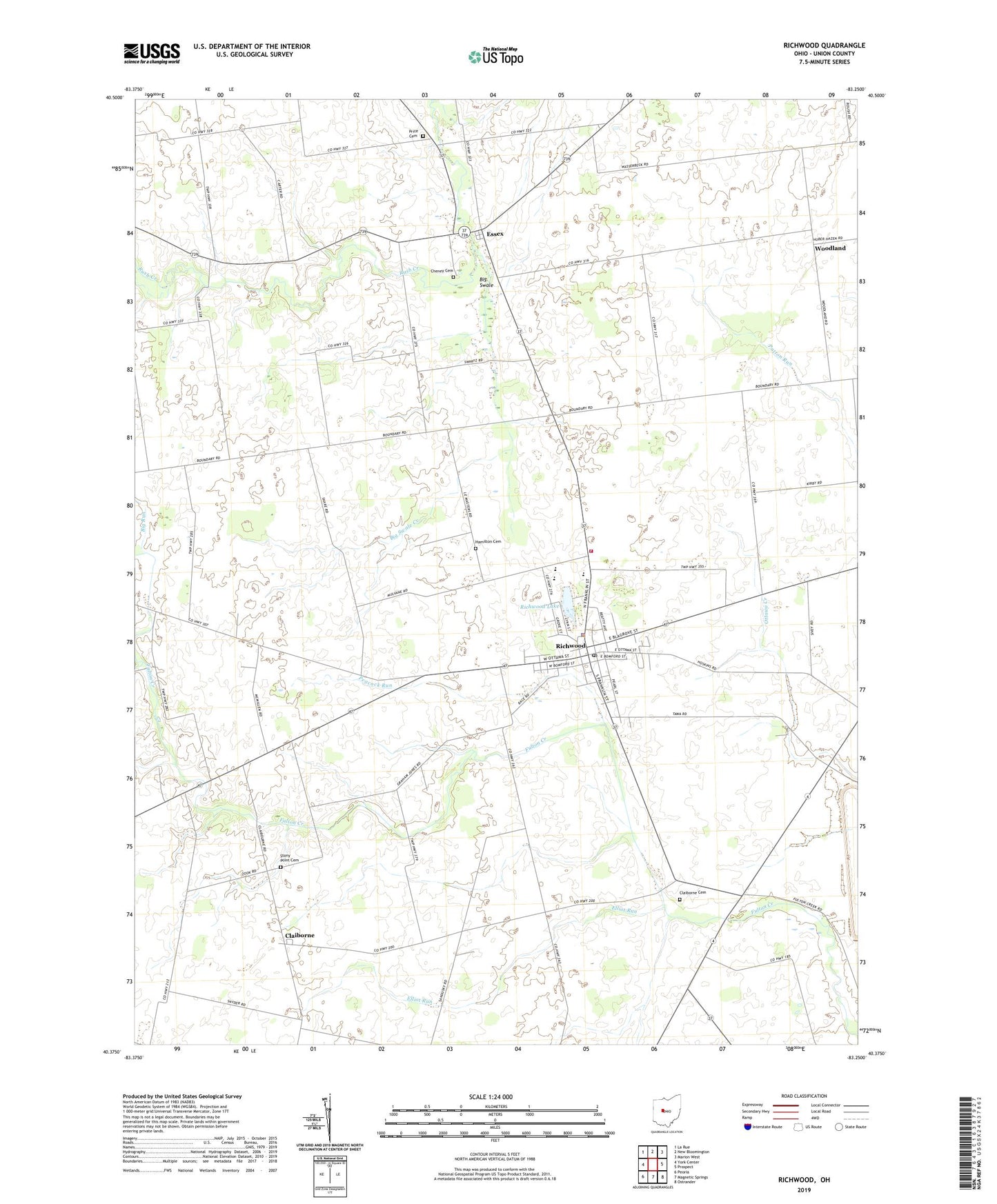
2019 topographic map quadrangle Richwood in the state of Ohio. Scale: 1:24000. Based on the newly updated USGS 7.5' US Topo map series, this map is in the following counties: Union. The map contains contour data, water features, and other items you are used to seeing on USGS maps, but also has updated roads and other features. This is the next generation of topographic maps. Printed on high-quality waterproof paper with UV fade-resistant inks.
Quads adjacent to this one:
West: York Center
Northwest: La Rue
North: New Bloomington
Northeast: Marion West
East: Prospect
Southeast: Ostrander
South: Magnetic Springs
Southwest: Peoria
Contains the following named places: Adams School, Baldwin School, Benedict School, Bethlehem Church, Big Run, Big Swale, Big Swale Creek, Big Swale School, Bigelow School, Boundary School, Cahill School, Carter School, Central United Methodist Church, Chaney School, Cheney Cemetery, Claiborne, Claiborne Cemetery, Claiborne Post Office, Claibourne-Richwood Elementary School, Deadwood School, Elliot Run, Essex, Essex United Methodist Church, First Baptist Church, First United Methodist Church, Hamilton Cemetery, Jackson Elementary School, North Union High School, Northern Union County Fire Department and Emergency Medical Services, Peacock Run, Price Cemetery, Richwood, Richwood Fairgrounds, Richwood Lake, Richwood Lake Park, Richwood North Union Public Library, Richwood Police Department, Richwood Post Office, Richwood Village Hall, Stony Point Cemetery, Stony Point School, Styre School, Sunnyside School, Tawa Estates, Tawa School, Tenery School, Township of Claibourne, Township of Jackson, Village of Richwood, Willey School, Woodland, ZIP Code: 43344