
MyTopo
Ridgeville Corners Ohio US Topo Map
Couldn't load pickup availability
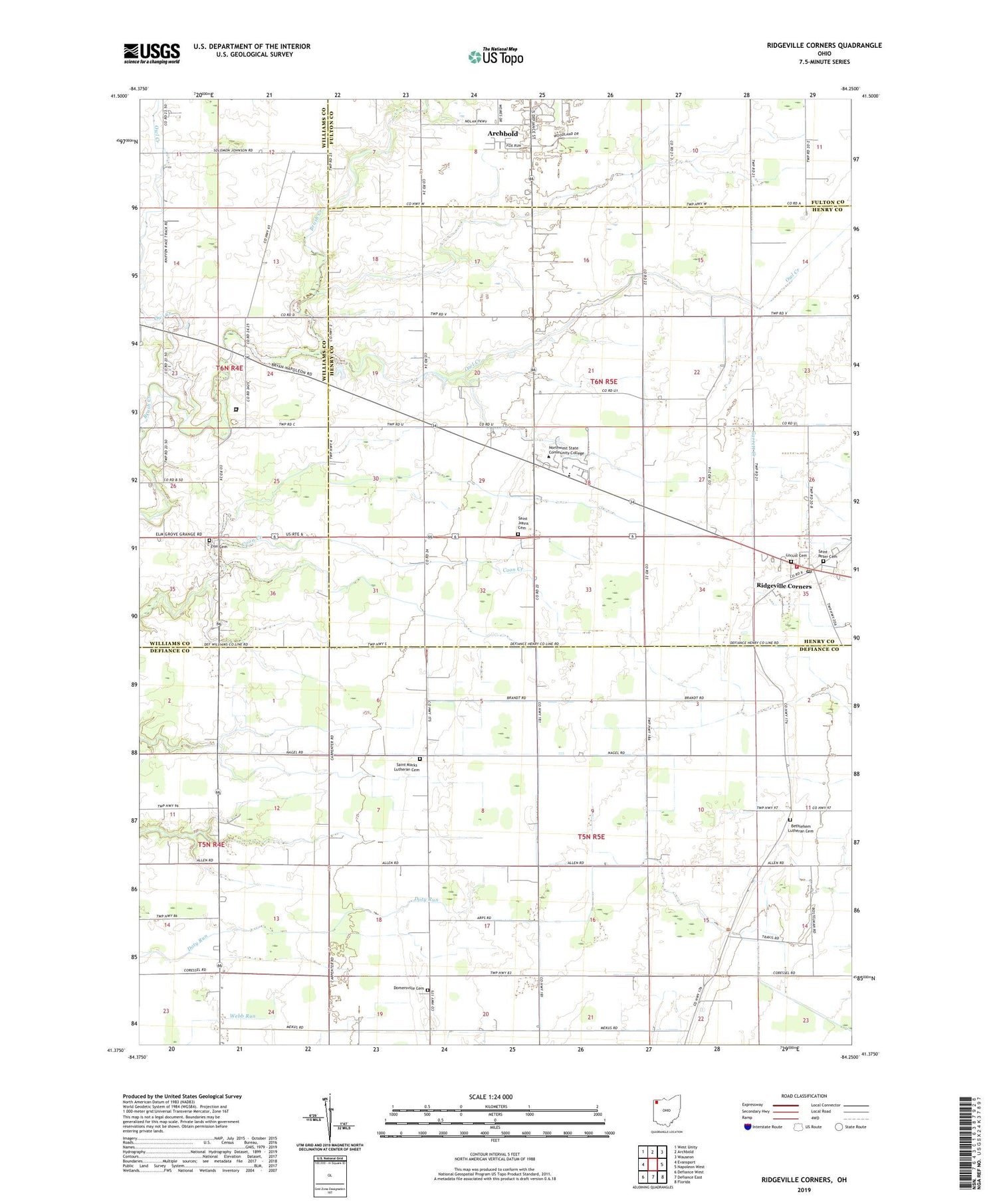
2019 topographic map quadrangle Ridgeville Corners in the state of Ohio. Scale: 1:24000. Based on the newly updated USGS 7.5' US Topo map series, this map is in the following counties: Defiance, Henry, Williams, Fulton. The map contains contour data, water features, and other items you are used to seeing on USGS maps, but also has updated roads and other features. This is the next generation of topographic maps. Printed on high-quality waterproof paper with UV fade-resistant inks.
Quads adjacent to this one:
West: Evansport
Northwest: West Unity
North: Archbold
Northeast: Wauseon
East: Napoleon West
Southeast: Florida
South: Defiance East
Southwest: Defiance West
Contains the following named places: Adams Ridge, Adams Ridge Post Office, Archbold Middle School, Bethlehem Lutheran Cemetery, Bethlehem Lutheran Church, Buehrer Farms, Corrections Center of Northwest Ohio, Domersville Cemetery, Domerville, Domerville Post Office, Four County Joint Vocational School, Fox Chase, Hickory Hills, Locust Cemetery, Northwest Technical College, Owl Creek, Plants Plus Nursery, Ridgeville Corners, Ridgeville Corners Census Designated Place, Ridgeville Corners Post Office, Ridgeville Township Volunteer Fire Department, Roselawn Farm, Saint John Lutheran Church, Saint Johns Cemetery, Saint Johns Church, Saint Marks Lutheran Cemetery, Saint Mark's Lutheran Church, Saint Peter Cemetery, Saint Peter Church, Township of Adams, Township of Ridgeville, Zion Cemetery, Zion Church, ZIP Code: 43555


