
MyTopo
Florida Ohio US Topo Map
Couldn't load pickup availability
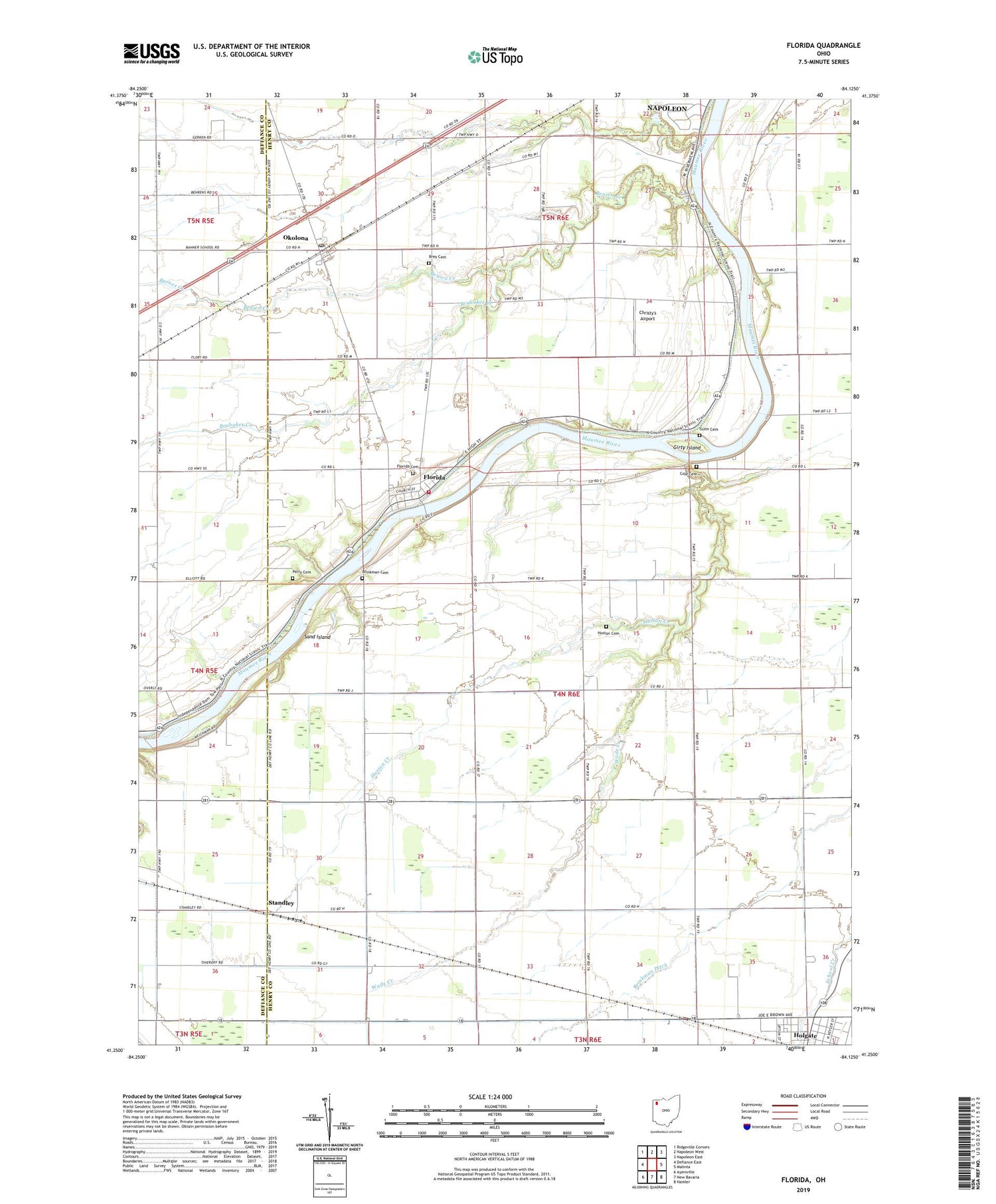
2023 topographic map quadrangle Florida in the state of Ohio. Scale: 1:24000. Based on the newly updated USGS 7.5' US Topo map series, this map is in the following counties: Henry, Defiance. The map contains contour data, water features, and other items you are used to seeing on USGS maps, but also has updated roads and other features. This is the next generation of topographic maps. Printed on high-quality waterproof paper with UV fade-resistant inks.
Quads adjacent to this one:
West: Defiance East
Northwest: Ridgeville Corners
North: Napoleon West
Northeast: Napoleon East
East: Malinta
Southeast: Hamler
South: New Bavaria
Southwest: Ayersville
This map covers the same area as the classic USGS quad with code o41084c2.
Contains the following named places: Barnes Creek, Benien Creek, Bethlehem Evangelical Lutheran Church, Brey Cemetery, Brinkman Cemetery, Brinkman Ditch, Brubaker Creek, Christy's Airport, Cole Cemetery, Florida, Florida - Flatrock Township Volunteer Fire Department, Florida Cemetery, Florida High School, Florida Post Office, Florida United Methodist Church, Girty Island, Gunn Cemetery, Holgate Post Office, Huston Cemetery, Huston Creek, Miami and Erie Canal, Okolona, Okolona Post Office, Parry Cemetery, Saint Peter Evangelical Lutheran Church, Saint Peters Evangelical Lutheran Church, Sand Island, Standley, Township of Flatrock, Village of Florida, Wade Creek, WNDH-FM (Napoleon)


