MyTopo
Rittman Ohio US Topo Map
Couldn't load pickup availability
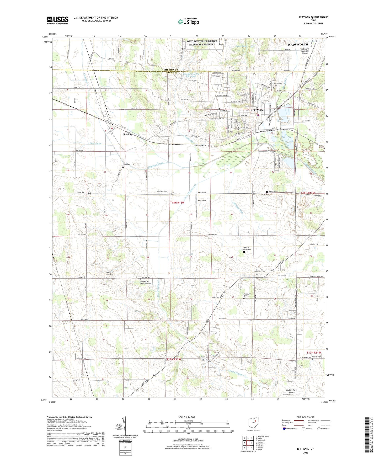
2019 topographic map quadrangle Rittman in the state of Ohio. Scale: 1:24000. Based on the newly updated USGS 7.5' US Topo map series, this map is in the following counties: Wayne, Medina. The map contains contour data, water features, and other items you are used to seeing on USGS maps, but also has updated roads and other features. This is the next generation of topographic maps. Printed on high-quality waterproof paper with UV fade-resistant inks.
Quads adjacent to this one:
West: Creston
Northwest: Westfield Center
North: Seville
Northeast: Wadsworth
East: Doylestown
Southeast: Dalton
South: Orrville
Southwest: Wooster
Contains the following named places: Acker Farms, Amwell Post Office, Apostolic Christian Cemetery, Bauman Orchards, Beech Grove Farm, Chippewa Conservation District Structure VII C Dam, Chippewa Creek Watershed 4a Reservoir, Chippewa Valley Angus Farm, Chippewa Watershed Conservation District Structure Reservoir, Church of Christ, City of Rittman, Clove Hill Farm, Conrad Cemetery, Crestland Farms, Crossroads Dairy, Crown Hill Mennonite Cemetery, Crown Hill Mennonite Church, Douglas, East Chippewa Church of the Brethren, Elindale Farms, Elm Farm, Enterprise Farm, Evergreen Farm, Excelsior Farm, Fairview Farm, First Baptist Church, Flickinger Cemetery, Fountain Spring Farm, Grace Brethren Church, Gresser Farm, Highland Farm, Hilty Field, Hoover Cemetery, Horst Farms, Johnsons Corners, L and R Dairy Farm, Little Chippewa Creek, Locas Lane Farm, Maple Grove Farm, Maple Hill Farm, Markley Farm Airport, Marty Farms, Milton Station, Morning Star Church, Mount Zion Cemetery, Mount Zion Church, North Street Elementary School, Oakland Farm, Old Dunkard Cemetery, Orange Lane Farm, Pleasant Hill Mennonite Cemetery, Pleasant Hill Mennonite Church, Pleasant Vale Dairy, Prospect Farm, Ramsier Farms, Rawiga Country Club Lake, Rawiga Country Club Lake Dam, Republican Farm, Riggenbach Farm, Rittman, Rittman Cemetery, Rittman City Hall, Rittman Community Church, Rittman Emergency Medical Services, Rittman Fire Department, Rittman High School, Rittman Middle School, Rittman Police Department, Rittman Post Office, Russell Station, Saint Ann Cemetery, Saint Anne Catholic Church, School Number 3, School Number 4, School Number 5, School Number 6, School Number 7, School Number 8, Shinersburg Cemetery, Smithville Church, Steele Ditch, Steiner Farm, Steinhurst Farm, Sterling, Sterling Census Designated Place, Sterling Elementary School, Sterling Fire District, Sterling Heights Dairy Farm, Sterling Union Cemetery, Stine View Dairy, Stoller's Organic Dairy, Styx River, Sugar Bridge Farms, Swan Meadow Farm, The Church on 94, Tommy Run, Township of Milton, Union Church, West Hill Elementary School, Wheatland Farm, Whitman Ditch, Zollinger Construction and Debris Landfill, Zuber Pond, Zuber Pond Dam, ZIP Codes: 44270, 44276