MyTopo
Wadsworth Ohio US Topo Map
Couldn't load pickup availability
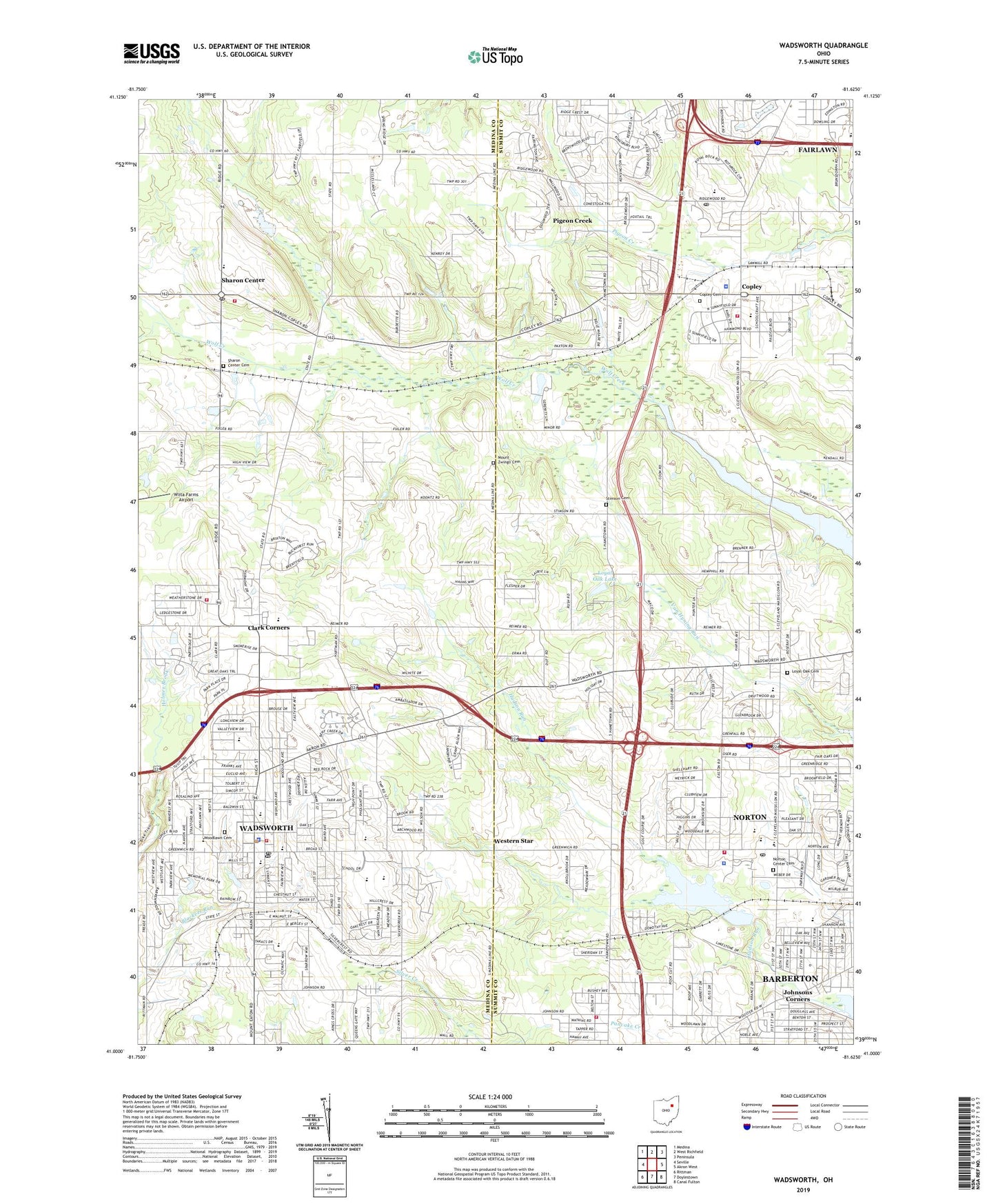
2023 topographic map quadrangle Wadsworth in the state of Ohio. Scale: 1:24000. Based on the newly updated USGS 7.5' US Topo map series, this map is in the following counties: Medina, Summit. The map contains contour data, water features, and other items you are used to seeing on USGS maps, but also has updated roads and other features. This is the next generation of topographic maps. Printed on high-quality waterproof paper with UV fade-resistant inks.
Quads adjacent to this one:
West: Seville
Northwest: Medina
North: West Richfield
Northeast: Peninsula
East: Akron West
Southeast: Canal Fulton
South: Doylestown
Southwest: Rittman
This map covers the same area as the classic USGS quad with code o41081a6.
Contains the following named places: Alderfer-oenslager County Park, Arrowhead Primary School, Barberton Church Camp, Barberton First Church of the Nazarene, Barberton Reservoir, Barberton Wesleyan Methodist Church, Bates Corners, Bender's Farm, Bird Street Park, Blue Sky Drive-In, Brookside Country Club, Calvary Wesleyan Church, Camp Jody, Camp Sharon, Central Middle School, Chippewa Watershed Conservation District Structure Reservoir, Christian and Missionary Alliance Church, City of Norton, City of Wadsworth, Clark Corners, Columbia Woods Park, Copley, Copley - Fairlawn Middle School, Copley Cemetery, Copley Fire Department, Copley Fire Department Station 1, Copley High School, Copley Police Department, Copley Post Office, Copley United Methodist Church, Dayton Nurseries, Dennison Station, Durling Park, Edgewood Park, Ella M Everhard Public Library, First Assembly of God Church, First Baptist Church, First Christian Church, First Mennonite Church, First Methodist Church, First Methodist Episcopal Church, Fort Island Primary Elementary School, Franklin Elementary School, Full Gospel Church, Grace Evangelical Lutheran Church, Greenleaf County Park, H and H Farm, Highland Field, Highland Middle School, Holmesbrook Park, Hudson Run, Hungarian Baptist Church, Isham Memorial Elementary School, Johnson Elementary School, Johnson United Methodist Church, Johnsons Corners, Lake Dorothy, Lake Dorothy Dam, Lehmann Airport, Lincoln Elementary School, Loyal Oak Cemetery, Loyal Oak Golf Club, Loyal Oak Lake, Loyal Oak Lake Dam, Memorial Park, Miller Field, Mills Road Park, Mount Zwingli Cemetery, Mount Zwingli Church, North Center Church, North Woods Park, Norton, Norton Center Cemetery, Norton Fire Department Station 1, Norton Fire Department Station 2, Norton Intermediate School, Norton Middle / Intermediate School, Norton Plaza Shopping Center, Norton Police Department, Norton Post Office, Norton Primary School, Overlook Elementary School, Paxton, Paxton Post Office, Pigeon Creek, Pigeon Creek Census Designated Place, Pine Valley Golf Course, Ruhlin Airport, Ruhlin Heliport, Sacred Heart Catholic Church, Sacred Heart School, Saint Andrews School, Saint Marks Episcopal Church, Saint Pauls Evangelical Lutheran Church, Santrock Elementary School, Sharon Center, Sharon Center Cemetery, Sharon Center Census Designated Place, Sharon Center Post Office, Sharon Center Public Square Historic District, Sharon Elementary School, Sharon Township Fire Department, Sharondale Field Airport, Sherman, Sherman Post Office, Spruce Run, Steiner Youth Center, Stimson Cemetery, Sunset Mobile Home Park, Terraceview Park, Township of Copley, Township of Sharon, Trinity Reformed Church, Valley View Elementary School, Valley View Park, Wadsworth, Wadsworth Church of the Nazarene, Wadsworth City Hall, Wadsworth Fire Department and Emergency Medical Service Station 1, Wadsworth Fire Department and Emergency Medical Services Station 2, Wadsworth High School, Wadsworth Police Department, Wadsworth Post Office, Wadsworth Recreation Center, Wadsworth Trailer Park, Walte Park, WEAO-TV (Akron), Weatherstone Park, Western Reserve Golf Course, Western Star, Western Star Cemetery, WHLO-AM (Akron), Wintergreen Park, Woodlawn Cemetery, WQMX-FM (Medina), WZIP-FM (Akron), ZIP Codes: 44203, 44274, 44281, 44321


