MyTopo
Ruraldale Ohio US Topo Map
Couldn't load pickup availability
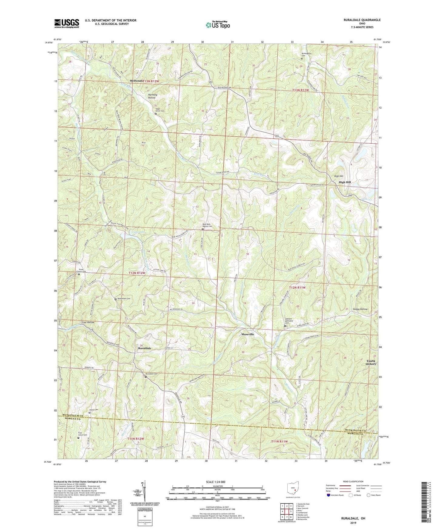
2023 topographic map quadrangle Ruraldale in the state of Ohio. Scale: 1:24000. Based on the newly updated USGS 7.5' US Topo map series, this map is in the following counties: Muskingum, Morgan. The map contains contour data, water features, and other items you are used to seeing on USGS maps, but also has updated roads and other features. This is the next generation of topographic maps. Printed on high-quality waterproof paper with UV fade-resistant inks.
Quads adjacent to this one:
West: Philo
Northwest: Zanesville East
North: Norwich
Northeast: New Concord
East: Cumberland
Southeast: Reinersville
South: McConnelsville
Southwest: Rokeby Lock
This map covers the same area as the classic USGS quad with code o39081g7.
Contains the following named places: Allens Cemetery, Bethlehem Cemetery, Bethlehem School, Blue Rock Baptist Cemetery, Blue Rock Baptist Church, Blue Rock Lake Dam, Blue Rock Lookout Tower, Blue Rock State Forest, Blue Rock State Park, Coal Hollow, Confederate Crossroads, Cutler Lake, Elliott School, Free Grace Cemetery, Guyst Fork, Harmony Hollow, Harmony School, Hedge School, High Hill, High Hill Post Office, High Hill Presbyterian Church, Kent Run, Lyon School, Marshall Creek, McDonald, McDonald post office, McNaughton Cemetery, Museville, Museville Post Office, Oakland Methodist Cemetery, Oakland Methodist Church, Quailtrap School, Ruraldale, Ruraldale Cemetery, Ruraldale Post Office, Sleepy Hollow, Sleepy Hollow School, Smith School, Starrett Creek, Stone Church Cemetery, Sugar Grove Cemetery, Sugar Grove Chapel, Toadtown School, Township of Blue Rock, Township of Meigs, West School, ZIP Code: 43727