MyTopo
Scott Ohio US Topo Map
Couldn't load pickup availability
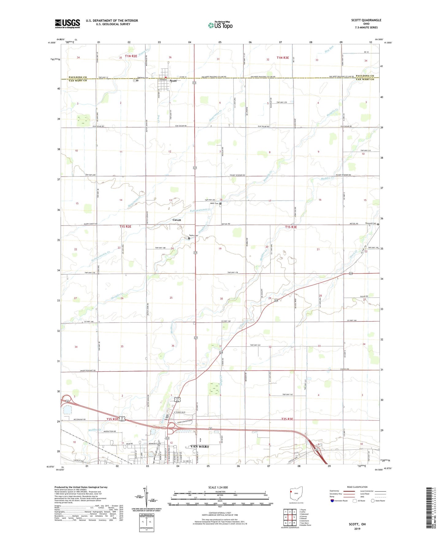
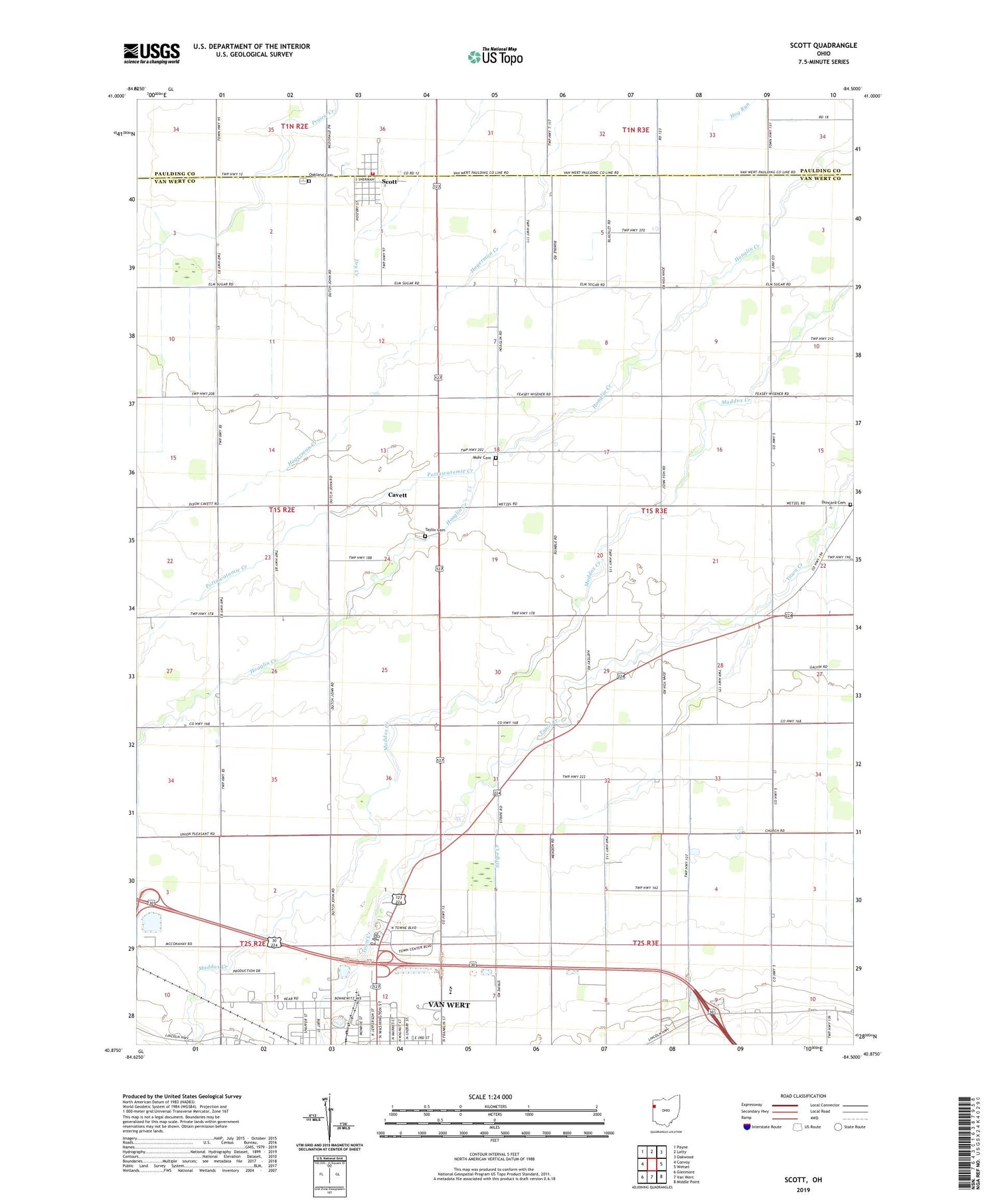
2019 topographic map quadrangle Scott in the state of Ohio. Scale: 1:24000. Based on the newly updated USGS 7.5' US Topo map series, this map is in the following counties: Van Wert, Paulding. The map contains contour data, water features, and other items you are used to seeing on USGS maps, but also has updated roads and other features. This is the next generation of topographic maps. Printed on high-quality waterproof paper with UV fade-resistant inks.
Quads adjacent to this one:
West: Convoy
Northwest: Payne
North: Latty
Northeast: Oakwood
East: Wetsel
Southeast: Middle Point
South: Van Wert
Southwest: Glenmore
Contains the following named places: Anthony Wayne Elementary School, Bresler Park, Briarwood Court, C B J Farms, Cavett, Cavett Post Office, Duncard Cemetery, Foust School, Gordons Trailer Court, Grand Victory Church, Horace Mann Elementary School, Jubilee Park, K C Farms, Kimart Farms, Lehman Farms, Mohr Cemetery, Myers Farms, North Union Church, Northwood Mobile Home Court, Oakland Cemetery, Pottawatomie Creek, Schaffner Farms, School Number 1, School Number 2, School Number 5, School Number 6, School Number 7, School Number 8, Scott, Scott Post Office, Scott Volunteer Fire Department, Stripe Creek, Taylor Cemetery, Thomas Edison Elementary School, Township of Hoaglin, Tri Sis Farm, Tyas Farm, Van Wert Sewage Treatment Plant, Vantage Joint Vocational School, Village of Scott, Vineyard Christian Fellowship Church, Wesley Park, Wilmore Ditch, ZIP Code: 45886