MyTopo
Wetsel Ohio US Topo Map
Couldn't load pickup availability
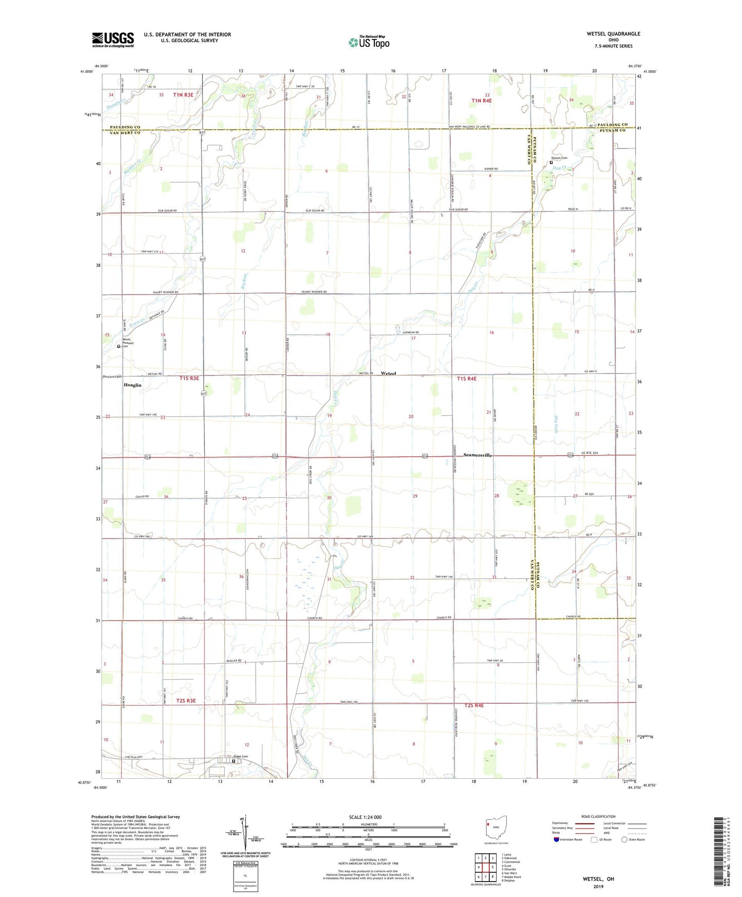
2023 topographic map quadrangle Wetsel in the state of Ohio. Scale: 1:24000. Based on the newly updated USGS 7.5' US Topo map series, this map is in the following counties: Van Wert, Putnam, Paulding. The map contains contour data, water features, and other items you are used to seeing on USGS maps, but also has updated roads and other features. This is the next generation of topographic maps. Printed on high-quality waterproof paper with UV fade-resistant inks.
Quads adjacent to this one:
West: Scott
Northwest: Latty
North: Oakwood
Northeast: Continental
East: Ottoville
Southeast: Delphos
South: Middle Point
Southwest: Van Wert
This map covers the same area as the classic USGS quad with code o40084h4.
Contains the following named places: Bastel School, Baxter School, Bell Ditch, Benson Ditch, Brox School, Cooper Grain Farms, Cowgill School, Dotson Cemetery, Eickholt School, Elm Grove Church, Gilberts Mills, Grace Church, Grove School, Harmony Church, Hermann Ditch, Hoaglin, Hoaglin Post Office, Huston School, Klinger School, Lincolnview North Elementary School, Maddox Creek, Morris School, Mount Pleasant Cemetery, Mount Pleasant Church, Needmore Church, Raabe School, Ridge Cemetery, Ridge Church, Seamersville, Seamersville Post Office, Slate School, Spangler School, Town Creek, Township of Jackson, Tri-County Airport, Union Church, Van Wert County Home, Wetsel Post Office, Wetzel, ZIP Code: 45863