MyTopo
Rutland Ohio US Topo Map
Couldn't load pickup availability
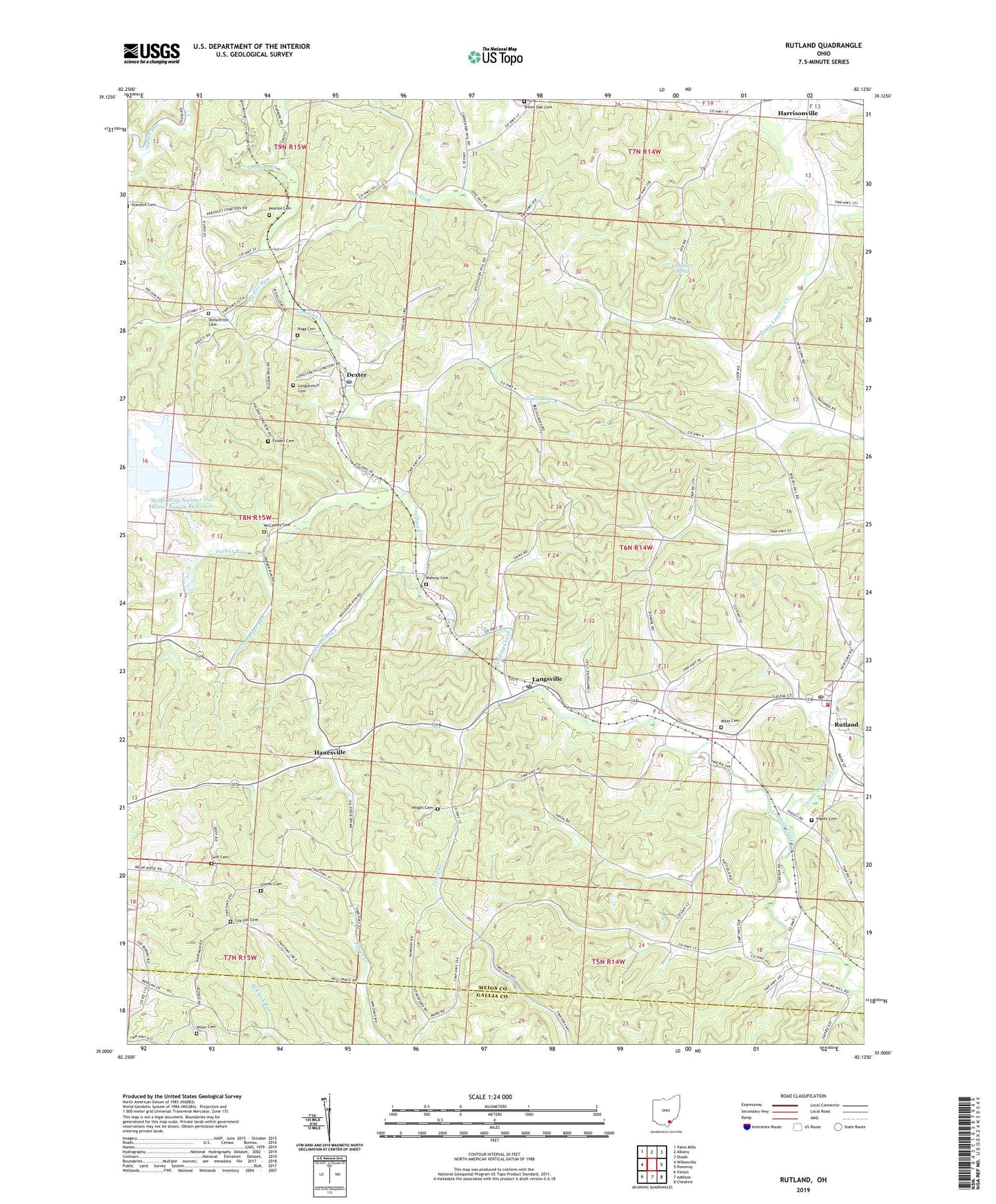
2023 topographic map quadrangle Rutland in the state of Ohio. Scale: 1:24000. Based on the newly updated USGS 7.5' US Topo map series, this map is in the following counties: Meigs, Gallia. The map contains contour data, water features, and other items you are used to seeing on USGS maps, but also has updated roads and other features. This is the next generation of topographic maps. Printed on high-quality waterproof paper with UV fade-resistant inks.
Quads adjacent to this one:
West: Wilkesville
Northwest: Vales Mills
North: Albany
Northeast: Shade
East: Pomeroy
South: Addison
Southwest: Vinton
This map covers the same area as the classic USGS quad with code o39082a2.
Contains the following named places: Buckhorn, Coy Hill Cemetery, Dexter, Dexter Church of Christ, Dexter Post Office, Dexter Run, Disciple Church, Folden Cemetery, Goff Cemetery, Gomer Cemetery, Grass Run, Hanesville, Hanesville Post Office, Higley Cemetery, Hugg Cemetery, Lambert Pond, Lambert Pond Dam, Langsville, Langsville Post Office, Little Leading Creek, Little Parker Run, Longstretch Cemetery, Malloons Creek, Martinsburg, McCaskey Cemetery, Meigs Mine Number One Water Supply Dam, Meigs Mine Number One Water Supply Reservoir, Midway Cemetery, Miles Cemetery, Miller Cemetery, Mud Fork, Old Dexter Church, Parker Run, Pearsol Cemetery, Rutland, Rutland Church of Christ, Rutland Elementary School, Rutland Emergency Medical Services, Rutland Fire Department, Rutland High School, Rutland Post Office, Township of Rutland, Village of Rutland, Vonschriltz Cemetery, White Oak Cemetery, Wright Cemetery, ZIP Codes: 45741, 45775