MyTopo
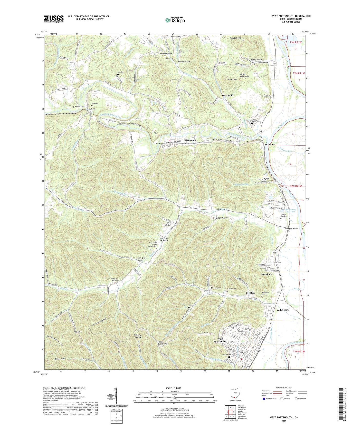
West Portsmouth Ohio US Topo Map
Couldn't load pickup availability
2023 topographic map quadrangle West Portsmouth in the state of Ohio. Scale: 1:24000. Based on the newly updated USGS 7.5' US Topo map series, this map is in the following counties: Scioto. The map contains contour data, water features, and other items you are used to seeing on USGS maps, but also has updated roads and other features. This is the next generation of topographic maps. Printed on high-quality waterproof paper with UV fade-resistant inks.
Quads adjacent to this one:
West: Otway
Northwest: Rarden
North: Wakefield
Northeast: Lucasville
East: New Boston
Southeast: Portsmouth
South: Friendship
Southwest: Pond Run
This map covers the same area as the classic USGS quad with code o38083g1.
Contains the following named places: Adams Cemetery, Apostolic Brethren Church, Arion, Arion Post Office, Big Island, Book Siding, Brookside, Buck Knob, Camp Eureka, Campbell Hill, Cave Lick Hollow, Cole Cemetery, Coles Park, Conley Cemetery, Cook Cemetery, Country Club Cemetery, Crowe Hollow, Crowe Hollow Church, Cut Rock, Days Mobile Home Park, Dry Run, Dry Run Chapel, Dry Run Elementary School, Dryrun Post Office, Duck Run, Duck Run School, Duncan Cemetery, Duncan Hollow, Duncan Hollow Creek, Elks Country Club, Elks Country Club Dam, Elks Country Club Lake, Ghost Hollow, Hall Cemetery, Holy Trinity Church, Holy Trinity Roman Catholic Cemetery, Inskeep Hollow, Jacquays Run, Jenkins Elementary School, Kelly Cemetery, Little Buck Knob, Little Cave Lick Hollow, Lute Cemetery, Malone Cemetery, McCullough Creek, McDermott, McDermott Census Designated Place, McDermott Elementary School, McDermott Post Office, Mershon - Swords Cemetery, Nauvoo Elementary School, Nauvoo Run, Nauvoo United Methodist Church, Noel Hollow, Oldtown Church, Owensville, Peach Orchard Hill, Pleasant Hill Church, Pleasant Hill School, Pond Creek Church, Portsmouth West High School, Reeds Run, Rush Church, Rush Township Volunteer Fire Department Station 1, Rushtown, Rushtown Post Office, Scioto Ambulance District Squad 2, Scioto Brush Creek, Scioto Burial Park, Seymore Cemetery, Sheep Pen Run, Sheep Ranch Hollow, Shepherd Fork Dry Creek, Starlight Church, Sturgeon Run, Sugarloaf, Sweeny Run, Township of Rush, Tremper Mound, Upper Dry Run School, Upper Pond Creek School, Valley View, Washington Township Emergency Medical Services, Washington Township Volunteer Fire Department, West Portsmouth, West Portsmouth Census Designated Place, Williams Cemetery, Williamson Cemetery, Wolf Run, WPBO-TV (Portsmouth), Wrights Run, WUXA-TV (Portsmouth), Zeufle Hollow, Zion Church, ZIP Code: 45652