MyTopo
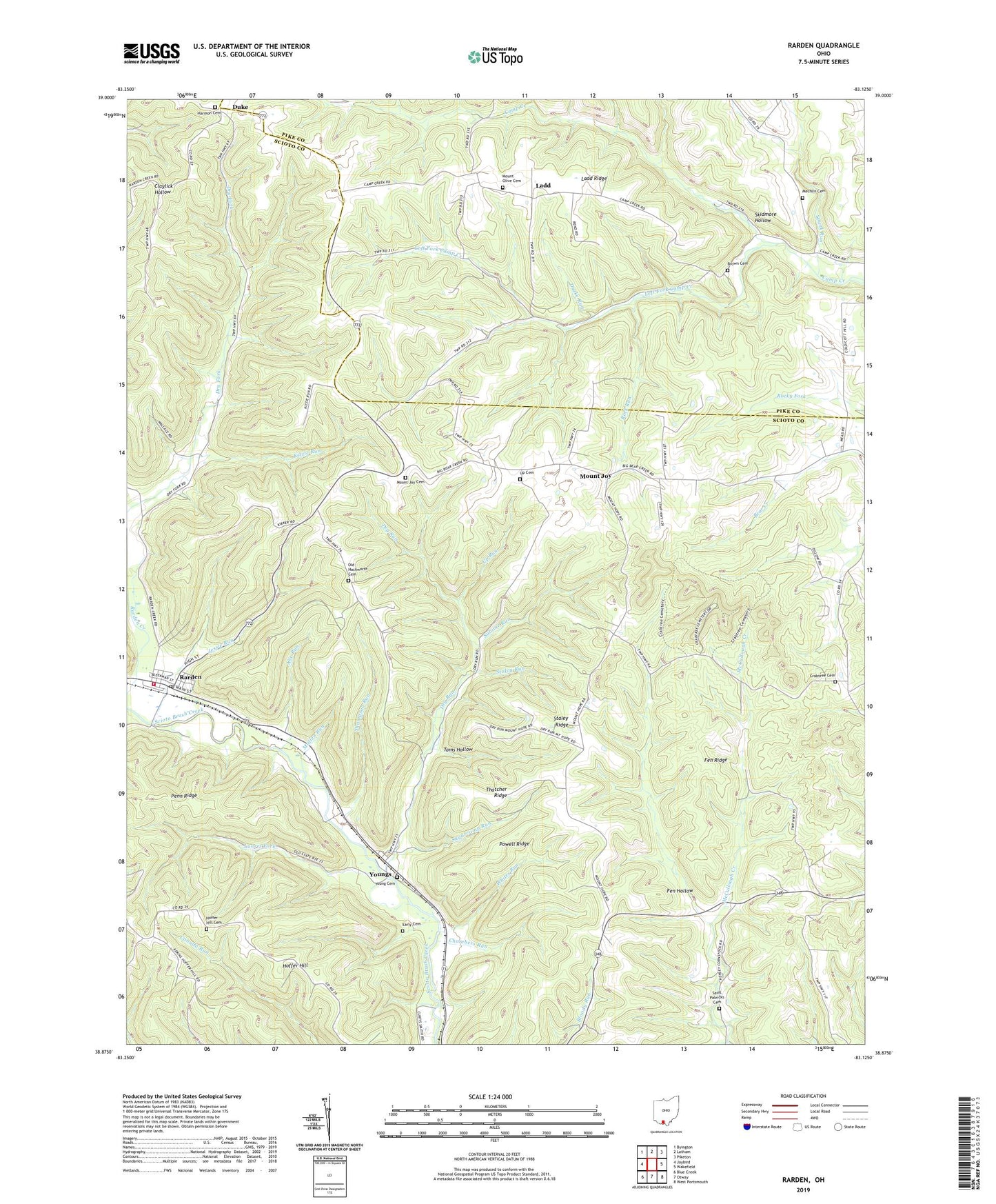
Rarden Ohio US Topo Map
Couldn't load pickup availability
2023 topographic map quadrangle Rarden in the state of Ohio. Scale: 1:24000. Based on the newly updated USGS 7.5' US Topo map series, this map is in the following counties: Scioto, Pike. The map contains contour data, water features, and other items you are used to seeing on USGS maps, but also has updated roads and other features. This is the next generation of topographic maps. Printed on high-quality waterproof paper with UV fade-resistant inks.
Quads adjacent to this one:
West: Jaybird
Northwest: Byington
North: Latham
Northeast: Piketon
East: Wakefield
Southeast: West Portsmouth
South: Otway
Southwest: Blue Creek
This map covers the same area as the classic USGS quad with code o38083h2.
Contains the following named places: Abe Run, Brown Cemetery, Brush Creek State Forest, Camp Creek House of Prayer, Chambers Run, Copasville Church, Crabtree Cemetery, Crabtree School, Drake Run, Dry Run, Duke, Duke Post Office, Early Cemetery, Fen Hollow, Fen Ridge, Hackworth Hill School, Harmon Cemetery, Harmon-salt Creek Church, Hoffer Hill, Hoffer Hill Cemetery, Hoffer Hill Church, Jessie Run, Kizzie Run, Ladd, Ladd Post Office, Ladd Ridge, Laurel Fork, Left Fork Camp Creek, McBridge School, Mechlin Cemetery, Mount Hope School, Mount Joy, Mount Joy Cemetery, Mount Joy Post Office, Mount Olive Cemetery, Mount Olive-Ladd Church, Mullen Run, Old Hackworth Cemetery, Old Hoffer Hill Church, Penn Ridge, Powell Ridge, Rarden, Rarden Post Office, Rarden Volunteer Fire Department, Rock Run, Saint Patricks Cemetery, Salome Run, Scioto Ambulance District Squad 4, Skidmore Hollow, Spunk Run, Staley Ridge, Staley Run, Sugarcamp Run, Thatcher Ridge, Thompson Run, Toms Hollow, Township of Camp Creek, Township of Rarden, Up Cemetery, Up Run, Village of Rarden, Whites Run, Young Cemetery, Young Post Office, Youngs, ZIP Code: 45671